Israel and Palestine 2013
Israel and Palestine 2013
Hardly a day goes by without Israel being in the news, and with its complex political and social issues, as well as its history, I thought it would be an interesting country to visit. There is a perception in Britain that it is a dangerous place, and parts of it are, but if you read up well in advance and keep an eye on developments while you are there the risk is low.
The Foreign Office advises strongly against visiting the Gaza Strip, some areas close to Lebanon, and parts of the West Bank unless you are accompanied by someone with local knowledge. For basic planning I used a large scale National Geographic map and a recent Lonely Planet Guide (LP), which was unusual in having sections on ‘What to do in a rocket attack’, ‘Minefields’ and ‘Gas Masks’. The internet also provided a lot of information, some of which proved to be of dubious accuracy.
There were stories about people having big problems in immigration, being held up for hours, strip searched and having their computers shot to pieces. To some extent this was supported by LP and as a result I did not take my netbook. In the event the immigration officer asked me if I had relatives or knew anyone in Israel, and when I answered “No” to both questions she just said “Welcome to Israel” and waved me through. Israelis I spoke to in the country dismissed the stories as anti-Israel propaganda. Anyway, I made sure I had clean underpants, just in case.
The plan was to stay one night in Tel Aviv, hire a car and work my way round the country for eight days, going to as many interesting places as possible. At the beginning of May the temperature in Tel Aviv was supposed to be in the range 15 to 25°C, which would be quite pleasant after the long cold winter in England. In the event, when the plane landed at 7.30pm it was 38°C (100°F), the normal figure for July and August.
Another shock came when the taxi pulled up outside the hotel I had booked on the internet. The address was 42 Allenby Street, one of the main thoroughfares in Tel Aviv, and as we stopped the taxi driver pointed at a boarded up building and said “That is number 42”. Sure enough, amongst the graffiti was a faded plate with 42 on it. For a moment I thought I had fallen for the scam of booking and paying for accommodation that did not exist, but then we saw a sign a few feet away with ‘Sun City Hotel – Entrance round the corner’. After booking in I went along the road to get something to eat (it was 9pm) and decided that it must be quite a safe area, because there were scantily-dressed young ladies on the nearby roundabout enjoying the warm evening.
Burning up in Tel Aviv
The next morning I went out for breakfast and a stroll through a street market before checking out of the hotel. At 10am it was already 36°, with the sun blazing down, and after a short time on the beach I began to feel unwell. The heat was just more than I could take after months of cold weather, and I retreated to a nearby McDonalds for coffee and an ice cream.
Once cooled down I felt better, but the car would not be available for collection until 3pm and I realised that I could not just wander about in the sun. From the map I saw that there was a large shopping mall not too far away, and decided to take refuge there. It was certainly not the way I would have chosen to spend my time in Tel Aviv, but it was a question of survival. At the entrance to the mall was an airport-style security check with a metal detector and a man searching bags. This is routine procedure at shopping malls, railway and bus stations, post offices and most public buildings.
At 2.30pm I arrived at the car hire office in a state of near-exhaustion after walking through the streets with my heavy wheelie case. The car was ready, a white Nissan Micra, which seemed appropriate for touring the Holy Land, as my local vicar has one. His is probably not air-conditioned, but fortunately mine was, and within a short time I was travelling comfortably northwards to my night stop at a tiny coastal resort called Mikhmoret.
Israeli drivers are reputed to be unpredictable and aggressive, but the people who think that have not driven in Albania, Poland or Russia, and I did not find the driving to be too bad.
Mikhmoret turned out to be a village in the sand dunes, and I drove around for miles on sandy tracks before eventually finding my accommodation, which was imaginatively called ‘The Resort’. It was a complex of two-apartment chalets and tents, and the whole atmosphere was very relaxed, with the staff sitting on an open verandah. The man in charge, a South African back-packer type named Mike, showed me to my en-suite room in a chalet and explained that I would be sharing the kitchen with the occupant of the other room. I could not complain about that, because I was not expecting to have a kitchen at all. Mike said I could eat at the Banana Beach Café or get some food from the supermarket not far away. The café was not very inspiring, so I chose the supermarket, and when I got back to the chalet the occupant of the other room was preparing her meal. She was a fairly mature Dutch lady who had once been married to an Israeli and came back to the country every year to work as a volunteer on an agricultural kibbutz. She had found out that Mike and his South African assistant were also volunteers working for the trust that owned ‘The Resort’.
Voluntary work has always been a big thing on kibbutzim (plural of kibbutz), and apparently still is, but to me it didn’t quite seem to fit in with the present day dynamic economy of Israel.
We sat outside to eat, and afterwards Clara made some green tea, consisting of tea bags in glasses of lukewarm water with no milk (or sugar in my case). This confirmed my longstanding view that the Dutch have no idea how to make tea. I have Dutch friends, or at least did have until the subject of tea was raised.
Haifa, Nazareth, Sea of Galilee.
 Haifa is only about a 40 minute drive from Mikhmoret and the road enters the town with beaches on the left and modern buildings with the names of high tech companies on the right. Adjacent to the beach were massive free car parks, and as the weather was within the realms of sanity at last I went for a long walk. It was Tuesday, but a very large number of people seemed to have found the time to go to the beach.
Back to the car and into the town. The road started to climb. And climb, and climb, and climb, until I suddenly realised that I was climbing Mount Carmel. Near the top I managed to park and look at the view over the harbour and Mediterranean coast to the north. Finding the road out to Nazareth was not easy, but eventually someone told me to keep going downhill until I came to ‘the big road’. My 2012 map showed a squiggly main road to Nazareth, but such is the rate of development in Israel that most of it had been replaced by new super-highways, and it took only a short time to cover the 30 miles.
When I first examined the map it seemed very strange to see what looked like quite ordinary places bearing names such as Nazareth, Jerusalem, Bethlehem and Jerico. Direction signs and place names are usually in Hebrew, Arabic and English, but street names, if they exist, are often only in the local language. Hebrew and Arabic are entirely different but equally impossible to read for anyone with no basic knowledge of the characters. The situation is further confused by the fact that there are often different ways of spelling place names in Roman letters, for example Bethlehem can be Bayt Lahm, and Ashkelon can be Ashqelon.
Most towns are predominantly Jewish or Arab, and it is immediately possible to tell which from the shop signs and other notices. Nazareth is Israel’s largest Arab city and was said to have terrible traffic jams, which certainly turned out to be the case. As soon as I reached the first traffic queue I turned off into a side road and parked, opposite to a big district police station high up on a hill above the city. The LP guide had a tiny map of Nazareth and I set off to find the Old City. The weather had turned hot again and as I walked down the hill I wondered about getting back. A policeman sitting in front of a bar directed me down a steep narrow path which eventually led into a main street, but I could still not see the way to the Old City. I asked another man who insisted in going into a shop and getting me a bottle of water and refused payment for it, before leading me along the road to within sight of my target.
There is no doubt that Jesus and his family did live in Nazareth, but little remains of the fabric of the city of that period. Most of the present day buildings date from the Ottoman-era or later, but the locations of biblical places and events are known to a fair degree of accuracy, and can be explored by following the Jesus Trail and the Gospel Trail.
 The Old City is an absolute labyrinth of narrow lanes and alleyways, lined with stalls and shops selling everything from food to souvenirs to electronic goods, in short, the things you find in markets everywhere. Many shops were closed, as I suppose it was not a peak time for tourists. There were passages leading off in all directions, and within a short time I had completely lost my bearings, which the LP says happens to everyone, and should be enjoyed. One stall looked as if it might have maps, and the man gave me a free tourist map of the city, and tried to explain the way to the big police station where I had left the car. He said “If you can’t find it, come back to me and I will take you there in my car”. Very kind, but unfortunately after another five minutes of twists and turns I realised that I had no hope of finding him or the police station.
My boyhood reading included stories of people wandering in labyrinths until they died of starvation or being bitten by a poisonous spider. As I staggered on through passage after passage I was beginning to give up all hope, when I suddenly emerged into a narrow side street to find a police car standing in front of me. The two officers spoke some English and I explained that I could not find the way back to my car, which was parked by a district police station high on a hill. It was not their police station, but they knew where I meant and started to tell me how to get there. After a while I said “I don’t think I can walk that far”. They said “All right, we will take you there!”
On the way one of them asked “Are you Jewish?”, to which I replied “No”. “Are you a Christian?” “Yes”. Afterwards I wondered what would have happened if I had said I was Jewish. Then they asked where I was going, and I said “Tiberias”. One of them said “It will be hotter in Tiberias”. Just what I wanted to hear.
It was. Tiberias is on the Sea of Galilee and at the roadside high above the town was a sign indicating normal sea level, which is about 200m (650ft) above the Galilee shore. The temperature was 42°C (107.4°F) at about 3pm. The hotels were well signposted, and I quickly found one, booked in for two nights and set off to walk to the sea front, which was about one kilometre downhill. By half way I had had enough, and went back to the hotel, intending to try again in the evening, when it might be cooler.
A strange thought occurred to me. Everyone in Britain knows that you cannot make good tea on the top of a mountain, because the water boils at too low a temperature due to the reduced air pressure. Conversely, therefore, it should be possible to make exceptionally good tea in Tiberias. It would have to be made by a British person, because the locals probably use lukewarm water anyway, like Clara.
With this thought in mind I set off for the town again at 7pm, but gave up again half way and went into a very Jewish restaurant where I managed to eat half of the vast quantity of food put in front of me.
Lebanon, the Golan Heights and Syria
 One of the aims of my trip was to visit a car museum at a place called Tel Hai Industrial Park near the Lebanese border, in the extreme north of the country. The Foreign Office warns against going to some areas close to the Lebanese border, because they are disputed territory. As I drove north on highway 90 I expected that the traffic would gradually fall off and there would be less general activity, but that was not the case. Very close to the border is a town called Kiryat Shmona, which seems to be quite a thriving place despite having been the target of rockets from Lebanon from time to time. The neighbouring part of Lebanon is run by Hezbollah, an anti-Israel Muslim group, and the unguided rockets take only 30 – 40 seconds to cross the border. At the very end of the road is a village called Metula, which is actually quite old, but has a lot of new building in progress right up to the border. It is possible to drive up to the border fence, and nearby is a half-buried tank, a memento of a battle in the area. Lebanon looked quite peaceful, without a rocket in sight.
Tel Hai, once a kibbutz I believe, is a very modern industrial estate with massive buildings carrying the names of high tech companies, but the man in the gatehouse informed me that the car museum had been moved to another site a long way away about five years ago.
 From here I took the road straight across the Golan Heights towards the border with Syria. Within a short time there were wire fences both sides of the road with notices in the usual three languages stating DANGER, MINES. Despite this, hiking in the Golan Heights is a very popular activity, and is said to be quite safe as long as you stay on the marked tracks. The Golan Heights were more mountainous than I expected, and the scenery was very good.
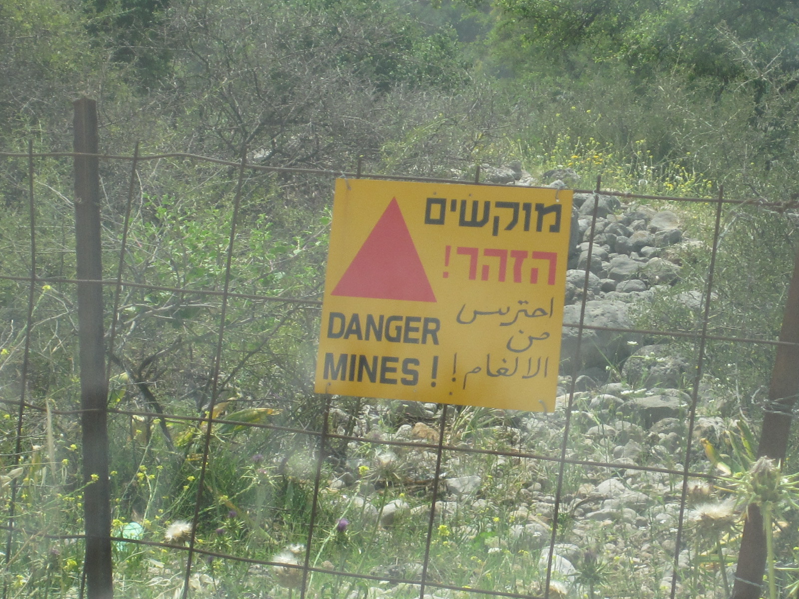
A few miles before the Syrian border I turned north towards Mount Hermon and Israel’s only ski resort. From a distance traces of snow were still visible near the summit, which is actually in Syria. On the way I came to a busy little town called Majdal Shams, which is the commercial and cultural centre of the Golan Druze community. The Druze are a minority Arabic language group who practice a version of Islam, and are mainly resident in Lebanon and Syria.
 The ski resort is a few miles north of Majdal Shams, and in May is definitely out of season, with just a few people there servicing machinery, although it is a hiking base in the summer. As I walked back to the car after a wander round I noticed that one of the rear tyres appeared to have low pressure, and found a small tyre shop in the main street of Majdal Shams on the way through. No one in the business spoke English, but a man who did was fetched from somewhere nearby and the tyre problem was quickly resolved, with a refusal to accept payment. I must be one of the few British people who can boast of having been to a Druze tyre shop.
From Majdal Shams the road runs south roughly parallel to the Syrian border, and I knew that at one point it was very close. A layby with a snack bar suddenly appeared at the roadside and when I stopped for coffee I realised that this was a viewpoint for Syria. The border fence could be seen running through the valley below, with watchtowers and a cluster of white buildings. A coach pulled into the layby and disgorged its passengers, who sat in front of their guide as she explained the features of the view in a language that I could not understand. Another coach came, full of Americans, who started asking their guide questions, some of which I think he did not want to hear.
Further along the layby was a pillar with buttons marked HE and EN. Pressing the EN button produced a commentary from a lady with an American voice, describing the view and extolling the performance of the Israeli forces in capturing the Golan Heights from Syria in 1967 and defending them in 1973. The white buildings are the permanent base of the UN Disengagement Observer Force (Undof), and alongside them through my binoculars I could see the ruins of the Syrian town of Quneitra, totally destroyed in 1973 and deliberately not rebuilt by Syria. As I stood on the layby two Israeli military convoys went past, as well as a few UN vehicles.
It seemed slightly surprising, but the viewpoint is actually on an extinct volcano, one of two in the area, and just along the road a local kibbutz has produced an educational display in a disused quarry showing the structure and working of the volcanos.
On the way back to Tiberias I drove round the eastern and southern sides of Gallilee before stopping in the town to have a proper look at it, as I had failed to do the previous day. LP described it as tacky, but I have been to worse places. One item of interest was the Water Level Indicator on the promenade with a digital display built into a frame shaped like the lake. A great deal of importance is attached to the water level, because the lake provides a quarter of Israel’s water supply, and if the level is too low the quality is compromised, and if it is too high there is a danger of flooding.
The next morning I set off for Jerusalem, and the most direct route was via highways 90 and 1, which run partly through the West Bank. My car was not insured for general use in the West Bank, but there is an exception for these two roads, because they are under control of the Israeli military police.
 Some distance south of Galilee highway 90 runs past Beit She’an, which has the dubious distinction of holding the record for the highest temperature ever recorded in the whole of Asia, at 53.9°C (129°F). Luckily I hit it on a cool day – it was only about 38°C. The road enters the West Bank a few miles past Beit She’an with a military checkpoint and runs for a long way quite close to the Jordan river, with the hills of Jordan clearly visible the other side.
Jerusalem, Bethlehem, Jerico
Shortly before turning westwards towards Jerusalem the road passes within three miles of Jerico, which I particularly wanted to visit, but I had been told not to take any ‘small roads’, so that would have to wait until later.
My hotel was in the centre of the modern part of Jerusalem, the other side of the Old City, and I was expecting to have a nightmare drive, especially as I did not have a decent map. On highway 1 at the entrance to Jerusalem was a toll-booth style military checkpoint but after that I seemed to have an easy run and found a free parking space near the central bus station, where I hoped to get a good map to enable me to find the hotel.
Within a short time of entering the bus station I was caught by a taxi driver, who insisted that he had the map I needed, and to cut a long and miserable story short, I finished up paying the equivalent of £6 for a tatty old map to get rid of him. However, the map did enable me to get to the hotel without too much trouble.
The modern Jerusalem Gardens Hotel had free undercover parking and a panoramic view from the balcony of my 11th floor room. The Old City was about two miles away, with a direct tram service from close to the hotel. Like all the non-locals, I had difficulty in getting a ticket from the machine, until a young American and his Canadian girlfriend came to my aid. My ten shekel coin would not work, so he bought a ticket with his money and refused to accept payment. He was wearing a T-shirt and shorts and a mini-kippa, a tiny skull cap about three inches in diameter favoured by many young Jewish men, and by the time we had gone six stops I knew his whole life story. His parents had moved to Israel some time ago and he had been studying at the Hebrew University in Jerusalem but was now engaged in religious studies elsewhere. He was a real all-American boy from Boston and it somehow seemed difficult to imagine where he would fit into the serious religious community in Israel, but I am far from an expert on such matters.
As mentioned earlier, my car was not insured for use in the West Bank (Palestine), which meant that I could not go to Bethlehem or Jerico in it. Getting there by public transport is not easy unless you have a lot of time and most guide books suggest going by taxi, which would be very expensive. The young American had advised me against getting involved with Jerusalem taxi drivers, backing up my own experience, and I decided that it would be cheaper and more convenient to hire a car for a day from an Arab company for use in the West Bank. A company recommended in the guide books was Green Peace (nothing to do with Greenpeace) in East Jerusalem, just north of the Old City, and I thought I would call in to their office while I was in the area. The tram stopped on the edge of East Jerusalem and I asked some people in a travel agency for the way to the Green Peace office. They rang Green Peace, who said they would have a car available for me at 8am the next morning.
 The temperature here was tolerable and I set off to explore the old city, starting at Damascus Gate. In many respects it was similar to the old city in Nazareth, but larger and with much more activity. It had the same maze of lanes and alleys, but the main ones were longer and straighter, mostly with names so that I could locate them on my map. There are many churches, synagogues and other notable buildings but it is difficult to see them from ground level because they are so densely packed in with little space between them. I particularly wanted to see the Western Wall and the Church of the Holy Sepulchre, but it was getting late in the day so I decided to come back when I had more time.
In central Jerusalem soldiers, male and female, were everywhere, many of them carrying automatic rifles. At one point, near the bus station, there were so many that I was practically swept along by them and thought for a moment that I had been conscripted into the Israeli Defence Force.
The next morning (Friday) I got up at 6.30am and caught a tram to East Jerusalem, arriving at Green Peace just after 8.00. As promised a car was ready, a silver Kia Rio with Israeli yellow number plates as opposed to the green number plates (actually white at the front and green at the back) for cars registered in the West Bank. The whole issue of driving in the West Bank is very confusing, because if you are in the wrong place with the wrong car at the wrong time you can find yourself being stoned by angry locals. When I told the Green Peace man what I was proposing to do he said “You can go anywhere in this car”. It had a big label on each side with Jerusalem Car Rental and a picture of a white dove, but whether that carried any weight I do not know. It just made me feel like somebody from the UN.
So I set off for Bethlehem. It is a very short distance, about 6 miles, and well-signposted, but I got confused about the entrance through the Separation Wall, and when I turned round I was accosted by a taxi driver who wanted to be my guide. After shaking him off I joined the queue for the check point. The Separation Wall, which has been built along much of the boundary of the West Bank, is enormous and hideous. It is about 8 metres high (26ft) and brought back memories of the Berlin Wall, but rather than preventing people from going through it is intended to prevent them from bringing weapons into Israel.
After a brief check I emerged into Bethlehem, to find a man standing in the road in front of me. He said “I am a guide. You are not in Israel now, you are in Palestine. It is different here. You need a guide.” I insisted that I did not need a guide and drove away. Unfortunately the street in front was no entry, so I had to make a loop through side roads and came back on to the original street about a hundred yards further along, where my friendly guide was standing in front of me again. I drove past him and found myself facing one of the most uninviting streetscapes I have ever seen anywhere. Welcome to Bethlehem. My first reaction was to turn round and go straight back, but I persevered and the scene improved to the point where it was only grim.
 Closer to the city centre it was better and I quickly found a place to park near a police station within about fifty yards of Manger Square, which presented a much more appealing image. The square is in between the Church of the Nativity and the entrance to the Old City, and is lined with cafés and shops.
It was still early in the day and the queue for the Church of the Nativity was short, so I joined it and went through the security check and the Door of Humility, an arch so low that even I had to crouch down to get through. Once a much higher opening, it was reduced by the Crusaders to prevent attackers from riding in on horseback. A service was in progress and I found myself at the back of a large crowd, ushered into an area on one side of the nave. The area in which the service was being held was extremely beautiful.
As far as I could tell it was going to be a very long time before there was an opportunity to venture any further into the church, and I was not religious enough to wait, so I crawled back through the door and went across the square into the Old City.
 Bethlehem Old City is smaller and more open than those in Nazareth and Jerusalem, with wider cobbled or paved streets used by vehicles, although there are alleyways branching off. On the way back to the car I passed the police station, where some tourists were photographing a policeman standing in the doorway with a rifle. This was what I regard as a proper rifle, not the stubby automatic weapons that the army and police seemed to have everywhere else. Normally it is unwise to photograph police or army personnel, but I asked if I could take a photograph and he said I could.
The route back to the checkpoint was more presentable than the way in, but approached from this direction the Separation Wall was even more forbidding. Shortly before the gate was a section of the wall covered with graffiti, some of it by well-known people, including Banksy, expressing support for the Palestinian cause. There were only two or three vehicles in front of me at the checkpoint, but it took several minutes to get through. I was asked if there was anything in the boot of the car, to which I said I didn’t think so (I hadn’t looked), but was then just waved through.
On to Jerico via Jerusalem. Jerico is about 25 miles from Jerusalem, via highway 1, and shortly after entering the West Bank I turned off the main road, through another checkpoint and up the hill to get some fuel at a filling station on the outskirts of Ma’ale Adumim, the largest of the notorious settler towns. Many countries, but not Israel, consider that these towns on captured territory are illegal under international law, but more houses are being built in the West Bank all the time. They are often occupied by ultra-orthodox Jews and the whole subject is extremely contentious.
 Because of time pressure I went straight back to Highway 1 and on to Jerico, which is very much a desert town. My map showed all the roads into Jerico as unpaved tracks, and I am sure some still are, but the route signposted was a well surfaced but dusty single carriageway road. After a short distance was a check point with a big sign at the side of the road in English stating that this was the point of entry to Palestine Area A, and it was illegal and dangerous for Israeli citizens to proceed any further. I was waved through without stopping.
Another complicated political issue. The West Bank is divided up into three areas, A, B and C, defining the amount of civil and military power Israelis and Palestinians have in each. These are not single large areas, but types of area. Area A is under full Palestine Authority civil and military control, and covers most cities in the West Bank, including Bethlehem and Jerico. Area B is under Palestinian civil control but Israeli military control, and Area C (including highways 1 and 90 in the West Bank) is under full Israeli control. As it said on the sign, Israeli citizens are forbidden to enter any part of Area A, but with a British passport I could. Strange, but true.
At the boundary of Jerico was a Palestinian military check point, and behind it another big notice stating that the development taking place on the area of land ahead was a gift from the American people to the Palestinian people. It was a vast site, partly built up, including a new chain hotel.
At first I seemed to have the only car with Israeli yellow numbers, which made me slightly uncomfortable, but then I did see a few others. It was easy to park and when I went for a walk around no one took any notice of me, and I was not hassled in any way. It struck me as quite a pleasant town, with mainly mid-twentieth century buildings rather than the ancient ones that might be expected. Maybe it was slightly less prosperous than Israeli Arab towns like Nazareth, but I did not see any great signs of poverty.
Joshua and his trumpet did a good job, as there was no trace of the old city walls, but in any case they would have fallen down by now due to the incessant horn-blowing by local drivers.
 Back in Jerusalem I handed the car to Green Peace unscathed and walked down to the Old City. It was impossible to get in against the vast tide of people coming out of Damascus Gate, so I went round to New Gate and right through to the Western Wall (Wailing Wall) in the far corner of the City. At one time, when the City was in Arab hands, the Wall was alongside a narrow alley behind a line of houses, but when the Israelis gained control they demolished the houses and created a large open space in front of it. Access to this area is via a security check where my backpack was X-rayed.
Until quite recently only men were allowed to go up to the Wall, but part of it, probably about one third, is now reserved for women. There is great resentment about this on the part of some ultra-orthodox Jews, and a few days after my visit hard liners started throwing things at the women worshippers, leading to a clash with the police. There are other examples of segregation, such as the bookshop on one side of the square which has separate entrances for men and women. Adjacent to the men’s area of the wall is a door into a building where large numbers of men, many in orthodox dress, were engaged in prayer, study or earnest discussion. Male tourists are allowed in, but are expected to be modestly attired and have some form of head covering. A baseball cap is quite acceptable for non-Jews, but a benevolent-looking man who appeared to be in charge was raising his eyebrows at some people who did not quite meet the expected standards.
It did not mean a great deal to me, but I was aware that to some of the people present touching the Western Wall was the greatest moment of their lives.
The Dome of the Rock and Temple Mount were clearly visible from the walkway above the Western Wall plaza, but unfortunately there is no access to them on Fridays, which happened to be the day I was there.
Next stop was the Church of the Holy Sepulchre, which is one of the many buildings hidden within the streets of the Old City and only properly visible from above. It was actually quite difficult to find the entrance, but once inside and through the security check it was obvious that a great many people had found the way in. The church is believed to be the site of Calvary, where Jesus was crucified and rose from the dead. Inside it are several chapels and the Holy Sepulchre itself, which was at the centre of a large mass of people queuing to get a glimpse of Jesus’s tomb. As might be expected there were many clerics around, but the scene was not enhanced by the considerable number of police officers and soldiers with guns. In the street outside were people selling nicely made wooden crosses about five feet high, and they were finding plenty of customers.
As mentioned above, it was Friday, and approaching the start of the Jewish Sabbeth, or Shabbat, which officially runs from sundown on Friday to sundown on Saturday. Almost everything in the Jewish parts of Jerusalem shuts down completely , starting from about 4pm, and I was lucky to get the last tram but one back to the city centre. The alternative would have been a dreaded taxi, if I could find one, or walking two miles along Jaffa Road, which connects the old and new cities.
By the time the tram reached the city centre the bus station mall and most other shops were closed. People were rushing to get home, many of them quite excited, and the atmosphere was rather like 6pm on a working Christmas Eve in England, but here it happens every Friday. A man in Orthodox dress pushing a pram with a baby in it turned to me as he passed and said “Are you Jewish?” I replied “No”, and he said “Well, Happy Shabbat anyway!”.
Happy Shabbat? For me it looked more like Hungry Shabbat, because all the restaurants were closed, and I was not sure whether the hotel would be doing meals. There were still a couple of small shops open selling comfort foods, and I bought a survival pack of biscuits, crisps and nuts, etc., just in case. In fact, the hotel restaurant was in operation so I finished up with a really good meal and a lot of stuff to put in the car.
 The view from my balcony on Saturday was unbelievable. In place of the frantic activity on Friday morning there was almost nothing moving. No trams, few cars, few people, no buses running but dozens lined up in neat rows in the car parks below. It was time for me to check out and set off for the Dead Sea, the Negev Desert, and Eilat on the Red Sea.
The Dead Sea, the Red Sea and Eilat
The way out of Jerusalem was the way I had come in, which I had memorized carefully, and with the minimal traffic on Shabbat I expected it to be easy. But as I found on my travels many times before, nothing is easy. The route from the city centre ran along a main road called Bar Ilan Street, which was easy to find, but closed with barriers on Shabbat because it was an Orthodox Jewish neighbourhood. There is strong feeling about people driving through such areas on Shabbat, so I had to find an alternative route that would take me well clear of the closed road, which took some time.
Eventually I passed through the checkpoint on to Highway 1, the route I had taken the previous day to Jerico. This time I turned south on to
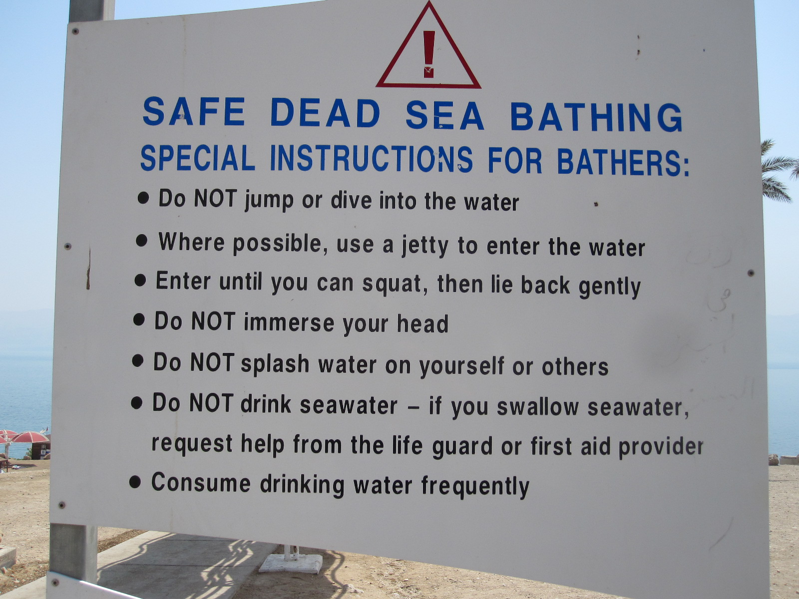 highway 90, through another checkpoint and within a short time the Dead Sea appeared on the left with the hills of Jordan on the opposite bank a few miles away. After about twenty miles the West Bank finished (yet another checkpoint) and the Dead Sea resort of Ein Gedi came into view. Ein Gedi has a public beach with free parking, a lifeguard station, toilets and few other facilities. At the entrance was a big notice telling people what they should and should not do on the sea shore.
Amongst the things you should not do are jump into the water, swim, swallow the water, get it on your face or in your eyes. The procedure for entering the water is to do so by gently lowering yourself backwards into it, until you are floating on your back, as many people were doing. If you do swallow the water or get it in your eyes you have to seek immediate medical attention from the lifeguard station. I put my hand in the water and tasted it, and it was incredibly saline. It actually has a mineral content of about 33%, mainly salt, but also magnesium, iodine and bromine. Within a short time my lips began to sting and I had to wash them with fresh water that I had in the car.
Some people were covering themselves with black mud, which is supposed to be good for the skin. I would have thought that this would intensify the effect of the sun’s radiation, leading to burning, but in fact the sun’s strength is reduced due to the dense atmosphere. The Dead Sea shore is the lowest point on earth, at about 425m (1380ft) below normal sea level, so the tea there should be fantastic if properly made. According to the digital indicator on the lifeguard station the temperature was 40°C (104°F).
Just off the main road few miles south of Ein Gedi is a string of expensive spa hotels right on the beach, designed to enable people to get the maximum health benefit from the water. More beaches and hotels are to be found on the separate, smaller part of the Dead Sea to the south, and at the very end is the Dead Sea Works, a massive, rusting industrial complex built in1930 to extract minerals, particularly potash, salt and magnesium.
From this point to Eilat and the Red Sea was a straight, boring drive of about 100 miles along the edge of the Negev desert, with the hills of Jordan still clearly in sight on the left. All the books said petrol stations were few and far between in the desert, but on highway 90 they were every 30 – 40 miles.
At 3.00pm I arrived in Eilat and quickly found a hotel, the Aviv B + B. Eilat is a popular holiday destination for Europeans, and most visitors arrive by air. The airport is unusual in that the runway extends right into the middle of the town and the main entrance is directly off the pavement near a roundabout in the town centre. By standing on a grass bank on the roundabout it is possible to get a pilot’s view of the runway.
It was still Shabbat and I was still hungry. The restaurants in the town were closed, but I thought perhaps there would be some places open on the beach, and there were. The temperature was in the upper 30s, but I was beginning to get used to it, and after the meal I managed to walk the whole length of the promenade by the Red Sea. The sea is not actually red, but is noted for its clear water and the luxuriant plant life on the sea bed. Glass-bottomed boat trips are a big attraction, and the area is popular with scuba divers.
The main item on the BBC World Service the next morning was that Israel had bombed Damascus in a fairly big way. I went down to the reception and asked the way to the breakfast room, only to be told “There isn’t one. We only do breakfast in the winter”. So although the sign with Aviv B + B could be read from almost all over the town it was really just the Aviv B. They recommended a nearby bakery for breakfast, where I paid a small fortune for coffee and a bagel. Some idea of the usual clientele of Eilat can be obtained from the fact that round the corner from the Aviv B was a place called the Fawlty Towers Hostel, with pictures of Basil, Sybil, Polly and Manuel on the sign.
Unless you go through into Jordan or Egypt the choice of roads from Eilat is limited to two, as the town is, in effect, on a land-locked peninsular. This meant either retracing my route for some distance or driving along the Egyptian border, a road that was closed at the time of publication of my LP guide (July 2012) due to terrorist incursions leading to the deaths of a number of civilians. The English lady who owned the Aviv B said the road was open again, but it squiggled about in the mountains and was “even more boring than the other one”.
The Egyptian Border, Negev Desert, and Be’er Sheva
 The Egyptian border road, Route 12, was far more scenic and interesting than the “other one”, and I realised that the lady’s measure of boring was related to the number of places where food and drink were available (none the way I was going). The only other vehicles on the road were taxis going the other way, although I don’t know where they were coming from, because it was a long way from anywhere.
After a few miles the road came to the border fence with Egypt and a proper Israeli army checkpoint, with camouflage and a big gun on the road pointing towards Egypt. There seemed to be two young men and two young women soldiers, and when I held up my passport one of the men asked me where I was from. I said “England” and he replied “Have a good day”.
The border fence was new and quite impressive, consisting of a double wire fence with a gap in between, and was slightly reminiscent of the pictures of the Great Wall of China as it stretched away into the distance, following the contours of the land.
Eventually another check point came into view, near the point where Highway 12 branched away from the border, to leave Highway 10 continuing about 120 miles to the coast and Gaza Strip. The soldier in charge just waved me through with a broad grin, and I had a feeling that he knew I was coming. If you broke down on that road I don’t think there would be any need to fetch Green Flag, the Israeli Defence Force would coming looking for you.
At the junction with Highway 40, the route used by normal people travelling north from Eilat, is a proper oasis, with a small shop and restaurant surrounded by trees. In the middle the actual spring had been made into a small water feature. About a dozen cars  were parked there, most if not all, travelling on Highway 40.
My night stop was to be Be’er Sheva (Beersheba), a drive of about another 100 miles across the desert, which was very barren but with some good mountain backdrops and occasional signs warning of camels on the road, although I did not see any. Army exercises were taking place here and there on both sides of the road.
Shortly before a small town called Mitspe Ramon the scenery became quite spectacular as the road crossed a vast crater called Makhtesh Ramon, which the LP likens to the Grand Canyon, although I would say that is a bit of an exaggeration. It is nevertheless an extraordinary landscape, with multi-coloured rock formations, and could be on another planet. The crater is 8km wide and 40km long, Mitspe Ramon being perched high on a cliff above it with a lookout built out over a sheer drop to enable visitors to make the most of the view.
At the roadside on the approach to Be’er Sheva were a number of Bedouin encampments in which people appeared to be living in appalling conditions, in what looked like makeshift tents, huts and old vehicles. Some Israelis told me that what  can be seen from main road is just a drop in the ocean compared with the amount that is out of sight. Some Bedouin still live the nomadic lifestyle in tents, moving around in the desert and others have become fully urbanised.
Not far from Be’er Sheva is a Bedouin city called Rabat with a population of 40,000 and a reputation for being crippled by poverty and crime. LP said a visit was not to be recommended.
According to LP accommodation in Be’er Sheva was limited to a choice between an expensive hotel and rooms in a college residential building used mainly by students and visiting professors. As well as being cheaper I thought the college would be more interesting. It proved to be very Jewish, with absolutely everything in Hebrew, although most of the staff spoke English. The accommodation was basic, but far better than the hall of residence I lived in as a student in London in the late1950s, and the room was more comfortable for reading or studying than any hotel room I have experienced.
 Be’er Sheva is quite a pleasant town, actually very old, but without much ancient fabric as far as I could see. The so-called Old City does not have a lot of character and is supplemented by a fair-sized modern shopping mall, but one thing I wanted to see was the Bedouin Market, which I thought might provide an insight into their lifestyle and culture.
At breakfast the next morning I was told off for sitting in the wrong place in the vast and almost empty restaurant, and the lady in charge treated the ‘guests’ as if they were 19-year-old students who were clearly up to no good and needed to be put in their place. I quite enjoyed the experience.
The Bedouin Market was a great disappointment. After stretching my walking ability to its limit it turned out that the people and the things they were selling were just like those in my local market at home. Most of the stall holders were shouting in the usual manner, but a couple had small loudspeakers playing a recorded message listing the items on offer. So much for tradition.
Ashkelon and Ashdod
From Be’er Sheva I was aiming for the Mediterranean coast for the last night before returning home. On the coast just north of the Gaza Strip are two towns called Ashkelon and Ashdod, both of which escaped a mention in the LP guide, although Ashdod is the fifth largest city in Israel. Looking at the map I somehow got the impression that they were run down places, but in Be’er Sheva I asked a lady who by chance came from that area and she said they were both nice towns.
The road from Be’er Sheva to Ashkelon runs within a mile of the Gaza Strip and about five miles from Gaza City itself. The Foreign Office warns against getting too close to the Gaza Strip because of rocket attacks, but it was not until I got home that I discovered that in 2012 over 2000 rockets were fired from Gaza into Israel, resulting in some deaths. Due to negotiations with Hamas, the group that controls Gaza, the number so far in 2013 was greatly reduced. Ashkelon and Ashdod were both well within range of the rockets.
At the point nearest to Gaza it appeared that a new educational establishment had been built, and on the bright, clear day that I was there it was hard to believe that there were hostile forces so close. Approaching Ashkelon from the south I came to a massive industrial estate, with enormous trucks running around loaded with materials rather than the ladies-underpants-from-China sort of industry that we have in England nowadays.
Ashkelon itself was a hive of activity with new building going on everywhere, reminding me of a typical fast-growing Florida coastal town. If the people firing the rockets think they are going to intimidate the Israelis they are very much mistaken.
Ashkelon might have a beach and a marina, but as far as I could see the only hotel was the expensive Holiday Inn, so I pushed on to neighbouring Ashdod, a considerably bigger town. At the far end of the long promenade was a large new and very smart hotel, with a couple of older ones nearby. The Hotel Orly had the character of a late 19th century French establish-ment and was the kind of place I was looking for.
 After getting sorted I went into the town, which appeared to be quite European as I strolled along a wide boulevard lined with shops and restaurants, but, as in Ashkelon, virtually everything seemed to be in Hebrew At a junction I turned down a side turning, went into a shop at the back of a small precinct, and was surprised to find the shopkeeper talking to a customer in Russian. I did not think much about it then, but a few minutes later as I was sitting in front of a snack bar enjoying a glass of freshly squeezed orange juice I looked around and realised. This was Russia! It was all there, the austere blocks of flats, concrete buildings with the aerials on top, and shabby little precincts. You could have picked the whole lot up and dumped it down in the suburbs of Moscow and no one there would have noticed. In general, however, the lady in Be’er Sheva was right, Ashkelon and Ashdod are nice seaside towns, but they are not likely to be in the European package holiday brochures while there is still the occasional rocket attack.
Although I had seen a lot during my visit to Israel, there was still much that I had not seen, especially in the West Bank. It is generally considered inadvisable to go to towns such as Nablus, Jenin, and Hebron, where there is serious poverty and massive refugee camps unless you are accompanied by someone who knows the ropes and has local contacts. I only saw a little bit of the separation wall, in Bethlehem, and afterwards I felt that I could have been more adventurous while I had the Green Peace car.
Israel is a country of enormous contrasts. It is impossible not to be impressed by the rate of development in terms of building and infrastructure, at a level far beyond the imagination of the British government, and many people must be working very hard to make it happen.
At the same time, the country is on a semi-war footing, with a huge military presence and in some areas machine guns are a common sight. The political and religious differences inside and outside the borders are immense, with, as far as I could see, no resolution in sight.
Chile & Argentina 2012
Chile and Argentina 2012
For years I had wanted to go to South America, but was deterred by the supposed danger in travelling around independently as I do. Several countries, including Colombia, Paraguay and Brazil are still a bit dicey, but in recent times the situation has improved and a number of countries are now considered to be reasonably safe. Peru is quite attractive, but half the people I know have been there on guided tours, so I looked for somewhere less popular
After some research on the internet I discovered that it was possible to hire in car in Santiago, Chile and drive over the highest part of the Andes to Mendoza in Argentina, which seemed quite a sensible thing to do. Chile is generally safe, and despite comparatively recent history Argentina was said to be ok for British people as long as discussion about the Falklands is avoided.
On a recent trip to Germany I had picked up a 3-year old edition of Ivanowski’s Guide to Chile, in German, for €2. It is unlikely that many British people have travelled around Chile or anywhere else using an Ivanowski guide, and it was nothing like as good as a Rough Guide or Lonely Planet, but it did have a large road map at the back. Subsequently I lashed out on a new Rough Guide (RG) which provided most of the information for my trip.
To be any good a map of Chile has to be large, because at 2700 miles from north to south it is the longest country in the world, although at its widest point it is only about 150 miles across. To put it in perspective, if you were to cut Chile out of a globe atlas and place the top end on Norway, the bottom would be on Nigeria. The capital, Santiago, is about half way down and is at the same latitude as Johannesburg in South Africa and Perth in Australia. As a consequence of the strange shape of South America the longitude of Santiago is east of that of Boston, although it is only about 70 miles from the Pacific ocean.
Despite its shape, Chile has clear cut natural boundaries, with a vast desert to the north, frozen wastes to the south, the Pacific ocean on the west and the Andes mountains on the east. This makes it impossible to generalise about the weather, but in the Santiago area I expected it to be warm in November.
There are no direct flights from England to Santiago and really it was a choice between going via Madrid, with a short flight and a very long one, or the USA with two fairly long flights. Because of the complications of immigration in the USA I decided on the Spanish route, although I was a bit concerned about the collapsing economy there. The flights were operated by Iberia in conjunction with British Airways and LAN Chile.
In the event everything went quite smoothly, although being crammed into a seat on an A340-600 for 14 hours was no great pleasure, especially as the space and in-flight services were little better than with Ryanair. Owing to a problem which my doctor describes as “common in men of your age” I had an aisle seat at the back near the toilet and had to get up at least 6 times.
Santiago
At Santiago Airport there was an excellent shared minibus system for taking people to their accommodation in the city, and it cost about £7 for 12 miles, although the traffic jams in the city centre were dreadful, practically the worst I have seen anywhere. By the time I got to my hotel I been travelling for about 30 hours.
On the way through the city we used the main thoroughfare, which has the name Avenida Libertador Bernado O’Higgins. Mr O’Higgins, who was presumably of Irish extraction, figures very prominently in Chilean history as the liberator of the country in the 18th century. Many British names crop up in a similar way, examples being Walker, MacIver, Mackenna, and Cox. (Click on picture to enlarge). Av O’Higgins is very long and parts of it were lined with shabby buildings exactly as I expected South America to be. Some of the buildings had big pictures of girls all over them. It was not clear what they were but I think they might be art galleries of some sort and I resolved to go back and have a proper look at the area before leaving Chile.
As usual I had booked a cheap hotel on the internet and the room was very small but clean and the people were nice. After getting sorted and resting for an hour or so I walked to Plaza des Armes, a small park which is the centre of life in the city. The hotel was in Providencia, a reasonably smart neighbourhood, and I felt quite comfortable about walking through the streets with my  backpack. On the way I called in at the car rental office, as there had been some last minute problems with the documentation for taking the car to Argentina. Over the previous few weeks I had had considerable email correspondence with a chap named Raphael, and it seemed strange to be meeting him face to face, but he said everything was ok.
The next morning I collected the car, a Nissen March (known in many countries as the Micra), and was pleased to find that it was in good condition apart from a few minor scratches. Raphael was out and the car was handed over by a pleasant Brazilian chap who said his English was not very good, and when I asked for directions to Los Andes he said “take Hooter Sink Nortay”. He repeated this several times, and it was like Basil Fawlty trying to make Manuel understand something in English, but the other way round, although this man was rather less aggressive than Basil. “Hooter Sink Nortay” was going round and round in my head, when I suddenly exclaimed “Ah! Route Five North!”. My recent attempts to learn Spanish have actually been a dismal failure but the signs to Ruta 5 Norte were easy to find and I was soon on the way to Los Andes. Once clear of Santiago there was little traffic and the road ran for a long way across an arid desert-like plain with rows of small trees as far as the eye could see. After a while I came to a toll booth, the first of many that I was to encounter in Chile. The road then climbed into the mountains via a tunnel for which another payment was demanded.
Los Andes
Eventually I arrived in Los Andes, a small town, and managed to scrounge a free map from the ‘tourist office’, a cabin at the side of the road. From the internet at home I had obtained a list of four hotels and set off in search of them with the map. The first street I tried to drive down had a man at the end in a yellow jacket taking to someone in a car, and thinking he wanted some money I squeezed past and entered the street. It was very narrow with cars both sides and I had to squiggle about to get through. After about 100 yards it was apparent that the road was blocked by a market. With great embarrassment, touching mirrors on both sides and following shouted instructions from the population of Los Andes, including the man in the yellow jacket, I reversed the unfamiliar car through the obstacle course back to the main road. The man in the yellow jacket required payment for his assistance, and I put the incident down to the SHHMS (Should Have Had More Sense) factor, which rears its ugly head somewhere on every trip.
As in many towns in Chile, the streets of Los Andes are laid out in a grid and most are one-way, which is no problem once you get used to it.
Eventually I found a decent, cheap hotel with a secure car park, which is said to be vital anywhere in South America. There certainly seems to be an obsession with security, with the iron railings and big locked gates that you see in pictures of that part of the world, but whether the crime rate is really so dreadful I don’t know. The locals warn you about walking through the streets with anything of value and the guide books tell you to keep the car doors locked and windows closed when driving around, but on the face of it it didn’t seem to me to be any worse than Portsmouth (England) and nothing like as bad as many cities in the USA.
Over the mountains
The next morning I was woken by a loud siren that I thought might be warning of an earthquake but turned out to be the way of rousing the part-time fire brigade. After breakfast I set off for Argentina, over the Andes, passing the highest mountains in the world outside the Himalayas. The road  rises to an elevation of about 3500m. (11,500ft), much higher than any European pass, via a series of over 20 hairpin bends before entering a toll tunnel which cuts off the top of the original pass. The actual border between Chile and Argentina is marked by a sign inside the tunnel and a short distance after the tunnel there was a kiosk in the middle of the road with a man who shouted something in Spanish and gave me three forms. These were an immigration form for me, a form all in Spanish for the car, and a little piece of blue paper with a stamp on it. He said something about another place in “treize kilometre”, but I didn’t know whether this was 3 km or 13km. It turned out to be the main customs post, at 13km, and this was a real old style frontier checkpoint, with several lines of kiosks inside a building. There were 5 kiosks in each line, some Chilean and some Argentine, and no one spoke English.
When I collected the car the rental people emphasised that it was vitally important to follow the correct procedure in the customs. As the temporary importer of the vehicle into Argentina it was my responsibility to ensure that the correct papers were stamped and I must be with the car on its return to Chile, otherwise I would be liable for duty in excess of its value. If it got smashed up in Argentina I had to come through the frontier with the wreckage on a breakdown truck. They omitted to say what would happen if I got smashed up.
In the customs shed my passport, the wad of papers I had for the car and the ones that I had been given by the man a few miles back were all taken and stamped, stamped, and stamped again. A young chap appeared who spoke a little bit of English and asked me for ” the paper with the blue light”, by which I assumed that he meant the little bit of blue paper, which had fallen down between the seats. This seemed to be the most important of the lot, and by the time I finally escaped it was completely covered with stamps.
A few miles further on I was stopped yet again by a man standing in the middle of the road who took the little piece of blue paper, folded it, and put it in a slot in the top of a box. It is impossible to understand the purpose of this arrangement, but I drove away feeling that I might somehow have voted for the next President of Argentina.
Argentina
The mountains on the Chilean side were plain and not very attractive, but on the Argentine side they were altogether more colourful. Although the road on the descent from the pass was comparatively straight the scenery was superb with little traffic. There were several places of interest that I resolved to look at on the way back, and I pushed on to a small town called Uspalatta, where I stopped for a look round. It was immediately obvious that Argentina was less prosperous than Chile, the place having a general run down appearance with many tatty old cars driving about. Only the few main streets were tarmacked, the rest being compacted soil.
On to Mendoza, which is the second largest city in Argentina. If you are a wine lover you will definitely have heard of it, but it was unknown to me until I planned this trip. It is quite large, population over 110,000, but I quickly found a reasonable hotel within walking distance of the centre, booked for two nights and went to explore.
Mendoza is a totally planned city, after being completely destroyed by an earthquake in 1861. It was rebuilt with wide tree-lined streets, but those I walked through into town were quite shabby with a lot of closed business premises. The pavements were in very poor condition, with large holes and open drainage channels everywhere, and you have to keep an eye on the ground at every step you take. The streets appear to be designed to cope with vast quantities of water, and I can only assume that when it rains it must do so in a big way.
The centre is smarter, with shopping streets based around a beautiful large park with four smaller parks nearby, and in contrast to the suburbs there was plenty going on. The main streets were very European in character, with lots of old French and Italian cars, plus a few British ones from the 1960s through to the 80s. Mr.O’Higgins was apparently also in  action here, his name having been given to a park. Like Santiago, Mendoza has a good road system, but again, without local knowledge you can easily get into a mess, as I did when drove down to a big modern shopping mall in the evening.
Within my lifetime Britain has fought in or against many countries around the world, Argentina being one of the more recent ones. In the period leading up to this trip there were rumblings about the Falklands (or Malvinas if you are on the other side) again and I was not sure how I would be received. In the event I did not sense any hostility from anyone, and the only reference to the subject I came across was a properly made notice at the roadside shortly before the border tunnel that appeared to say MALVINAS FOR ARGENTINA. On one of the main streets in Mendoza there was an old-style British red telephone kiosk with a working phone in it and intact windows, which suggests that in this area, at least, there cannot be any ill feeling.
 On the Sunday when I drove from Los Andes to Mendoza there was little traffic on the road, but for the first 20 miles when I left on the Tuesday morning to go back over the mountains I was dicing with death trying to get past an endless string of slow trucks. Fortunately most of them turned off into an industrial area leaving a fairly clear road to the border. A few miles before the border is a famous place called Puerte del Inca (Bridge of the Incas), which is a natural stone bridge over a river with a high concentration of minerals, so that objects left in it for a long time become “petrified”, acquiring a hard bright yellow coating of rock-like material. Many such items are offered for sale along with the usual tourist tat.
Also at Puerto del Inca are the remains of the former narrow gauge railway from Los Andes to Mendoza, originally built with the help of British engineers. It was abandoned in 1989, and bits and pieces of it can be seen alongside the road on both sides of the border. This is the main land route between Chile and Argentina, and In 2009 it was decided that a new railway would be built, but bearing in mind the surprisingly low amount of traffic on the road it is hard to see how the vast cost could be justified.
It was vital for me to get the car papers stamped before leaving Argentina, but it was not clear how to do that, because the customs post that I had been through before was only for traffic going the other way, and there was nowhere else before the tunnel. Eventually I found a young priest in the customs queue for Argentina who spoke quite good English, and he explained that there were Argentine officers in the customs on the Chile side of the tunnel.
 About the only similarity between the two customs posts was that no one spoke English on the Chilean side either, and I was led from window to window, queue to queue, desperately trying to hang on to all my pieces of paper. Every time I thought it was all over another obstacle would appear. Next time I will bring my own rubber stamp, because I think it is a bit like Russia - as long as you have enough pieces of paper with stamps it doesn’t matter what is on them.
Eventually I managed to escape and after a couple of hundred yards turned off the road into Portillo, described by the RG as an upmarket ski resort. For me this would be the Ski Resort from Hell, consisting of what appeared to be a brightly coloured pre-fabricated accommodation block and some big blue sheds. The skiing is undoubtedly good, because of the altitude, but limited in scope compared with European resorts and completely lacking in Alpine character.
The first two days in Chile had been pleasantly warm, but when I got back to Los Andes it was scorching hot, I would estimate about 90deg. I had reserved a room in the same hotel as before, and the lady owner seemed quite pleased to see me.
To the Pacific coast
Originally I planned to drive across country to the coast, but the route was not very inspiring so I decided to go back via Santiago and call into the car rental office to make sure that the papers were in order and give them time to sort things out if they were not. This would have been a good idea if I had a decent map of Santiago, but within a short time of entering the city I was hopelessly lost. By now I realised that the city was very much larger than I thought. With a remarkable piece of luck I found two men polishing second hand cars in front of a place called Royal Cars, and they both spoke good English. They set me on the right track, but it took 10 minutes driving at 60 mph on an urban motorway to bring me close to the car rental place, which gives some idea of the size of the city.
Everything was ok with the papers so I set off for the coast, aiming for a resort called Viña del Mar, near Valparaiso. On the way I departed from the motorway a couple of times to go into the mountains. At the first attempt I ended up on a concrete road that was only wide enough for one vehicle,  with a strip of bumpy sand 2 or 3 inches lower on each side so every time something came the other way (and there was a lot of traffic) I had 2 wheels on the concrete and 2 wheels on the sand, at one stage doing about 30mph with a bus a few feet behind. There are a tremendous number of little buses everywhere, mostly Mercedes-based and quite old. They seem to be very tough and can take this sort of treatment in their stride, which my car could not.
There was also a marvellous stretch of mountain road with lots of hairpin bends, sheer drops and trucks coming the other way. This road was not too badly surfaced, but once you deviate from the main highway it is common to find stretches of dirt, sand or gravel.. 
The first thing I noticed on entering Viña del Mar was the number of stray dogs running around, almost like Romania. The town was a bit of a disappointment, with terrible traffic and seemingly no hotels of the sort I was looking for, so I decided to try Reñaca, a couple of miles further north. According to the RG, Reñaca is a lively upmarket resort, but overpriced. The guide was wrong on the first two counts but right on the third. The place was like Bognor Regis on a bad day in the winter, with the sea front all messed up by road works, but I got a very expensive room overlooking the ocean, or as much of it as was visible through the mass of electrical cables and junction boxes.in front of the window.
 I had seen the Pacific a few times before (in California) but never stayed close to it, and I was amazed at how noisy it was. For years I have lived in a beach house on the English Channel and am used to the sound of a rough sea, but the breaking waves of the Pacific seemed to be a whole order of magnitude louder, even though there was no wind. Just as I arrived some surfers were packing up for the day, and although the breakers were very wide they did not look exceptionally high.
Valparaiso
Next on the list was Valparaiso, or Valpo as it is known to blasé world travellers such as myself. After the fiasco with the hotel in Reñaca I went on the internet and lined up three cheap hotels in Valpo with secure parking, using the maps in the local phone book, but did not make a reservation because the internet connection was public.
Valpo is an extraordinary place, with the centre more or less at sea level and the rest of the town rising up steeply behind it. It has a big container port, and the guide books warn about the danger of walking at night or alone in the port area. The hillside above the town is covered with densely-packed brightly coloured houses, mostly built on stilts to compensate for the steep slope. Many are in poor condition and give the appearance of a shanty town when seen from a distance. Some parts of Valpo on the higher ground are laid out in a grid, but the roads leading up from the main town take a tortuous route with hairpin bends through narrow streets.
The previous evening I had studied the telephone directory maps very thoroughly and had a good idea of the way to the three hotels I was looking at, which were quite close together near the top of the hill above the harbour. At the quaintly named Plaza Wheelwright (presumably another British pioneer) I turned off left onto the steep climb, followed by several taxis, which started sounding their horns after a while because I was not going fast enough. Not fast enough for them, that is, I was going quite fast enough for me. As the road went uphill the character of the neighbourhood went the other way, becoming the sort of area where I would not really want to stop or get  out of the car.
The first hotel was in a street called Levarte, and although it was slightly better than some of what I had come through it did not exactly come across as salubrious. Driving slowly along the street I realised that there was one building that was much smarter than the others, a single storey Spanish style house with a forecourt behind the obligatory iron railings and gates. This was the Hospedaje Familiar El Mirador Bed & Breakfast, and turned out to be absolutely brilliant. It was run by a lady and her daughter, and was like a comfortable Spanish family house with self-catering apartments behind it. The price was exactly half that of the awful place in Reñaca.
Parking in the centre of Valpo is practically impossible, so I decided to walk into the town. The ladies told me take nothing of value with me, including my passport, which they said I should put in the room safe. This was a tiny steel box bolted to the wall, and had an electronic system for setting up the combination number, which I knew from past experience was difficult enough if the instructions were in English, and here they were only in Spanish. In any case it never seems very sensible to me to leave valuables in a place where everyone would expect to find them, and safes like that are only as good as the wall they are fixed to, which in this case would probably not amount to much.
In the end I hid my passport in the locked car in the locked car park and put one credit card under the insole of one of my shoes, as well as some other security measures. The ladies gave me a bunch of six keys, with instructions not to lose them, so that I could get to and from my room, and also a map marked with all the local sights.
It was a walk of about a half mile down the hill to the port area, including a long, graffiti –covered flight of steps between derelict graffiti-covered  buildings. There is graffiti everywhere, some of it quite artistic I suppose, but who is to say what is artistic nowadays? There was hardly anybody around and it was not an environment to inspire a feeling of security, but I tried to look as if I belonged there and knew where I was going. It would probably have been more convincing if I had been holding a can of aerosol paint.
The port area and centre of Valpo really were South America as I had hoped to find it, with narrow streets, rough old buses and trolley buses, and buildings ranging from smart to dilapidated, mostly the latter. Some of the more imposing buildings and monuments were connected to the city’s naval heritage, and there were a fair number of seamen around.
 The central area is long and narrow, just a few blocks wide, with several plazas and small parks. At intervals there are long flights of steps leading up the hill and ancient cable operated lifts with wooden cabins holding about 12 people in each direction. The RG recommended trying these to experience the view from the top, and said that “despite their rickety frames and alarming noises they’ve so far proved safe and reliable”. I tried one called the Ascensor Concepción, built in 1883, and was pleased to find that the “so far” held out. The view from the top was worth it, but I had to walk down to avoid a half hour queue.
On the way back to the hotel I stopped for a rest in Plaza Echaurren, city’s oldest square, described in the RG as “very picturesque save for the wine-swilling characters who permanently occupy its benches”. Despite not swilling any wine I felt quite at home there. A friend often says I go around dressed like an extra from ‘On The Waterfront’, which is probably not a bad thing in such places. Nearby was another  funicular lift, Ascensor Artilleria, which took me up the steepest bit of the climb back to my hotel and avoided an unsavoury part of the route.
At about 9pm I ventured out of the hotel and walked down Levarte to some small shops. These were like the back street shops I remember in England from my childhood, the small, dark front rooms of houses, although there was one bright one, which seemed to be a lottery-based betting shop. Back at the hotel, a veranda near my apartment afforded a magnificent view across the city, with all its coloured lights.
The coast.
The next morning I set off to explore the Pacific coast travelling south round a headland high above the ocean, and immediately ran into heavy mist, causing the car to fog up in a big way. The day before I noticed that the houses high on the hill were in low cloud, and from road signs warning of fog it appeared that this was a frequent occurrence.
The first place on my itinerary was to be a coastal village called Quintay which could only be reached by driving inland for some distance and taking a mountain road. It was quite a scenic drive and eventually I came to what appeared to be the main street of Quintay, consisting of a short length of dual carriageway with a dirt surface between two lines of bungalows. At this point I suddenly realised that I was low on fuel, with 2 bars showing out of 10 on the gauge, and I had no idea how far how I could get on that. There was a small shop half way along the street, so I went in, looked at the lady behind the counter and said “Gasolina?”. I knew it was called that because it said so on a Dymo-Tape sticker on the dashboard to prevent misfuelling. She took me outside, pointed diagonally across the street and said something about ‘five litres’. There was no sign of any petrol pumps where she had indicated, so I drove back to the tarmac road and turned downhill towards the ocean. Half way down there was a man loading something into a white pick-up, and when I asked him about gasolina he indicated that I should follow him. We stopped in front of a bungalow in exactly the place that the shopkeeper had said, and he shouted something, whereupon a lady appeared from behind the building. At this point I noticed a rough piece of wood on the fence with “LINA” scrawled on it, so this was the filling station.
The lady produced a five-litre clear plastic container full of a pale yellow liquid, and a funnel with a long tube attached. The whole set-up was spotlessly clean. She put the fuel in the car and charged me the equivalent of £8, the highest price I have ever paid for five litres of petrol, but it was  a captive market and my fault for not watching the petrol gauge. The normal price for petrol in Chile is about £1.15 per litre, so the lady was, as they say, onto a ‘nice little earner’.
Back to the coast road, and this led to a bay with a pretty little fishing port, but, like Reñaca, it was still out of season and everything was closed. Pushing on south, the road ran through a series of coastal resorts, with names like Algarrabo, El Quisco, El Tabo. Some had nice beaches and I stopped here and there for a walk around.
Looking at the map, the most sensible place to spend the night appeared to be San Antonio, but I changed my mind when I got there. It was a rough port town, and the first impression was it was not a good place to stop at all, let alone for the night. There seemed to be only one hotel, combined with a casino, and after failing to find another hotel on a drive right round the town on the back roads I decided to move on to somewhere else.
The next town, about five miles away, separated from San Antonio by a long bridge over the Rio Maipo estuary had the grand name of Rocas de Santo Domingo, and was as grand as its name. It was unbelievably different from San Antonio, like an upmarket private estate with big detached houses. There was a sign to a hotel that turned out to be as smart as the rest of the place, with a separate restaurant/reception building and the accommodation in chalets amongst the trees. In the car park there was one car which obviously belonged to someone who could not afford to be a paying guest, and I quickly discovered that I was also in that category. Anyway, the place was deserted and it would be like staying in a chapel of rest.
Back to Santiago
The next day I had to be in Santiago, so there was little choice of route from Santo Domingo, and the only likely place for a hotel was a town called Melipilla, about 50 miles away. On entering Melipilla it was San Antonio all over again, the sort of area where everybody looked like extras from ‘On The Waterfront’, even though it was not a port. I pulled on the forecourt of a service station and stopped in front of the office. As I got out of the car a man came out of the office and shouted at me. He was the toughest, hardest looking character I have ever seen, let alone met. He was a bit taller than me but about twice as wide, with a big ugly face, swarthy complexion and a scar on his chin where a knife had been jabbed into it. This man was hard, real hard, fifty per cent harder than the two Mitchell brothers put together, but instead of killing me he pointed out that I had left my headlights on.
I looked at him and said optimistically, “Hotel?”. He put his hand on my shoulder, guided me to the edge of the forecourt and explained very carefully three times in Spanish that there was a hotel on the left hand side of the third road on the left. He then walked back to the car with me, shook my hand and went into the office. At least I know where to find a bodyguard if ever I want one.
The hotel was excellent, obviously catering mainly for business people because I cannot imagine many tourists visiting Melipilla. With some trepidation I decided to go out and have a look at the area and find something to eat. The main road really was seedy, with a lot of scruffy car repair workshops, some closing for the evening, and a fair number of dubious- looking characters just hanging about. In this situation you always want to take photographs but it is unwise unless you have a concealed camera.
The first eating place I came to looked like a proper restaurant, but in fact only did “sandwiches”, like a vast number of places in Chile. The sandwiches consisted of large round bread rolls with an exciting choice of fillings - ham or cheese. I chose the former, with a fizzy drink. Unsurprisingly this was not really enough, and rather than continue the hazardous walk towards the centre of Melipilla in the hope of finding a better restaurant I got some stuff from a small supermarket and took it back to the hotel. This will be a good example to put in the “Travellers’ Guide to Fine Living”, when I get round to writing it.
 It was about 50 miles to Santiago, and the next morning I wanted to take the car back to the rental office, check in at my hotel, and spend the rest of the day looking round the city. Needless to say, I got lost yet again on the autopista in the suburbs, adding at least 20 miles to the journey and paying one toll twice, but I saw quite a lot of the outskirts in the process.
The car rental people were extremely fair, actually reducing the charge because I had returned the car 22 hours early. Overall, I had found both Chile and Argentina to be very “straight” countries in this sort of way, with no one trying to make a quick buck at every opportunity.
To give me more time in the central area I took the crowded underground train from near my hotel to Avenida Bernado O’Higgins, holding my backpack in front of me, and it didn’t seem any different from the underground in any other capital city.
Santiago hasn’t actually got a lot of “sights”, but I photographed a few streets, buildings and monuments. There were certain areas in the main streets with signs saying that photography was not allowed, although I could not see why. In this day and age, when so many people have camera phones, it is ridiculous anyway. There were police around in cars, on foot, as well as on motorcycles and scooters, but not to the point where it felt anything like a police state, which it certainly was from 1973 to 1988.
A strange thing that I noticed in all Chilean towns was the extraordinary number of dispensing pharmacies, with staff smartly kitted out in white uniforms. The general health of the population appears to be quite good, and it is difficult to understand how all these businesses can be viable. Second to pharmacies were hardware shops. Macdonalds and Burger King were also there in strength.
There was far less German influence than I expected, with few recent BMWs or Mercedes on the roads, but a lot of VW products from Brazil. Most new cars and small trucks are from the Pacific rim, and increasingly, China.
Despite the rough bits, overall I liked Chile and Argentina. The people were generally pleasant and honest, and then was none of the in-your-face hassle found in some other countries, but the language was a bigger problem than I expected. When I was waiting at the airport for my flight home I was interviewed by a lady from the Government Tourist Office, and she said although English is the second language it is not very well taught and few pupils leaving school can actually speak it. It is hard for us to complain about this, because how many British children come out of school able to speak a foreign language?
Another matter she asked me about was the cost, both of getting to Chile and when I was there. In both cases I said it was high, and she said Chile is the most expensive country in South America.
Perhaps the biggest unanswered question is the matter of safety and security on the streets. As mentioned above, the locals everywhere seem to think the country is crime-ridden and take what might seem to many West Europeans to be extreme precautions. The area around my hotel gave the impression of being quite safe, but no one was allowed into the hotel without being scrutinised. There was a parking regime in the nearby streets with marked spaces and signs stating the charges. During the day a man with a yellow jacket sat at a junction within sight of the spaces to collect the money and act as security. As soon as he went home the cars disappeared and very few were left on the street at night. The Chinese vehicle dealership in the next road cleared the open forecourt at closing time and put everything into a secure compound at the back.
On a completely different tack, there were lots of birds around but not many insects anywhere. Even in the 90 degree heat of Los Andes and the damp of Valparaiso all I saw were a few flies In 800 miles I only had to clean the car windscreen once. The books warned about a disease-bearing mosquito, so I took plenty of DEET insect repellent, but did not need it.
Chile and Argentina are vast countries, and in the nine days that I was there I saw just a tiny, but significant, part of them. Other parts are undoubtedly very different, with wild landscapes and extremes of climate, but a wider exploration would be demanding in both time and cost.
Berlin 1967 and 2012
BERLIN 1967 and 2012
In 1967-68 I spent two years in Germany, living in Düsseldorf and travelling all over the country on business. During this period I went to Berlin four times, once for a long weekend by car and otherwise by air for day visits to customers.
This was the height of the Cold War. Germany was still divided into East and West zones, the East being controlled by Russia, and the West still occupied by British, American and French troops, although there was complete freedom of movement in the West and it was essentially self-governing.
Berlin was not part of East or West Germany, it was a sovereign city, divided into four sectors directly administered by the four above-mentioned powers. It was totally surrounded by East German territory, over 100 miles from the West German border, and connected to the west by a small number of road and rail routes. From time to time the Russians would close these routes for a few hours, just to show that they could, in the face of strong protests from the Allies.
At Easter 1967 I drove to Berlin on the autobahn through East Germany from Helmstedt (Checkpoint A) to Dreilinden (Checkpoint B) . There were strict rules about not stopping, not leaving the main route, and taking too much or too little time for the journey. If you took too long you would be questioned about what you had been doing, and if you got there too soon you would be fined for speeding! Despite this, West Germans were known to hold brief meetings with East German relatives on the laybys along the route.
There was a tension in the atmosphere in Berlin that it is impossible to describe, brought about by the feeling of insecurity. Until1961 there was free movement between the sectors of the city, but so many people were leaving the east to live in the west that the Russians put up a physical barrier between their sector and the rest of the city. At first it was just a wire fence, but it was very quickly changed to a wall which itself was substantially reinforced as time went on. In 1967 foreigners and West Germans could visit East Berlin, but West Berliners could not.
Because of the uncertainty there was little investment in the city, and many young people moved to West Germany. As an incentive to try to combat the aging population young German males could avoid conscription by going to live in Berlin.
 Many West Berliners did not bother to have a car, because there was nowhere that they could go in it without driving right across to West Germany. In 1967 it was possible to park at the roadside almost anywhere in the city centre without paying.
My secretary knew a West German girl who had a boyfriend in East Berlin and went through the border quite frequently to visit him, so it was arranged that she would take me into the Russian sector for a day while I was in the city. The normal way for foreigners to go through the wall on foot or in vehicles was at Checkpoint C, better known as the famous Checkpoint Charlie, a control point between the American and Russian sectors in Friedrichstrasse, near the city centre. However, because we went on the underground we crossed over in Friedrichstrasse Station, which entailed pushing our passports into a slot followed by a nerve-racking wait while they were processed by someone who would decide whether or not we could go through and continue the train journey.
It is now greatly to my regret that I did not take any photographs in East Berlin, but I think perhaps I was worried about getting arrested for spying or something, because I took photographs only on the western side of the Wall. My main memories are of two-stroke cars and vans producing clouds of blue smoke, state-owned restaurants called Mitropa, with dreadful coffee, and a general atmosphere of austerity. At the time mini-skirts were the height of fashion in the west, and I commented on the fact East German girls all still had long skirts, to which my companion replied “They can’t get the material”. It was difficult to think of an answer to that.
Forward to 2012. Sunday.
 From Schönefeld Airport I travelled partly by S-bahn (a sort of underground railway that runs above ground) and partly by proper underground, to the city centre, and came up right at Checkpoint Charlie. The cheap hotel that I had booked was called “Hotel Lebensquelle am Checkpoint Charlie”, although it was quite some distance from the checkpoint, and I quickly realised that any business within 500 yards of the checkpoint describes itself as “at Checkpoint Charlie”. The former checkpoint is a massive tourist attraction, with buses and coaches disgorging tourists who rush over to the sentry post in the middle of the road to be photographed alongside the American soldiers on duty. It is highly unlikely that the men in uniform are actually American or soldiers, and the sentry post is definitely not genuine, the original having been taken away to a museum years ago.
Facing the “Americans” is a picture of a stern-looking young Russian border guard and a sign stating YOU ARE LEAVING THE AMERICAN SECTOR, which may be original. This is all part of the huge industry that has built up around the Berlin Wall and other ramifications of the Cold War.
Most of the Wall has gone, but the line of it is marked for much of its length with a double row of cobbles set into the ground, and this led to within a few yards of my hotel. Before booking I had read the reviews and it seemed to be all right, although there were some slightly odd remarks like “The staff did not smile, but that was not because they were unpleasant, it was because they were Russian”.
Before the war the city centre was in the area around Alexanderplatz, which finished up in the Russian sector. After the division West Berlin developed its own centre around the Kurfürstendamm, a main thoroughfare well to the west of the Wall.
It was Sunday afternoon and after checking in with the unsmiling staff at the Lebensquelle I went to look at the old city centre as it was not too far to walk. It is 23 years since the Wall came down and a lot has happened since then, with many new buildings going up and old ones being restored, but there are still signs of the utilitarian style that characterised Eastern Europe under Communist rule. Alexanderplatz and the surrounding area was bustling with life and, unbelievably, THE SHOPS WERE OPEN ON SUNDAY AFTERNOON! IN GERMANY!
However, in other ways Germany is still Germany, and close to Alexanderplatz was one of the enormous building sites to be found elsewhere in Berlin and all German cities, in this case for the construction of a new underground line close to the surface. In the 45 years that I have been going to Düsseldorf I can never remember a time when the city has not been massively disrupted by one civil engineering project or another. If you say anything to the locals they say “Ah, yes, but it will be lovely when it is  finished”. The problem is that it never is finished, because as soon as they complete that project they start another and even if you cannot imagine anything else that needs to be done they will think something up.
Most of the well-known German retail outlets had branches in Alexanderplatz, but I was rather amused to see that Primark are opening there shortly. That will shake things up a bit, because at the bottom end the clothing sector is less competitive than in Britain.
Close to Alexanderplatz is the imposing TV tower, built in the 1970s, and until recently the tallest structure in the EU. It has just been surpassed by The Shard in London.
Also not far away is the Nicholaiviertel, (Nicholai quarter), an ‘old town’ area. Despite the difficult conditions in the years after the war the Germans set about rebuilding most of their old city centres in the original style, and when you wander about the ‘Altstadt’ areas of Nurnberg or Düsseldorf it is hard to believe that they are really only about 60 years old. Originally the East Germans did not restore most of what was left of the old buildings, in fact they demolished them and replaced them with the uninspiring architecture of the period. In the 1960s they had a change of mind and decided to build the Nicholai Quarter, a small conglomeration of old-style buildings that are not particularly convincing.
On the way back to the hotel I discovered a marvellous museum of East German motorcycles, open until 10pm, and the DDR museum, also open late. This is dedicated to life in the DDR (German Democratic Republic, the Russian dominated East German state), and covers all aspects of the period between 1945 and 1989, from politics through to domestic practicalities. There were samples of the branded goods of the time, mostly state-produced, and a mock-up of a typical dwelling, with period furniture and fittings. Many people were laughing at this, but actually I thought quite a lot of it bore a resemblance to my own house.
The route took me for a short distance along Unter den Linden, the wide avenue lined with fine buildings intended to rival the Champs d’Elysee in Paris. The East Germans did restore those buildings to the original style, but they have a strange sterile look about them, although some big names are moving in and the intention is clearly to make it the most prestigious thoroughfare in the city again. It is not helped by much of its length being a building site for the new underground, and this work has been going on for years.
Monday
 The next day I had booked a visit to the glass dome on the Reichstag building at 10.00am. On the way I came across the recently constructed Holocaust Memorial, consisting of 2711 dark coloured rectangular marble blocks of different sizes placed in rows over a large area at the roadside. It was designed by a Jewish American architect, and seems a strange format for a memorial, but as I gazed down into the dark gaps between the stones on a bright sunny morning I felt that it was very effective.
After a quick look at the Brandenburg Gate I arrived at the Reichstag building, which is now once again the seat of the German parliament, and quickly joined a group for admission to the glass dome. The building had a dome until the 1960s, when it was removed during a period of rebuilding, and a new dome was designed at the end of the last century by Lord Foster. It is far from just a glass dome, but a high-tech engineering construction to control the environment inside the building. There is a 230m long spiral ramp leading to a platform near the top, from which there are spectacular views in all directions over the city. A more perfect day for this visit could not be imagined, with a totally cloudless sky. The top of the dome is open to the elements with a large hole through which hot air goes out in the summer and rain and snow beat in during the winter, but there is some cunning arrangement whereby the water is channelled away before it gets through to the
  parliamentary chamber below.
From this point on I revisited the sites I had photographed in 1967, and the photos from that time are on the left of the text below, and those from 2012 are on the right. Click on them to enlarge.
Not far from the Reichstag is the Russian War Memorial, which had changed very little over the 45 years, and the same could be said of the Siegesäule (Victory Column), one of those wonderfully Germanic monuments dating from the 19th century. Unfortunately I had changed quite a lot over the 45 years, and after the walking I had already done I could not climb the steps right to the top, so had to be content with a photograph from a lower level than on my last visit.
 It was interesting to see that it still seems to be possible to park all day free of charge on the road near the Siegesäule, which is only about one mile from the Brandenburg Gate and Reichstag. There are plenty of spaces as well.
Next on the agenda was a proper look at the Brandenburg Gate, taking in the River Spree on the way. Unlike many European capitals Berlin does not have a grand river like the Thames, Seine or Danube, but has to make do with the Spree, which is about as imposing as its name.
The Wall stood just yards in front of the Brandenburg Gate, which was marooned on the ‘wrong’ side when I took my 1967 photograph. The most surprising thing is how low the Wall was then, and it was not until some years later that it was increased to its standard height of 3.6m (almost 12ft) and reinforced in other ways. The gate itself is little changed from my previous visit.
 Having seen the old city centre around Alexanderplatz I decided to revisit what had been the heart of West Berlin in Charlottenburg. This proved to be more difficult than I expected due to the underground work, and I wasted a great deal of
 time trying to understand the public transport system in its temporary form.
Ultimately I arrived at the Kurfürstendamm and went in search of the Kaiser-Wilhelm Gedächtniskirche (Kaiser-Wilhelm Memorial Church), which is one of Berlin’s best known monuments. The tower was preserved in its ruined condition after the war, in the same spirit as the old Coventry Cathedral, and I had photographed it 1967. After a while I was sure I had found the place from which I took the photograph, but to my astonishment the church was nowhere to be seen. How could this be? Eventually I discovered it inside what appeared to be an aluminium and glass skyscraper office block, where it is being restored to its immediate post-war ruined state.
 The church is on one side of a large square, and opposite to it was a building also undergoing renovation, covered by an immense hoarding about 100 yards long with huge pictures of David Beckham in his underwear. The church must be only
 too pleased to be hiding inside its ‘office block’. The building behind the hoarding will be a branch of H&M, and all the well-known retail names plus many international purveyors of goods to the moneyed classes have outlets in this part of town. Whereas Alexanderplatz has all the style of a typical British new town shopping centre, parts of the Kurfürstendamm are more Tunbridge Wells. Even so, it is likely that some of the upmarket businesses will drift away to Unter den Linden eventually.
The only shops in which I actually spent any time were the vast Saturn multi-media store, where I wandered about wishing I was 17 so that I could understand what I was looking at, and a bookshop. It was interesting to see how many books there were on the subject of Germany’s economic situation, including some which dared to raise the question of Germany leaving the EU, which would have been unthinkable at one time. Books about personal development also seem to be quite popular, and one had the title that I would translate as “I Don’t Know What I Ought to Want”, which leaves one wondering how the author ever managed to get round to writing a book at all.
Another struggle with the public transport and a meal at Nordsee, a fish restaurant where other poor people go to eat, and I was back at the Lebensquelle.
Despite the supposedly excellent public transport, one thing I had noticed about Berlin was the vast number of bicycles and motorcycles everywhere. During the working day the pavements in the city centre were lined with 2-wheeled machines parked usually on a strip adjacent to the kerb, and there is a far greater tolerance of motorcycle parking than in Britain. Bicycles can be hired all over the place, and as I wanted to venture some way into the suburbs the next day this seemed to be a sensible way to travel.
Tuesday
The hotel had a few bicycles for hire, but with one exception these had enormous frames, presumably for Dutch guests, and the odd one had its seat set far too high for me. I attempted to resolve this problem, but without knowing the Russian for “Can you lower the saddle, please” it was clear that I was not going to get anywhere.
 In the end I obtained a bike from a place near Checkpoint Charlie, and it was a dreadful American style cruiser, with massive wide handlebars and a back-pedal brake, which is extremely awkward in traffic.
Generally Berlin is well set up for cycling, being mainly flat and many streets having a red strip on the pavement for cyclists. There are often separate traffic lights for cyclists at junctions, with slightly different timing from the main ones. The Germans ride their bicycles with the same grim determination as they do everything else, and I felt more under threat from other cyclists than from the general traffic.
My first port of call was the Classic Remise classic car centre in the western suburbs. This is one of several in Germany, and a concept that, surprisingly, does not exist in England. Under one roof it provides classic car storage (in large glass boxes on two levels), workshops, dealer sales areas, showrooms for new sports cars and motorcycles, and a restaurant. During normal working hours anyone can just wander in and look around, and it is like a constantly changing museum.
 Berlin is generally flat, but I was intrigued by one of the highest hills in the city, called the Teufelsberg (Devil’s Mountain), because it is entirely man-made. It is one of a number of Trümmelberge (rubble mountains), built out of the rubble left by the devastating bombing towards the end of war. Between 1950 and 1972 up to 600 lorry loads of rubble were taken to this site every day, and the final total was 34,000,000 cubic yards. When I set off in search of it on my bike I was expecting to find a mound in the middle of a park in the Grunewald, but eventually found myself slogging up a long steep hill in a large area of woodland. At the top, which I did not quite reach, was a ruined radar station and far under the ground is said to be a Nazi military-technical college built by Albert Speer, Hitler’s architect. The allies tried unsuccessfully to blow it up and decided it would be easier to cover it with rubble. One day in the distant future I am sure archaeologists will quite literally have a field day on this site.
From here I cut across through the suburbs to Charlottenburg and pushed the bike for the whole length of the Kurfüstendamm. It had not been a stunningly exciting day, but I had ridden about 20 miles and seen a good cross section of the city.
Wednesday
One place I had to visit on my final morning in Berlin was the Wall Museum at Checkpoint Charlie, which tells the story of the Wall from start to finish, with the political background and its effect on people’s lives. It was founded in 1962 and although somewhat amateurish in its presentation it is highly regarded for its integrity. There are numerous examples of the methods people used to escape from the Russian sector, ranging from vehicles with concealed compartments to balloons, hang-gliders, and even a submarine. It is all a bit cramped and claustrophobic, but perhaps that is not a bad thing, and there were certainly a large number of young people making notes on their Ipads.
 From there I walked westwards, aiming for the German Technical Museum, which is in a remaining part of the Anhalter Bahnhof (Anhalter Station), and on the way came across the longest standing length of the Wall in Central Berlin, along one side of Niederkirchner-strasse. The Wall here is the standard height of 3.60m with the curvature at the top to make it hard to climb, although it has a lot of holes.
Before the war Anhalter Bahnhof was one of the busiest stations in Berlin, with connections all over eastern Europe. The Iron Curtain made it largely redundant, and it was finally closed in 1952. Sadly, it was also one of the main stations from which Jews were transported to the concentration camps in the east, and there is a plaque commemorating that on the entrance portal, which has been preserved in isolation. From the portal down to the Technical Museum is quite a long walk, with traces of the old platforms, rails and embankments visible here and there along the way.
One thing Berlin does need is a new airport, and it will get one in 2013. When I booked my easyJet flight from Gatwick in April 2012 my ticket was made out to Berlin Brandenburg. Just a couple of clicks on the internet revealed that Berlin Brandenburg was a very long way behind schedule and would not open until June 2013, leaving me wondering how much compensation I would get for being kept waiting for 14 months at Gatwick. Needless to say, revised tickets appeared within a short time, made out to Berlin Schönefeld.
Schönefeld falls very far below the standard expected for an airport of one of Europe’s leading capital cities. On the way to and from the city centre the S-bahn travelled right alongside the old Tempelhof Airport, which was the mainstay of West Berlin during the Cold War years and continued to be used until 2008. It is now a city park, and on the bright Sunday afternoon when I arrived the former runways and grass areas were being put to good use by families enjoying themselves. The terminal buildings were visible on the far side of the airfield, and I had forgotten how big they were. The main building is almost a mile long, curving round a corner of the field, and at the time of its construction just before the war it was one of the largest buildings in the world. It was part of Hitler’s grand plan for Germania, a super city to be the capital of the Third Reich in its ultimate form. Viewed from above the terminal complex was supposed to look like an eagle in flight, although I would not have guessed that if I had not read it. No decision has been made about its future use.
It is difficult to understand why, but Berlin is different from other large German cities, somehow less hectic and more parochial. Perhaps it is because it went for so long after the war with an uncertain future and limited investment until recently, but I felt that it would not be a bad place to live.
Alaska 2012
Alaska 2012
Alaska. The Arctic Circle, North Pole, The Yukon and other cold places
It is probably a sign of advancing age, but shortly after booking my flight to Alaska I could not actually remember why I had decided to go there. I think it went back to the days of my early youth, when new books were hard to come by and my reading matter consisted of pre-war offerings with titles like the Big Adventure Book for Boys, with stirring stories of Real Men fighting against the elements and one another in the Yukon and Klondike in search of gold. They were far away places in those days and I could never have imagined that one day I might see them.
Alaska is not very easy to get to. There are no direct flights from England and some of the flights are very indirect, via places like Frankfurt or Los Angeles. The shortest time is over 15 hours and many are well over 20. The flight I eventually booked, with Delta via Minneapolis, took 21 hours from Heathrow to Anchorage, and at 6523 miles is one of the shortest by distance. It seems very uneconomical considering that the distance as the crow flies is only 4481 miles, but nobody actually goes that way, not even the crows.
 The plan was to fly to Anchorage, hire a car, drive up to the Arctic Circle on the infamous Dalton Highway and then cut across to Dawson City in Canada, where I hoped I might be able to pan enough gold to pay for the trip before returning to Anchorage. That was the original plan, anyway, but the more I read about Alaska the more ambitious it seemed to be, and I realised that once I got there I would have to take things as they came. (Click twice on the map to enlarge, once on the other pictures).
For a start Alaskan roads are, quite literally, thin on the ground. Alaska is the largest state in the USA, twice as big as Texas and over six times as large as the UK, but has a total population much smaller than Birmingham. The great majority of people live in the south eastern part of the state and outside that region there are few roads at all. Of those most are what the Americans call ‘unpaved’, which means that they are surfaced with gravel or dirt in the summer and ice or snow in the winter. In addition there are the pure ‘ice roads’ over frozen rivers or lakes, usable only in prolonged cold periods. The main routes all have names, such as Parks Highway or Dalton Highway, mostly in honour of people who played a part in the development of the State..
Before making any definite arrangements for flights and accommodation I thought I should check to ensure that I could rent a suitable vehicle, and immediately ran into a stumbling block. It is standard practice in the USA (and most other places) for car rental firms to prohibit their vehicles from being driven on unpaved roads. The first two or three companies I contacted on the internet confirmed that that was their policy, and I would not be able to go on the Dalton Highway or most of the other routes I wanted to use. In one case I said I had read that the Dalton Highway was now paved at least as far as the Artic Circle, and they replied “Well, it might be, but you still can’t take our cars on it, it’s too dangerous”.
After a long search on line I eventually found a firm called GoNorth that rented out 4x4 vehicles, including what they called trucks, that you were allowed to use on all roads. Accommodation was another problem, because in the areas where I wanted to go it seemed that ‘lodgings’ were few and far between and mostly very expensive. Amongst GoNorth’s rental packages was a truck with camping gear, and that seemed to provide the combination of reasonable cost and flexibility that I was looking for.
So I booked a ¾ ton 4x4 truck with all the essential equipment for happy camping, including tent, sleeping bag, stove, crockery and cutlery, etc. It was a long time since I had done any tent camping, 39 years to be precise, and I was not greatly looking forward to putting up the tent for the first time in front of other people, especially in a place where I could not do it under cover of darkness..
Immigration at Minneapolis was very quick, but this was followed by a 6 hour wait for the flight to Anchorage, so I decided to get the light rail transit to the Mall of America, about 2 miles away. Claimed to be the largest mall in the USA, it has 570 shops around a large amusement park, so it was about as far from the wilds of Alaska as it is possible to get, but it was better than sitting around at the airport. One of the attractions was a rather strange exhibition called ‘Diana – A Celebration’, about the life of Diana, Princess of Wales. On the way the train passed a mind-bogglingly large military cemetery with lines of crosses as far as the eye could see.
The truck was arranged for collection from GoNorth in Anchorage at 10.30 the next morning so I had booked a room in America’s Best Value Inn nearby, and arrived at 1.45am fairly shattered after being up for 29 hours, but I have known worse.,
 On arrival at GoNorth’s premises I noticed a huge silver Dodge Ram truck in front of the door, and thought "I would like that". After sorting the paperwork the lady in the office said "We are giving you Ben, the truck in front of the door". Paradise! Ben was 20 feet long and had a 4.7 litre V8 engine. It was referred to by its manufacturer and its owners as a truck, so I really was a truck driver in Alaska. The load bed was about 10 feet long and had a glass-fibre top with windows, so I could sleep in it, which was ideal. All the specified items of camping gear were there including an axe and a large spade. I could imagine a use for the latter but I did not know what I was supposed to do with the axe. Perhaps they were expecting me to build a log cabin. There were also two sleeping bags.because the lady did not realise that I would be on my own. She offered to take one out, but I said I would keep it in case I met someone, as people always do in films.
 She also suggested that I stock up with food at a Safeway supermarket about 4 miles away in the direction I was going, but as soon as I stopped in the car park I could smell burning brake linings, and found that one of the front brakes was very hot. The only thing to do was to take Ben back, and I was worried that I might lose him and get something not so good, but as soon as I got to GoNorth the mechanic checked the brakes and said the pads had been replaced the previous day and were just bedding in. That would not be my method of bedding them in, but in the event there was no problem.
Back to Safeway, and I was astonished at the high prices of both the food and non-food items. American prices are generally reasonable, but many of the items were twice the price they would be in Lidl or Tesco, although there are substantial discounts for loyalty card holders. After a time I came to the conclusion that this was the Alaska effect, a consequence of the high cost of getting things there and the reduced economy of scale.
Anchorage to Willow
For the first 40 miles going north from Anchorage, to Wasilla, the road was like a typical American freeway, a dual carriageway with a fair amount of traffic. After Wasilla it became mostly single carriageway with overtaking lanes for short distances and there was much less traffic.
For the first night I found a campground at Willow Creek on the Parks Highway about 70 miles from Anchorage and set about organising my living arrangements. The truck was divided into 3 sections, the front seats, the rear seats, and the load bed, which was separated from the seating area  by a double bulkhead. This meant that the only access to the living area was through the tailgate, which was split into upper and lower halves. The lower half was part of the vehicle construction, not counterbalanced and so heavy that I could hardly lift it. It was also high when open, and GoNorth had given me some portable steps to make it easier to climb up. For normal access to the interior with the flimsy top tailgate open this was no problem, but when I retired for the night there was a difficulty, because I could not close the bottom tailgate once I was inside. The only way round this was to close the tailgate from the outside and then climb in through the slot above, Dukes of Hazzard style, although I did it with rather less panache than the occupants of General Lee. But there was still a problem, because I was then at the wrong angle to pull the top gate down against its strong pneumatic struts. This vehicle was definitely not for wimps, but I solved it by tying a piece of string (in the camping kit) to the top of the gate which enabled me to pull at a better angle.
Over a period of 2 months before going to Alaska I had been monitoring the local temperatures as reported in the Daily Telegraph, and they were generally 5 to 10 deg C. lower than in the south of England, so I was expecting to have a relatively cold holiday. In fact, as I prepared for the first night in the truck it was quite warm. Because I did not need electric hook-up I had a pitch close to the river away from the big camper vans with all their paraphernalia, and it was very pleasant until I woke up at 2am to find that it was cold and raining. The cold was dealt with by using the second sleeping bag as a cover, but some water was getting into the back end of the load area, and I decided that I was going to need a strict regime to prevent it from spreading to where I was sleeping. Memories flooded in of those student camping holidays when everything just got wetter and wetter.
In the morning the rain had stopped and it was warm outside, so I set up the stove, got breakfast, showered and quickly forgot about my concerns in the night.
Willow to Fairbanks
 From Willow to Fairbanks was about 300 miles, which I expected to cover in a day. The road runs 30 miles from Mt.McKinley, the highest mountain on the whole North American continent at over 20,000ft, although the road itself does not reach any very great height. For a long way there are roadside viewpoints every few miles, and lots of other parking areas, some with toilets but otherwise few buildings of any kind.
In rural America everywhere you go you come across people living in tumbledown properties surrounded by everything they have ever owned or collected. Cars, trucks, tractors, buses, farm machinery, and in Alaska old snowmobiles and bits of pipeline or mining equipment. This is a lifestyle that I can empathise with. Many items are used as plant pots or decorated in other ways, and there are often dogs, cats, turkeys, geese, goats or other animals wandering about in the middle of the junk. It may or may not be for sale, but the owners are usually happy for people to take photos.
 The first such place I came to in Alaska was at Trapper Creek, a place called Wal-Mikes (from WalMart), which claimed to be world famous, although I had never heard of it. It was a shop and post office, and did seem to have a wide selection of everyday essentials as well as the things nobody was likely to buy.
The Alaska Railroad runs alongside the Parks Highway for most of its length and at one point I saw a very glamorous train with 2 bright yellow diesel locomotives pulling a string of very smart double-deck carriages. This was the Alaska Express, a tourist train that runs from Anchorage to Fairbanks, and like most American trains it seemed to trundle along at about 30mph, which my father would have said is a nice speed for seeing the countryside. The Railroad is the only public railway in the state, and has just one route, with a couple of short branch lines, running from Whittier in the south to Fairbanks. Most of it seems to be single track.
About midday I stopped for coffee and a cake at a small place called Healey, and after that the landscape suddenly changed, with snow at the roadside and a general Arctic appearance. Approaching Fairbanks the road seemed to climb for miles, and I imagined that it would be much colder than in Anchorage, but in fact it was about 70deg F. Fairbanks is the second largest city in the state, after Anchorage, but neither is the capital, that honour going to Juneau, a small town in the far south east. You might find that information useful one day in a pub quiz. Some people in a kayak centre directed me to an excellent campground with a restaurant and shops nearby where I could top up on my provisions.
 The campgrounds are used by a very diverse range of people, from backpackers who walk in with a tent to people in £100,000 motor homes towing a car behind them. Some sites are basic, but most have at least toilets and showers, and I found that the other campers were invariably well-behaved and quiet at night, which cannot be said for the occupants of a lot of American motels.
Fairbanks to the Arctic Circle – The Dalton Highway
At 2am I woke up briefly and it was still very light outside. At 7am I woke up again and looked around inside the truck. It was in such a mess that I thought for a moment that I was at home, so my new regime was not working very well. My target for the day was to reach the Arctic Circle, a distance of about 190 miles from Fairbanks. The only road in Alaska that crosses the Arctic Circle is the Dalton Highway, which was built in the 1970s to provide access to the Prudhoe Bay oilfield on the Arctic ocean and was made famous by Ice Road Truckers. Sometimes called the ‘Haul Road’, it was built by the oilfield operators (Conoco/Philips/BP) and for many years it was restricted to use by vehicles serving the oilfield and pipeline, but was eventually opened up to the public..
 At Fox, a few miles north of Fairbamks, I got my first view of the Alaska Oil Pipieline, which runs 800 miles from Prudhoe Bay to the port at Valdez in the south. The pipeline is very close to the road at Fox, and there is a public information point with details of its construction and maintenance. It has a bore of 48in and is heavy insulated so the oil retains its natural heat to prevent it from freezing in the winter. The pipe is about 10ft above ground on stilts for almost its entire length.
It was very hard to get reliable information about the condition of the roads I was planning to use. Some reports said they were paved all the way, others suggested that they were not. My map of Alaska showed the whole route from Fox to Prudhoe Bay (485 miles) as a ‘loose surface highway’.
Also at Fox was the Hilltop Truckstop with a sign stating that there were no more services for a very long way, so I decided to fill up with ‘gas’ at $4.459 per US gallon, which equates to £3.69 per Imp. gallon or £0.81 per litre, which Americans think is a dreadful price.
From Fox the first 74 miles is the Elliott Highway, which is a reasonably smooth tarmac road . There is nothing on the way apart from a general store surrounded by junk, masquerading as The Arctic Circle Trading Centre, and a place called Livengood which has a sign saying ‘No Services’.
 The Dalton Highway starts shortly after Livengood as a narrower tarmac road with a sign stating ‘The James W.Dalton Highway’, followed by a sign with 50MPH SPEED LIMIT FOR THE NEXT 416 MILES. For a few miles there was a thin covering of loose gravel on the road which I found slightly disconcerting, but it then changed to a compacted soil surface which continued on and off for a large proportion of the 120 miles to the Arctic Circle. There were two quite messy stretches of road works, one 9 miles long, with a lot of mud, before the Yukon River crossing where I stopped for a meal at the roadhouse.
So far I had seen very little traffic, just a couple of pick-ups and one or two trucks. In the summer there are supposed to be 160 trucks a day on the Dalton Highway, but it seemed to me that there were fewer, perhaps because it was Sunday.
 The roadhouse was exactly what might be expected, a single-storey shack-like building, and there were only a two or three customers in the restaurant. The lady in charge was very friendly and wanted to know where I was from and where I was going. A man then joined in and asked me if I had a CB radio, and I told him I didn’t, although GoNorth had them but had not suggested that I ought to take one. He said “Well, you will probably be ok as far as the Arctic Circle, but if you go past there without a CB you will get KILLED!
CB radios are used to communicate with truck drivers on the approach to blind bends or brows, using the mile markers at the roadside as a reference. The trucks are very large, travel fast, and basically do not expect to have to give way to anything they cannot see or do not know about.
 After the roadhouse there was about a half mile of thick yellow mud, 3 or 4 inches deep, all over the road and the surface was of variable quality for the next 60 miles to the Arctic Circle, but mostly unpaved in one way or another. One problem is that in many places the traffic causes the dirt to build up into a ridge along the edge of the road, making it even narrower, and they have a special machine that travels along scooping up the soil from the ridge and spreading it across the road in an even layer about 4 feet wide. The Dalton Highway would not be a good place to take your new car for its first outing. There were no significant bends, but some sharp brows with limited vision, especially on a stretch of road called the Rollercoaster.
At one point the landscape changed quite suddenly from forest with deciduous trees to Arctic tundra, with quite short pine trees. About 15 miles south of the Arctic Circle a rather extraordinary thing happened. I suddenly developed an urgent need for a restroom (as the Americans would say) and was wondering what to do, when a viewpoint appeared at the side of the road with a large parking area and two small toilet blocks. Next time Arun District Council are planning to close public lavatories in Littlehampton and Bognor Regis because of lack of demand I must remind them of this.
 At the Arctic Circle there is a monument in a car park set back from the road, and when I arrived the only person there was a man from the US Bureau of Land Management, who offered to take a photograph of me alongside Ben in front of the monument. He said there was an undeveloped campground there with no facilities, but I decided that it was too early to stay for the night.
Just to make absolutely sure that I had been to the Arctic, in case they had put the monument in the wrong place, I drove four miles further north and did not get killed, contrary to the expectation of the man in the café. There was no point in going up to Prudhoe Bay on the Arctic Ocean, because it was another 300 miles, and the oil companies have taken steps to prevent anyone from getting through to the coast. It was time to turn round and go south again and by the time I got back to the Yukon River roadhouse I was ready to stop. I thought they had a campground, but they did not, and in any case the mosquitoes were intolerable (more about that later), so I drove on and decided to find somewhere just off the road to stay for the night.
 This proved to be quite difficult, because the only side roads are for access to the pipeline service points, and have barriers across them, but eventually I found a place and set up the stove next to the truck to get a meal. I suddenly realised that it might not be a very good idea, because I was a few feet from dense woodland, and there are known to be bears along the Elliott and Dalton Highways, so I packed everything away and got something to eat in the truck. .
Before going I had read up on the subject, was aware that there are brown bears (grizzlies) and black bears, the former being larger and more aggressive. Generally they don’t go looking for people but are attracted by the food we eat and will attack if they are hungry or feel threatened. If you are approached by a grizzly, advice is to keep calm and still or play dead until the bear turns away. If you are attacked by a black bear, the recommended course of action is to fight back!
Despite occasional trucks passing by in the night I slept well and woke up to a magnificent view from inside the truck. I was standing outside using the door mirror for shaving when a pick-up stopped behind me and a cheerful young man with a beard and pony tail, on his way to the pipeline, said “I’ve just seen a bear at 9 mile” (this refers to the mile markers at the side of the road). At that moment I did not know exactly where I was, but shortly after starting off I discovered that I was at 8 mile, so my fears the previous evening were not unfounded.
Dalton Highway to Tok
With the bear probably on its way I decided not to hang around, but to get a proper breakfast somewhere. After 80 miles and over two hours driving I found myself back at the Hilltop Truckstop, and ordered the “Traincrash” breakfast, which consisted of diced ham, diced potato, diced vegetables and diced just about everything all piled up in a heap, which presumably someone thought looked like the aftermath of a train crash. For $3 I also got a shower.
For my next night stop I was aiming for a place called Tok, on the Alaska Highway, from where I could branch off to Canada and Dawson City, on the Klondike River. After by-passing Fairbanks I stopped at small city called North Pole to get fuel and stock up with food. North Pole was given its name by local traders in the hope of attracting a toy manufacturer, but it is used by unscrupulous tourists like myself who have no hesitation in leading people to think that they have been to the North Pole. .
From North Pole to Delta Junction was an easy, pleasant drive on the Richardson Highway, passing through forests with a mountain backdrop. Shortly before Delta Junction I stopped at Rika’s Roadhouse, now a museum, where the lady guide sitting in front of the entrance looked at Ben and said “That’s the dirtiest truck I have ever seen”. Apart from the overall layer of yellow dirt, there were lumps of earth caked all around the wheel arches, and I had been thinking that I ought to clean it up before going to Canada. I don’t know about the Canadians, but the Americans can be funny about people bringing soil into the country, even on their shoes, and I didn’t want to have problems at the border.
 From Delta Junction the road is the Alaska Highway, dead straight for the first 35 miles, including an 8-span bridge over the Gerstle River, which was completely dry, exposing a vast expanse of gravel and rocks. Some miles farther on the road crossed the Johnson River, which was equally wide, but strangely full of ice floes. It was difficult to understand how this could be possible, because the air was really warm, but I can only suppose that the floes were maintained by the very cold water coming from the snow-covered mountains a few miles away.
At Tok I quickly booked in at the Tundra RV Park, next door to which was a filling station advertising “FREE WASH WITH FILL-UP”. I filled up with gas, went into the office, pointed to Ben, and said to the lady at the desk “It says free wash, how far does that extend?” She looked out of the window and said “ As far as you like. You have to do it yourself!” It was a Jet Wash (they  supply the water and high pressure hose, you point it at the vehicle), and twenty minutes later Ben looked reasonably smart, which is more than could be said for me. Fortunately there was a launderette at the campground.
Tok to Dawson City - Canada
The next morning I turned off the Alaska Highway at Tetlin Junction onto the Taylor Highway, towards the Canadian border. The road was well surfaced to start with and climbed to about 5000ft, passing on the way through vast areas of land on both sides blackened by forest fires. Unimaginably large tracts of land were affected, as far as the eye could see. These fires, caused mainly by lightning, are regarded as part of the natural ecological process and are often not fought unless there is danger  to human life or habitation. However, they are becoming more frequent and there is concern about the effect on global warming amongst other things.
For about an hour after leaving Tetlin Junction there was no traffic on the road at all, and I was somewhat surprised therefore to encounter a 1960s Rolls-Royce Silver Cloud going the other way. This was just about the last car I would expect anyone to own in a remote corner of Alaska, and a few minutes later I was still puzzling about it when a 1970s Ford Mustang came flying round a bend. That was followed by an open 1920s Bentley with two people in it, and British numbers! At this point I realised that it was one of the many long distance classic car rallies, organised mainly by British companies. These are for rich people, who pay large amounts of money to have their cars shipped around the world and then follow a  planned route, often over quite challenging terrain. They generally stay in good hotels, enjoy fine dining and have full engineering and medical support. There were about 30 cars in this group, mostly British registered, and as I was to find out, they had come over some rough roads, but I still thought I was having more of an adventure.
On the approach to a town called Chicken (more about Chicken later) the road surface began to deteriorate, and quickly changed to dirt, with a steep climb, hairpin bends and sheer drops on one or both sides. This continued for about 40 miles, almost to the Canadian border. My only previous experience of Canada was about three days in the Toronto area, and it rained solidly from when I entered the country to when I left. True to form, this time when I got about 100 yards from the border post it started to rain. The young officer at the frontier asked me what I was doing, where I was going, where I got the truck from, and then waved me through after checking Ben’s papers. On the Canadian side of the border the road was called the Top of the World Highway, and although it is neither the highest road in the world nor the northernmost, it sometimes felt like it. The rain stopped, the views were magnificent and the surface was better, though there were still stretches of gravel..
 There is a time difference of one hour in Canada, and distances change to kilometres. After 106 km the road descended to the bank of the Klondike River, where there is a free ferry across to Dawson City. The ferry is very small and can carry only one truck or bus or a few cars.
With some help from the Tourist Information Centre I found the Gold Rush RV Park right in the city centre and went for a look round. Dawson City is a real time warp, with a mish-mash selection of buildings mostly dating from the 19th century, and I noticed that they were still using traditional materials like the corrugated iron sheeting for roofs and walls in some cases, There were some marvellous original features like the single storey building in the main street with LOWES MORTUARY in hand-painted lettering on the front. It still appeared to be a mortuary, though they probably don’t get as many victims of shoot-outs nowadays.
Ba ck at the campground it was time to start recharging my batteries, or rather those of my camera, camcorder and netbook. I was not equipped with the cables to use the campground hook-ups, and had originally thought I might have to stay in a hotel at some point to get power, but shortly before leaving home I bought a 75W 12v dc to 240v ac inverter that plugged into a vehicle cigarette lighter socket. This meant that I could get the equivalent of a British mains supply from Ben, and use the normal leads for my gadgets, though only one at a time. It worked very well, but some care is needed with 240V inside a vehicle.
The next morning I stocked up with provisions at the very traditional grocery store on the river front, and drove down to look at Dredge no. 4, a restored dredge from the days when gold panning changed to an industrial scale. On the way back I also stopped at Claim no.33, where members of the public can pan for gold, but I got the feeling that it would take too long to earn enough to pay for my holiday. During my stay in Dawson City it rained on and off but was quite warm. However, I got the  impression that life is still hard there through the long winters.
Dawson City to Tok
There are only two roads leading to anywhere from Dawson City, one being the one I came in on and the other leading to Whitehorse a long way down south, where it joins up with the Alaska Highway from the USA. The only way for me to go was to retrace my steps to Tok. At the border I was held up for some time behind a bus and was then quizzed much more thoroughly than when I had entered the USA at Minneapolis, although there was no fingerprinting.
 A few miles before Chicken I got behind a huge tanker truck and followed it all the way along the dirt road with the hairpin bends and sheer drops. It was travelling as fast as I wanted to go, and even if it was empty its performance was pretty impressive. American vehicles are not generally noted for good handling, but I can only conclude that the size and weight of the trucks gives them a degree of stability on rough roads that smaller vehicles do not enjoy.
There was a sign pointing to Downtown Chicken, but the place seemed to consist of three separate groups of buildings, and it was not clear which one was Downtown. There was the usual collection of old cars, trucks, pumps, tractors and other decaying junk, the ‘streets’ being delineated by bits of cast iron mining machinery. It was an original gold mining town, intended to be called Ptarmigan, which is a local bird, but due to disagreements over the spelling they decided to call it Chicken. The  resident population is said to be 35 in the summer and no one at all in the winter, because the road is closed from mid-October to mid-March. The name is worked to death, and there is a big store selling every possible form of chicken-related merchandise, although I came away without a single T-shirt, mug or key ring to prove that I had been there.
At Tok I went back to the Tundra RV Park, and picked up a leaflet in the office about Mukluk Land. This was apparently a junk-based theme park nearby and decided that I just had time to get there before it closed. The RV Park was 1315 Alaska Highway, and Mukluk was 1317, so I thought it was next door, but it turned out that the numbers refer to miles along the Alaska Highway, which rather puts things into perspective. Anyway, when I got there I was welcomed by a lady who only charged me $2 instead of $5 because I was so late. She told me that she and her husband had come there as teachers in 1985, lived for 9 months in a tent (still there) and then built a log cabin. He started collecting junk and eventually had so much that they opened it as a theme park.
 It was unbelievable. Some things in groups, some just scattered around. Cars, trucks, tractors, engines (aircraft, boat, stationary), a collection of wooden ‘outhouses’, ‘Heater heaven’ for old heaters of all sorts, and at least 40 snowmobiles, Everything out in the open and decaying. There were lots of children’s play areas and, of course, a gift shop. When I left the lady told me I was the sort of person who made it all worthwhile, kissed me on the cheek and gave me a bag with some leaflets and a couple of sweets. This could only be America.
Tok to Glenallen
When I was shaving the next morning I noticed that my left eyelid was swollen from a mosquito bite. Since arriving in Alaska I had been bitten quite lot, but the bites were not very painful and went down after a couple of days, just leaving a little scab, I had been using insect repellent with 50% DEET, but it did not seem to work very well and was messy to use. If you are in one place you can use nets or coils which burn to produce vapour, but these are not very practical when you are going around.
 From Tok I took the Tok Cut-off Highway to Glenallen, which was a much easier drive than I expected and I arrived quite early in the afternoon, which gave me time to sort out and write my cards. At his point I realised that I could have done more than I originally planned, but I had already used the 1000 free miles with the truck, and it was now costing about 26p per mile plus fuel. The campground did not have many people but a vast number of mosquitoes and the tent-camper pitches had metal containers to store food so that the bears could not get it.
On the way in I saw a van with THAI FOOD on it at the road junction about 300 yards away. In the evening I walked along the wide verge to it, and while I was waiting for my food I saw a hand-written notice on the van: BEAR IN AREA. USE CAUTION. I realised that I had just walked past dense woodland, and as I hurried back with my hot pork and fried rice I decided that if the bear appeared I would throw the food at it and run. But what if it didn’t like Thai food?
In the night I woke at about 2am and found that the mosquitoes had struck, My right eye was half closed and by 7am it was completely closed. The area around it was all puffed up and I looked like the One-eyed Monster from the Planet Zruk. However, the swelling was soft and not painful, so I thought it might go down quickly, which it did, and by mid-day I could see well enough to drive. The one place you can’t put insect repellent is close to your eyes, and I supposed the mosquitoes have discovered that.
Glenallen to Wasilla
 This was the Glenn Highway, another easy drive on good surfaces, with beautiful snow-covered mountains and a glacier quite close to the road at one point. At mid afternoon I stopped for coffee and a cake at a café surrounded by old tractors, farm machinery, and of course, general junk. There were some enormous black turkeys with tail feathers like a peacock, and one of them followed me as I walked around. The coffee was ok, but I think the cake was as old as the tractors. The lady said she would warm it up, as it would be nicer, but it was like eating a piece of charcoal.
At Wasilla, on the Parks Highway, I found the Big Bear Campground, which was relatively free of mosquitoes and totally free of big bears.
Wasilla to Hatcher Pass and back
On the way to Fairbanks I had intended to visit the Alaska Museum of Transportation in Wasilla, but somehow missed it, so I took the opportunity now that I was back there. There were trains, planes, boats, cars, engines and lots of other machinery, most of it outdoors. In that part of the world the idea of potentially valuable exhibits being left out in the weather to deteriorate seems to be accepted as the norm.
 One odd item amongst the aircraft was what I identified as a V1 Flying Bomb from WW2. Many V1s exceeded their intended range, but it can be said with certainty that none reached Alaska, and I thought it might be a film prop or something. It turned out that it was actually an American-made copy of the V1 called the JB-2 Loon, for use against Japan, but was never put into service. 1300 were made, some by the Ford Motor Company.
So far Ben had run perfectly, but just down the road from the museum a light came on on the instrument panel. From the handbook I discovered that it was the “engine malfunction” light, the meaning of which was uncertain. After checking the oil and peering at the black boxes under the bonnet I went into Willow library to see if there was a pay phone, and a kind man lent me his mobile to ring GoNorth. They said it was probably just to do with emissions, and I should carry on, as I only had one more day anyway.
 From Willow there is a road across the mountains to Palmer called Hatcher Pass which sounded interesting. After driving for several miles along a twisty gravel road alongside a white water river I came to a partial barrier across the road and a sign stating ROAD CLOSED. Other signs said
TRAVEL BEYOND THIS POINT NOT RECOMMENDED
Expect extreme cold/heavy snow
Carry Cold Weather Survival Gear
Tell someone where you are going
I saw this as a challenge to my spirit of adventure, and decided to carry on anyway. The outdoor lifestyle is very big in Alaska and over the next few miles I was to see it in action. Every few hundred yards there were big motorhomes parked amongst the trees, with family members enjoying themselves playing with boats, ATVs and other toys. None of them looked as if they were on the brink of hypothermia..
 The road climbed for a long way, until it levelled out above the tree line and there was snow around, but no more people. It stretched away into the distance, and I decided to wait for a while to see if any vehicles came from the other way. Nothing did, so I had a rare attack of common sense and decided to turn back.
After a few minutes I met a 4X4 coming the other way, and asked the lady driver whether she thought I could get through to Palmer. She said “Where are you from”. I said “England” and she replied “I’m from Wales!”, She thought we could get through, but another lady came down the hill on an ATV and confirmed that the road was still blocked by snow and would remain so until July. So it was back to the shopping malls of Wasilla and Big Bear. On the way I went into a huge sports shop, sports in this case meaning huntin’, shootin’ and fishin’ with an astonishing range of equipment, including guns of all sorts, something you would never find in a shop like that in England. Many things were expensive compared to elsewhere in the USA.
The next day was to be spent looking around Anchorage and preparing Ben for return to his owners. It was a condition of the rental that the truck must be taken back in the same condition as it was when it was collected, with a penalty of up to $85 for cleaning if the owners were not satisfied.
 In the morning I drove down to Anchorage, booked in at the Golden Nugget campground and put Ben through the high-tech car wash opposite. Next stop was downtown Anchorage, which turned out to be quite European in character, with few high rise buildings. As usual I was in need of a public toilet, and the people in the tourist office sent me to a government building opposite, where I was put through a full airport-style security check before being allowed to use the lavatories. I saw quite a lot of Anchorage, and it came across as a pleasant place with none of the run down areas that characterise so many American cities.
Back at the campground I spent several hours finalising Ben’s clean-up, inside and out, with furniture polish, window cleaner and a large amount of paper towel. It is one thing for GoNorth to prepare the vehicle with their workshop facilities, but quite another to get the same standard when you are out and about.
 When I took Ben in the next morning all was well, and the only extra charge was for the 800 miles that I had done above the 1000 included in the rental. At the airport I had several hours wait for my flight and took the opportunity to visit the Aviation Museum in the airport complex. Light aviation has always been a big part of life in Alaska, and many people seem to use planes on an everyday basis like cars. You see small planes parked around all over the place, and every little town has its airstrip or lake grandly described as an ‘airport’. Float planes are very common, and the floats are replaced with skids in the winter. In the museum it was interesting to see that there were ‘friendship flights’ from Anchorage to towns in north-eastern Russia some years before the collapse of the Soviet Union.
The journey home was pretty grim. I left Anchorage at 9pm on a Monday and arrived at Heathrow at mid-day on Wednesday, which might lead you to think I was travelling in a balloon, but actually I got 8 hours sleep on the Tuesday in a hotel in Minneapolis.
USA – The Deep South 2011
USA – The Deep South 2011-12
Where is the Deep South? There are differing opinions on which States it applies to, depending upon whether geographical, political or historical criteria are considered, but it seems that Alabama, Louisiana, Mississippi, Arkansas and Tennessee are always included. It is sometimes extended to cover Georgia, South Carolina, northern Florida and even Texas. On previous trips I had driven through the first three of these last four regions, although I had not explored them in any detail apart from the coastal strip. Somehow I had expected Georgia and Alabama to be all swamps and jungle, but in fact most of the countryside I saw was forest with sandy tracks, like that not far from where I live in England, but on a larger scale.
This time I decided to fly to Atlanta and drive round in a circle taking in Nashville, Memphis, and New Orleans, Atlanta being chosen for the starting point because there are direct flights from Gatwick with Delta Air Lines. Without going to Stamford’s Map Shop I could not find a guide book dedicated to the area I was visiting, but a colleague at work gave me the Mobil Guide to the South, which was ideal. Most people who extol the wonders of the places they have travelled to don’t mention the bit about getting up at 3.30am in December to drive 40 miles to the airport at the start, but on this occasion the weather was perfect and everything went very smoothly right through to Atlanta.
Atlanta
According to official statistics Atlanta is the busiest airport in the world, and with five runways, two terminals and six ‘concourses’ that is not hard to believe. It does, however, have a totally crackpot system whereby international arrivals have to recheck their bags and go through security again after immigration and customs before travelling by train to the exit terminal. My case, and those of some other people on my flight, disappeared for over an hour during this process.
After another journey on something called the SkyTrain I reached the Rental Car Area and in due course was offered a bewildering choice of ‘compact’ cars, ranging from a Fiat 500 to a Chevrolet HHR. The latter is very American in style, being inspired by the pre-war gangster cars, with their thick window frames behind which the occupants could shelter from the occasional hail of bullets. It was very tempting to take it, but hopefully I would not encounter a hail of bullets, and I eventually chose a Nissan Versa saloon with much better driving visibility.
If possible I always avoid driving far after a long flight, and the vast Motel 6 Atlanta Airport North, at 2 miles from the Alamo depot, was easy to find, if somewhat mundane. As airline food goes the Delta meals were ok but I was still hungry. The area was solid with hotels and eating places, mainly fast food chains, but I chose a rather shady bar-restaurant which was frequented by locals rather than travellers. The first thing I noticed on leaving the airport, incidentally, was how cold it was, actually colder than in England, but at least it was dry.
Atlanta is a thriving city with a number of well known names having their headquarters there, including CocaCola, CNN, Delta Air Lines and UPS. There is plenty of scenery and food in the USA, but the main reason why I go to the States is for the American experience, and where better to find that on a visit to CocaCola World. This was after having a breakfast consisting of two enormous pancakes with syrup, two eggs, two big sausages and two strips of bacon which was the ‘special’, cheapest, offering, and if I lived in the States I would probably soon finish up more than slightly overweight like a good proportion of the local population.
CocaCola World is in downtown Atlanta and I was forced to park in an expensive multi-storey car park. The tour started with a lecture on the history and culture of the company, with a massive display of advertising art and artefacts produced by the firm since 1886. This was followed by a cartoon-style film about the ‘Happiness Factory’, to cheer everyone up, then an extremely impressive 4-D fantasy film, the main character in which was a crazy English scientist. Three of the four dimensions were achieved in the usual way with polarised glasses, and the fourth one was done by means of seats than jolted violently as we were all moved through space and time. Anyone who was pregnant or had back trouble would have been well advised to heed the advice and avoid this dimension. The tour then became self-guided and included lots more history and art as well as a chance to see The Vault in which the secret formula for the drink is kept, but I missed that out because of the queue. In the next room unlimited quantities of Coke and its associated drinks were available for consumption on the spot, and every visitor was presented with a free bottle of Coke “specially for you” straight off the production line. The exit was, of course, through a shop with a massive range of clothing and other ColaCola labelled merchandise.
At $14 concessionary entry fee plus $10 to park I did not think it was particularly good value, and a lot of people were grumbling about the cost of parking, although the parking also covered the nearby Aquarium which I did not have time to visit.
Chattanooga

Chattanooga
The next stop was Chattanooga, which is situated on the Tennessee River and surrounded by tree-covered hills. Once one of the dirtiest cities in the USA, it has re-invented itself as a recreational area and is a reasonably pleasant place, although not beautiful. The Chattanooga Choo-Choo (a nineteenth century train which gave its name to the dance) lives on as a hotel and conference centre based on the well preserved former railway station.
Just as I arrived a large number of people all about 50 years younger than me were arriving for a conference. Two young men appeared to be checking tickets or passes at the entrance, but when I drove up one of them looked at me and said “OK Sir” and waved me through. I wandered about taking photographs, secure in the cloak of invisibility that comes with being over 70. Perhaps I should apply for a job in the secret service.
There were a couple of ancient locomotives and several long trains of carriages that appeared to be parked permanently at the platforms, but from the condition of the rails it looked as if some of the rolling stock was still operational.
Nashville is about 120 miles north west of Chattanooga, and the interstate highway was quite scenic, at one stage climbing through endless long curves between high sheer rock faces, one of which had recently collapsed onto the road. Surprisingly there was no sign at the top indicating the ‘elevation’, which is a bit of an obsession in the USA.
Nashville
My night stop was at America’s Best Value Inn on the outskirts of Nashville about 120 miles north of Chattenooga, and by the time I got there I had driven over 270 miles in the day, which was really too far so early in the holiday. At the Tennessee state border was a sign saying that Central Standard Time now applied, one hour earlier than in Georgia, which would only compound any jet lag that I might be suffering from.
Whether America’s Best Value Inn was actually that I cannot say, but it was ok, and again surrounded by eating places. I set off on foot, hoping to find a decent family restaurant like Denny’s or Perkins, but as on the previous evening they were mostly fast food joints, and I finished up in Hooters, a branch of a chain that described itself as a restaurant. It was a quite rowdy place ‘manned’ by a large number of young ladies wearing bright orange hot pants and tight white vests with HOOTERS on the front and DELIGHTFULLY TACKY, YET UNREFINED on the back. One of the young ladies introduced herself and asked me what I would like to drink. I said “car-fee” (if you say coffee they often don’t understand), and she said it would take a while because she would have to make it. When she came back to take my food order I asked her if I was a nuisance asking for coffee and she said I was. This was obviously a pretty up front place in more ways than one. On the CzechWrecks rally a couple of years earlier I had been into a Hooters in the ultra-conservative resort of Interlaken in Switzerland. It had similar décor but was much less rowdy.
 After a do-it-yourself continental breakfast in the motel the next morning I set off for the Lane Motor Museum, one of the reasons for my trip to the USA. It is a remarkable collection of rare and interesting cars, built up by a man named Geoff Lane, who tracked down many of the exhibits in Europe.
My night stop was to be in Paducah, Kentucky, a place I had never heard of until I planned this journey, but it meant that I had about 160 miles to do after leaving the museum, so I was unable to spend any more time in Nashville. As I set off on the freeway I was rather surprised that I could not find any music worth listening to on the car radio. In Nashville! It would have been unreasonable to expect to find fairground organ music or German folk songs, but elsewhere in the States I have always been able to find country music or something to my taste.
Paducah
The freeway was busy, with a lot of trucks, and not very scenic until the Kentucky Lakes region shortly before reaching Paducah. One thing I did notice was the large number of pieces of truck tyre tread on the road, a lot more than in Europe. In one place there was an entire tread in the middle of the inside lane, and if you hit that at 70mph in a Nissan Versa you would know about it. Fortunately in the bright sunlight it was visible at ¼ mile and everybody swerved round it, but at night it would be another matter. They can find clever ways of detecting low pressure, but it seems that they cannot let the drivers know when the tyres are falling to pieces.
The motel in Paducah was in the middle of a vast shopping area, and I could walk, with difficulty, to Walmart and across the road to a shopping mall and restaurant. America is simply not designed for people to walk between business sites, and when you try to do it you find yourself trudging through mud, clambering across ditches and trying to find the way round fences. There are often no pavements and crossing an urban highway is like walking across the main runway at Heathrow. You are supposed to get in your car even if you only want to cross the road. The one problem with going to the States at this time of the year is that the days are short and you cannot just wander about in the evening as you might in most of Britain or Europe. To be safe you have to spend the evenings in enclaves such as restaurants, shopping malls or entertainment centres.
The next morning I risked my life again to get across to Cracker Barrel for breakfast. Cracker Barrel restaurants are brilliant concept, being based on the idea of a traditional country store, with the entrance in a veranda full of wooden furniture, including rocking chairs that you can buy. Access to the restaurant is via a shop stocked with the kind of things that you might find in Hawkins Bazaar in England – “The Things That You Thought Had Gone For Ever”, but with an emphasis on the country lifestyle. The restaurant itself is like a museum, with traditional American food and judging by the number of people there in the evening it has filled a gap in the market.
 At 9.30am on Friday 30th December Historic Downtown Paducah was like France on a Sunday – CLOSED, but nevertheless proved to be well worth a visit. Historic Downtowns are sometimes decidedly suspect, but this one does have real history, including the small matter of beating the British.
The most impressive thing is the Mural Wall, which is actually quite recent, but related to the past. The town is on the Tennessee River, which runs into the Mississippi not far away, and the wall is part of an extensive flood defence scheme. It is concrete, about 10ft high, and potentially very unsightly, but the saving grace is the  existence of about 50 beautifully produced murals depicting scenes from the town’s history. At a guess each mural is about 8 ft high by 12 ft wide, with a plaque on the ground in front of it explaining the meaning of the picture.
Illinois, Missouri, Arkansas
Like many Americans, I collect States, and could not miss the opportunity to pop into Illinois, Missouri and Arkansas while I was in the area. So far on the trip I had spent much too much time on freeways, which are not a good way to experience the country, so today I decided to stick to ordinary state roads at least part of the time. Illinois is across the river from Paducah, and to get there I drove over the Brookport Bridge, which is a notable structure in that it has a steel mesh road surface. There is a 25mph speed limit, and notices at both ends, with good reason, advising motorcyclists to take care. It was difficult believe that I was now in the same state as Chicago.
The freeway took me to Vienna, a bit smaller than its Austrian namesake, and from there across to Ware was a pleasant switchback road through farming country. This was 4-way stop land, a means of traffic control as far as I know unique to the United States. At many cross roads, even in open countryside, there is a STOP sign with ‘4-way’ or ‘all ways’ underneath on each road. It works on the basis that everyone stops, and then the vehicles go in the order of priority in which they have stopped. If two or more vehicles arrive at the same time the ones coming from the right have priory, but I have never found out what happens if four arrive at the same time. The system usually works well, but if there is a queue from all directions, which there was at one junction on my route, it seems to come down to mutual agreement or whether you are driving a truck.
At East Cape Girardeau I crossed the Mississippi River into Missouri. Cape Girardeau has a Historic Downtown, and guess what, a newly built flood wall with murals. Different in style from the ones in Paducah, a bit more arty, but in my view not as good.
For the first 90 miles south from Cape Girardeau to Arkansas I took the boring freeway and then changed to US61, a traffic-free single  carriageway road running through flat, bare agricultural landscape with occasional small towns and villages. It was an aspect of rural America that I had not seen before, and a bit depressing, with many farms and agricultural plants in a state of dilapidation, giving the impression that times have been better. One notable town was Osceola, which seemed to consist largely of vehicle and farm machinery repair shops in which nothing was ever thrown away. It looked as if anything that was past repair had been just pushed to one side and left, a perfect reflection of my own lifestyle.
Memphis
For the last 30 miles into Memphis I resorted to the freeway again and was expecting to find my accommodation with little difficulty, but I should have known that there is no such thing as little difficulty. I only had a tiny map of Memphis, and an even tinier map on the motel reservation form showing its location, but I knew that it was immediately on the right of the freeway after crossing the river.
There was heavy traffic on the bridge, and the turning on the right immediately afterwards, which most people took, seemed to be another freeway so I just pressed ahead. This took me into a ‘business’ area in which little business was being done, in fact it was totally deserted. I came to a cross road with highway numbers on it, and turned right. Within a short time I realised that this was a BAD area. While the main drag would be safe the side roads would not, so I decided to turn round and head for the skyscrapers in downtown Memphis, where I could hopefully buy a map. You might wonder why I did not ask someone the way, but in areas like that you don’t stop and get involved with anyone unnecessarily, and from my experience most people won’t be willing or able to assist you anyway.
In downtown Memphis I am sure a lot of things could be bought, but a map was not one of them. Most shops seemed to be closed and parking was impossible without going into a multi storey or paying a $10 flat rate. Following a tour of the main streets I glimpsed the river and drove down to the riverside road, with the intention of working my way back to the place where the motel was supposed to be.
After about a mile a filling station appeared on the left, and I asked if they had a map or knew where West Illinois Street was. They didn’t have a map or know the way to anywhere, but a customer, a big, loud, bloke with a massive shock of hair and beard said he had a GPS. He also said “What you come from England to Memphis for anyway? Memphis is a terrible place and there are a lot of terrible people here”. I was inclined to agree with him. The GPS failed to recognise West Illinois Street, but knew of West Illinois Avenue (in the event it turned out that Super 8 didn’t know the address of their own hotel, it said Street on my reservation form but it was actually Avenue). Anyway, the man said he knew of a Super 8 downtown and would lead me there in his car, a silver ‘Darge’ similar to the ones I had been offered. We finished up taking the same route round the central area as I had previously taken, and it was clear that the Super 8 was not where he thought. After some time in the traffic we got stuck behind a security van parked in the middle of the road, and when we eventually got going it was apparent from my friend’s driving style that he was losing his temper, something he probably did quite often. I imagined him to be saying “Why didn’t that goddam (or something much stronger) old Limey stay at home in England?”. He roared away from the lights, down to the riverside road where I had been before, and I hoped that he was now trusting his GPS. As soon as we got clear of some roadworks he put his foot down and tore past all the traffic on the inside lane, with me trying to keep up. It was nearly dark, and he was my only hope. Now I knew what it was like for Steve McQueen in Bullitt, or would have been like if he had been driving a Nissan Versa instead of a Mustang. We streaked past the garage that we had started from and the angry man suddenly braked hard and gesticulated violently towards the right hand side. There, on top of very long pole rising up from somewhere down below, was a massive sign with SUPER 8 $39.95 on it. The only problem was that I had just driven past a slip road that possibly led to it, so as my friend roared away into the night I reversed along the hard shoulder (probably another $100 fine on top of the ones for speeding and reckless driving) and turned off. This was actually the slip road to Interstate 55 North, and I thought I was about to enter another nightmare when I noticed EXIT 12C HERE on top of the SUPER 8 sign. Sure enough, exit 12C was about 100 yards along the road, and took me straight down to the motel.
At some point on most of my ‘holidays’ I am a shattered wreck, and that was certainly the case now. The area around the motel was not safe to walk about in the dark, and I had no intention of going out in the car again until the next morning, so I had to make do with snacks bought from the vending machines. Of course, if my parents had made me join the Boy Scouts I would have been prepared, with decent maps and directions noted down.
By the next morning I had calmed down and the police weren’t waiting outside the motel for me, so I set off for Graceland, which is compulsory viewing if you are in Memphis. The closest involvement I have actually had with Elvis was a barber I used to go to in Portsmouth, who was an Elvis impersonator and traded under the name King Kutz.
 A very large proportion of Americans have visited Graceland at some time, and I imagined that it would be an attraction on the scale of the Disney parks, but when I arrived at 9.30am on New Year’s Eve there were fewer cars and people than would usually be found at my local Sunday market.
There were “Three Great Options” for touring the site. I bought the Platinum one, which entitled me to see the house, the car museum and aeroplanes, as well as some soppy things I was not interested in like “Sincerely Elvis”. The first thing that struck me, and some Americans thought the same, was how small the house was. I expected a huge mansion, but it is really just a fairly big house, although undeniably very attractive and it is easy to understand why Elvis became so attached it. The audio guided tour just covers the ground floor, some outbuildings and the garden. It culminates at the burial site of Elvis and his immediate family, where some people were on the verge of tears.
The car museum contains about 30 vehicles, including some motorcycles and oddities like a snowmobile converted to run on the Graceland lawns because there isn’t much snow in Memphis. There are two aircraft, a 4-engined Convair 880 jet liner converted to provide luxurious accommodation for Elvis, his friends and family, and a much smaller twin-engined jet.
From Graceland I went to downtown Memphis where preparations were being made for a New Year’s Eve party in Beale Street, the entertainment centre. As on the previous afternoon there was not much going on in the city centre, and even Beale Street, which is supposed to be famous for its round the clock street entertainers and musicians, did not seem very exciting, though it probably was later in the evening. The most interesting thing to me was A.Schwab & Co., a dry goods store in the same family since 1886 and still selling many of the same things. Upstairs they have a marvellous museum of everyday household items and clothing.
Shock! Horror! As I had plenty of time to kill I decided to risk a proper cultural experience, and visited the Belz Museum of Asian and Judaic Art, just round the corner from Beale Street. In a country where most people have the attention span of a gnat it was such a contrast to find single works of art that had taken an individual years to create. The museum was in a tree-lined pedestrianised street in which almost everything else was closed, and I was clearly not seeing downtown Memphis at its best, but in any case it did not seem to have much going for it apart from Beale Steet. The journey back to the motel was a great deal less stressful than on the previous afternoon.
Mississippi
The next destinations on the list were Baton Rouge and New Orleans, both in Louisiana. Baton Rouge is about 400 miles from Memphis and I did not expect to do it in a day, as I was using Route 61 for most of the distance rather than the Interstate 55 freeway. A lot of books have been written about Route 66 but I don’t think there are any about Route 61, and if there are they are not likely to be very thick. It runs parallel to the Mississippi river through flat agricultural land for over 200 miles, and by the time I got to Vicksburg I never wanted to see another ploughed field again. The traffic density was low and I made much better progress than I expected, cruising a lot of the time at around 60mph. There were churches every couple of miles and many farms, some with dilapidated housing for workers, but the one thing that took my attention was a sign to Downtown Rolling Fork. Life in Rolling Fork on New Year’s Day was centered around a filling station with a shop and café, and in England it would not have qualified as a town at all, though it was actually quite a pleasant little place. There was a linguistic problem when I bought a cup of coffee in the café and I got the impression that they don’t get many foreigners in Rolling Fork. The young black lady behind the counter couldn’t understand my English “accent” and I couldn’t understand her. It was easier to buy a cup of coffee in Russia or Japan.
Vicksburg has a Historic Downtown with, wait for it, a flood wall with magnificent murals just like the ones in Paducah. The countryside after Vicksburg was totally different, with rolling hills, more heavily wooded and much greener, and south of a town called Natchez it started to turn into the swamps and jungle that I had previously expected to find in Alabama. Originally I had considered staying in Natchez, but I had made such good time that I thought I would push on and find a motel in Baton Rouge in Louisiana, which the event did not prove too difficult. By the time I got there I had driven 414 miles in the day, including the entire length of Mississippi from north to south, with very little use of the freeway.
Baton Rouge
 The next morning I went into downtown Baton Rouge, which was a revelation. It is the state capital of Louisiana and has old and new Capitol buildings, both of which are very impressive. The new Capitol is set in parkland, and I think I could safely say that the worst bits of Baton Rouge that I saw were almost like the best bits of Memphis, though many people would no doubt argue that Memphis has made a much greater contribution to human culture than Baton Rouge.
New Orleans
New Orleans is about an hour's drive from Baton Rouge and as I had done my homework this time I found the pre-booked Super 8 motel very easily. Following directions to the French Quarter I called at the Welcome Centre which is in an old railway building, and the lady gave me a map and told me where to park. She didn’t tell me it would be $25 (£16) for 4 hours in a car park and I thought I was being massively conned but later found that that is the going rate in the afternoon at holiday time. Street parking is much cheaper if you can find a space, but the area outside the recognised boundary of the French Quarter is considered to be dangerous.
 The French Quarter is similar in character to what I expected, but very much larger than I had imagined it to be. To someone who has not been before there is no sign of the effects of Hurricane Katrina. The buildings, with the wrought iron verandas and balconies are fantastic and the area seems to be regarded by many Americans as the best preserved historic site in the country.
Bourbon Street, which runs the length of the Quarter would amply meet most people’s craving for food, music, sex and voodoo culture, and in the bright sunlight it was like walking past a series of dark caverns from which music boomed out. There were closed doors beneath neon signs such as BIG DADDY’S WORLD FAMOUS LOVE ACTS – MEN AND WOMEN, and this seemed to be a place where the normal American conservative and often slightly prudish attitude went by the board. One young man twice tried to persuade me to enter a place of ill repute, but the man in front of the one next door just asked me how I was, perhaps because I looked pale with shock. There were jazz bands here and there in the streets and a large number of policemen standing around in groups, some smoking fat cigars.
The French Quarter is bordered on the southern side by the Mississippi river with a promenade, and on the west side by a wide tree lined thoroughfare with modern hotels and tourist attractions. The area that I drove through to the east and north after my visit was a good deal less pleasant.
In one way or another New Orleans is surrounded by water on all sides and it is easy to see why the consequences of Hurricane Katrina were so disastrous. New flood defences have already been built in many places.
The Gulf Coast, Mississippi, Alabama, Florida
Before the long drive back to Atlanta I decided to have an easy day and stay overnight at Biloxi in Mississippi, which I imagined would be a nice place on the Gulf Coast where I could go for a long walk on the beach. From New Orleans I took Highway 90 rather than the Interstate route, because it runs closer to the coast and looked more interesting. Along the way there were still signs of damage to property and areas of woodland devastated by Katrina, including clearings in the forest in which everything was totally dead, caused I believe by large quantities of sea water carried inland by the wind and dumped down miles from the coast.
 This was an area of lakes, creeks and bayous, with wooden houses on stilts and men with big American pick-ups fishing and messing about with boats. In this part of the world the crew-cab pick-up is king, and it seems that every man has to have one, to the extent that in some places they outnumber the cars. It was an insight into a whole lifestyle.
At one point I followed a sign to “Scenic Route to Space”, which after several miles of narrow tree-lined road led to a woodland cemetery and then finished up at a clearing on the bank of the Pearl River. Rather mysterious, but the “Space” apparently referred to a NASA test site nearby.
Eventually Highway 90 came through to the coast and for the last 30 miles to Biloxi ran alongside a pristine white sandy beach, and it  was easy to understand why the people in that area were so angry about the BP oil spill. The land on the other side of the road was lined with expensive properties, ranging from large houses to magnificent mansions.
Biloxi did not disappoint, and after booking in at the new Motel 6 on Beach Boulevard I went for my walk along the beach, 2 miles each way, in cool but otherwise perfect weather. It was not until I went out for breakfast the next morning that I realised the situation in Biloxi. About 300yrds from the motel was a big WAFFLE HOUSE sign at the side of the road and I walked down to it looking for the restaurant. I asked an elderly couple coming the other way if there was a Waffle House and they said there used to be, but it was blown away by the hurricane and had not been rebuilt, just leaving the old sign. I then realised that all along the road were vacant plots of land where you could see that there had been buildings, and in some cases the access roads and car parking spaces were still there on the ground. This was 6 years after Katrina. Some new buildings, like my Motel 6, have been put up and others are being built, but I suppose a lot of people are reluctant to make the investment or had no insurance. A few months after Hurricane Andrew in 1992 I had seen similar things in the Miami area, including a whole shopping mall that had completely gone, but the difference was that with Andrew there was no large-scale flooding, and everything was quite quickly rebuilt. Along the Gulf Coast it was surprising how many mature trees there were in full leaf that had survived and recovered from Katrina in places where the buildings had gone.
From Biloxi I set off eastwards on highway 90 for what I thought would be another easy day’s drive to Pensacola in Florida. At a place called Pascagoula I turned off towards the beach into what became a very upmarket neighbourhood, and suddenly found myself driving towards two enormous off-shore oil rigs on land, towering above the houses. Following the road round brought me close to a vast  marine engineering maintenance site where the rigs were apparently being worked on. The nearest one was called the Sovereign Explorer, made in England. This was obviously an important part of the Gulf oil industry, and there were associated businesses for several miles.
A few miles further on, now in Alabama, I followed more signs to an Alabama Scenic Byway and Coastal Connection. This turned out to be a 30-mile route on minor roads leading to a toll ferry which would take me to Pensacola without going to Mobile. Along the way was a notice stating that the ferry ran every 90 minutes, but gave no indication of the toll charge. Looking at my map the crossing was about 4 miles, and I just hoped it would be cheaper than getting to the Isle of Wight. When I got to the ferry it was 12.20, just in time for the 12.30 sailing, excepting that it seemed that the ferry wasn’t going anywhere. There were three men working on the bridge (of the ferry) and I walked past the cones on the slipway and asked them if the ferry was out of service. One them said “Yes, we’re broke down”. As he was holding a large spanner I didn’t think this was the time and place for a discussion about the finer points of grammar, and when I walked away he wished me a nice day. It had been until then. Anyway, I probably avoided two things, one being the $16 (approx. £11) toll charge and the other death by drowning, judging by the general condition of the ferry.
By the time I reached Mobile I had driven at least 30 miles further than the direct route and continued on highway 90 to Pensacola in Florida, where I found a rather scruffy traditional style motel with doors opening straight into the rooms from the parking lot. Before dark I thought I would pop down and look at Pensacola Beach, without realising that it was 16 miles each way, including a causeway so long that drivers were advised to check their fuel before driving on to it. The beach area was very typical of Florida, a long strip of land with the sea on one side and the Intracoastal Waterway on the other. A wide expanse of almost white sand like Biloxi, with nobody on it apart from me, but at least I was treated to a superb Florida sunset as I drove back over the causeway.
The next day was really just a long slog mainly in Alabama to Opelika, which would leave me with about 120 miles to Atlanta on the last morning. On the way I stopped for petrol in a small run-down town called Greenville where half the pumps were broken in the only filling station I could find that was open. During the last few days I had spent a lot of time travelling through quite poor rural areas, and although there were pockets of wealth the overall impression was not one of prosperity. The whole area covered on this journey was part of what is known as the Bible Belt, and I cannot imagine how many churches I had passed along the way. A fair proportion of them were Baptist, but there were many others, a lot with names that were not familiar to me. Some were quite remotely situated, and it is hard to see how they had congregations large enough to sustain them.
Approaching Opelika I saw a sign advertising StayLodge at $39.99 per night. It was a rather strange establishment, quite large, offering long stay accommodation and most of the other people there seemed to be contractors or students from the nearby Auburn University. The rooms had self-catering facilities.
Big surprise the next morning, when I went out to the car and found the windows covered with ice, although the air did not actually feel very cold. Improbable though it might seem, amongst the things in my case I found a small plastic ice scraper, so no one can accuse me of not being prepared this time.
When I finally handed the car back it had covered 2002 miles in my hands in 10 days and was no more blemished than when I collected it. My original estimate for the distance was about 1600 miles, but distances in the USA are very large and you always finish up doing more than you expect, such as the extra for the broken down ferry and the 16 miles each way to the beach in Pensacola. In the end I felt that I had spent far too much time driving, and should have spent more time on the Gulf Coast. The weather had been remarkable. With the exception of one cloudy day in the area around Paducah there were clear blue skies and sunshine every day, and no rain at all, although it was cool, with temperatures mostly in the 40 to 50 degree range.
Romania 2011
In almost anything you read about Romania two names crop up again and again. The first is Vlad Ţepeş (1431 - 1476), also known as the Vlad the Impaler and the figure on which Bram Stoker's Dracula was based. There is no doubt that Vlad was a very unpleasant person,  who enjoyed torturing people, but no evidence that he was actually a vampire.
The second notable character is Nicolae Ceauşescu, who together with his wife Elena, ruled Romania as a dictator from 1965 to 1989. He established a Communist regime and instituted many unpopular reforms, leading eventually to a violent revolution in which the couple were both executed by a firing squad.
Like most dictators, Ceauşescu lived in fear of being invaded by foreign forces, and as part of his defence strategy he built a road over the Fărăgaş Mountains, some distance north of Bucharest, so that he could move his troops quickly in that direction if necessary. It took the army 4½ years to build the road, at a cost of 38 soldiers' lives and it was finally opened in 1974. In recent times it has become well known amongst motoring enthusiasts as a driving challenge, especially since it was featured in 2010 on the BBC Top Gear programme, when Jeremy Clarkson described it as "the best driving road in the world".
It was my desire to drive this spectacular route, now known as the Transfăgărăşan Highway, that caused me to go to Romania. As it is normally closed from October to May, and occasionally during bad weather in the remaining months, I decided to go in August when it was most likely to be open. The plan was to fly from Heathrow to Bucharest and stay in a hotel near the airport for two nights, to spend one day looking round the capital and then hire a car on the second morning and set off northwards to the mountains and Transylvania. For information I was using the Lonely Planet Guide to Romania, hereafter referred to as LP.
The evening before my flight a friend who travels a lot told me on the phone that I was bound to forget to pack something. I assured him that I had a perfect system, with check lists, and I never forget anything. It was rather annoying, therefore, when I realised on the way to the railway station that I had not shaved, and furthermore I had forgotten to pack my shaver. Fortunately I had just enough time to rush to Wilkinson's before getting on the train and buy a Braun Mobile shaver, something that I should have done long ago.
Otherwise the journey went well until I arrived at Bucharest airport at 10.00pm, and as the hotel was about a mile from the airport I had to get a taxi. There were taxis lined up in front of the terminal, but they did not want to take me, apparently because they were waiting for people who wanted to go the 10 miles into the city. A man standing nearby said "They won't take you, you need to get one of the taxis over there", pointing to the other side of the car park. I discovered later that this was also the advice given by LP. When I got to the other side of the car park a taxi stopped in front of me and I told the driver where I wanted to go and asked him how much it would be. He didn't tell me, but bundled my luggage in the car, and we raced off to the hotel, which was nearer than I thought. He took my luggage out and when I asked him how much he said "200 lei". £42.50!! For less than one mile! I was so angry that I refused to pay, and it developed into a stand-up argument in front of the hotel, during which I noticed that on the side of the taxi was painted '1.39 lei/km'. When I pointed that out he said "That's just in town". Eventually I gave him 100 lei, which was still far too much, and he jumped in the taxi, shouted "F*** You" and raced off. A good introduction to Romania.
Bucharest
The Hotel RIN Airport 3 was better than I had expected, with a decent room and good breakfast the next morning. As usual in such places, all advice was not to drive in Bucharest, which was why I decided to go into the city using public transport and pick up the car the next day at the airport. It was about 9 miles to the city centre, and there was a bus stop near the hotel, but you had to have an electronic swipe card to use it, and the nearest place to get that was the airport, so I had to go there on the hotel shuttle. The swipe card cost the equivalent of £2.27, and the lady said it would last for four years, by which I assume that she meant that it could be topped up for four years. I hardly think I could get four years' bus travel for £2.27.
My first impressions of Romania were very different from what I had expected. The road from the airport to the city was like an American urban highway, 3 lanes each way, lined with businesses and with lots of new cars tearing along (much faster than in the USA), including Mercedes, BMWs, Audis etc. Next to the hotel was a Ferrari dealership, and on the way into town we passed Lotus, BMW, Mercedes, Land Rover and many other ultra-modern car showrooms. Overall the traffic was not heavy, and there were only brief hold-ups, again contrary to what I had expected. It was a Tuesday, but perhaps there is an August effect, with people on holiday, which itself would suggest a measure of prosperity.
 The weather was very hot, around 35ºC (95ºF), not ideal for wandering around a capital city, and I soon found myself consuming drinks and ice cream at a great rate. The bus went to a vast square at the boundary between the old and 'new' areas of the city. As part of his reforms Ceauşescu demolished about one sixth of the old city and built an enormous palace with an avenue leading to it to rival the Champs d'Elysee in Paris. The palace is the second or third largest building in the world, and the avenue is lined with what are supposed to be imposing buildings and hundreds of fountains. There are very mixed opinions about the architecture, which incorporates
  traditional Romanian features but has a somewhat sterile look about it, like the pastiche Disney or Las Vegas structures. Like all dictators, Ceauşescu liked balconies, and he had several thousand to chose from when he wished to address his adoring subjects. Whatever you think about the architecture it cannot be denied that it was an amazing feat of construction.
 Many of Bucharest's original fine buildings were destroyed by a combination of the Second World War and a major earthquake, and the city is not noted for its sights. The older part was, however, bustling with activity and there was a lot of building work in progress everywhere. There are still some interesting old buildings mixed up with new ones in a way that to my mind is not entirely successful, but I am not considered to know anything about town planning. I followed the walking tour recommended in the LP Guide, and although it referred to some crumbling and derelict areas I did not think it was too bad and there were few signs of real poverty. At least it was possible to walk around and sit
  down to enjoy an ice cream without constantly being pestered by beggars, unlike some places I have been to.
There were a lot of English language signs and adverts around, and I found that most young people could speak English without hesitation. Everywhere you look there are well-known German and American business names and the whole place seems to be quite westernised.
Eventually I couldn't walk any further and took a City Tour on an open-topped double-deck bus, which took a long route to the north of the city and back. Due to the strong sun and the wind I had to wear my baseball cap with the peak at the back to prevent it from blowing off, so with my sunglasses I sat there looking like a Mexican teenager. The most outstanding building that I  had not already seen was the Triumphal Arch, a copy of the one in Paris and built in 1935, so it saved Ceauşescu the trouble of building one. Of course, City Tours always go to the nice bits. Perhaps I should get a bus and start running tours of the hideous blocks of flats, the derelict factories and the orphanages.
The overall impression that I got was that the city is thriving. From the large number of recent cars, many of them expensive German ones, it is clear that money is somehow finding its way into people's pockets. There were also a significant number of high-powered sports motor-cycles which indicates that some younger people (or their parents) have high disposable incomes. Others are not so well off. At one point I went into a KFC for a snack (don't usually, but it was easy) and left a few chips and part of my "sandwich". As I got up to go a tidy-looking young man at the next table looked across and said "Ah, chips", and moved into my place to finish what I had left.
In the evening I had a meal in the hotel restaurant and was slightly puzzled by an item on the menu described in English as "Outlawry Chump (for two persons)". As I was only one person I did not have the opportunity to sample it.
On the road
The next morning I got the shuttle bus to the airport to collect my car. When the man from Budget Car Rental took me to it I laughed. It was a bright yellow Chevrolet Spark, a reincarnation of the 3- cylinder Daewoo Matiz and I don't think it was quite what Jeremy Clarkson would have in mind for storming the Transfăgărăşan Highway.
According to all reports it would take several hours to drive over the mountains, so I decided to stay for the night at a town called Pitesti near the southern end of the road. There was a fast road to Pitesti, but as I had plenty of time I thought it would be more interesting to go via several other towns on what might be quieter routes. The first of these was a place called Ploiesti, the centre of Romania's oil industry. Until then I did not even know Romania had an oil industry, but apparently the country supplied a substantial part of Germany's oil needs during World War II. The road to Ploesti was lined with buildings for the entire 40 miles, and this was where I discovered that on main roads between towns Romanians drive as fast as they can, regardless of the many speed limits. The road seemed to be full of German cars and white vans all desperate to get past my little yellow Chevrolet.
 Ploiesti was quite a pleasant town, apparently thriving like Bucharest, and had an unusual attraction in the form of an oil museum, which I wanted to visit but it was closed. It was too hot for walking very much, so I went across country to the next town, Targoviste. The car had air conditioning, but that was struggling to cope with the high temperature. The road was less hectic than earlier, with more open countryside, although I was disappointed not to see any oil wells.
There was not much to see in Targoviste so I went on to Pitesti and parked near the centre while I looked round for a hotel. When I asked a man how to use the parking machine he not only showed me, but insisted on giving me the money (about 11p) to put in it! Eventually I found a hotel recommended by LP called the Hotel Muntenia, and got a room overlooking the main square. Pitesti is the home of Romania's only car factory, called Dacia (owned by Renault), which is very successful, and again it seemed to be a prosperous place. About half the cars on the road are Dacias, and they are sold all over Europe excepting in Britain.
LP said Pitesti had 'energy and a lively atmosphere', and was a good place to stay the night. The square was packed with people sitting  outside eating and drinking until late, and then I was kept awake until 2.30am by yobs messing about with car alarms and upsetting the dogs (see later). I suppose this could be described as 'energy and a lively atmosphere', but perhaps someone should remind LP that they are travel guide writers, not estate agents. The buffet breakfast was dreadful, a particularly bad version of the meat, cheese and hard dry bread that seems to be the norm in Europe nowadays.
Transfăgărăşan Highway
The mountain route actually starts at the southern end from a spa town called Curtea de Argeş, about 25 miles north of Pitesti. At 10.00am on a Thursday morning Curtea was a complete madhouse, and although I would like to have stopped to look round, it was impossible to park anywhere near the centre.
For some distance after leaving the town the road was built up on both sides, but then started to climb through open countryside and into the mountains. The surface deteriorated into large potholes which cars were steering round, and the pace came down to about 10mph through a seemingly endless succession of uphill hairpin bends. This section of the highway, with its bad surface for miles, demanded so much concentration that it was difficult to look at the scenery. Eventually the road crossed a dam, part of a hydro-electric  scheme and ran along the side of the picturesque Lake Vidraru, still in tight bends for a long distance before dropping down and straightening out. The surface then improved greatly and the road began to climb steeply through many more bends, forcing my inappropriately named Spark down to second gear at times. Fortunately there was little traffic on the road, so I did not get wiped out by Jeremy Clarksons with their several hundred brake horse power.
Shortly before reaching the top of the pass the road entered an 887m (approx half mile) long straight tunnel through the solid rock of the mountain, leading to what can only be described as a recreation area, with a large car park, souvenir stalls, a burger bar, a restaurant, and a lot of people. Bearing in mind how little traffic there was on the road it was hard to see how they all got there. The cable car from the valley below did not seem to be in operation and there is no public transport.  Above the car park, to the right, was the amazing Lake Bâlea, described by LP as hovering like a mirror among the rocks.
From there the road zigzagged downhill with sheer drops on one side for much of the way, but fortunately I could not see them because I was on the side against the rock face. In several places there were viewpoints from which the road could be seen snaking down into the valley with a mind-boggling number of hairpin bends. The scenery in the valley was beautiful, with some waterfalls tumbling down the rock faces not far from the road.
In its entirety the route is like two mountain passes in succession, the northernmost one being higher and better surfaced. In some  respects it is not as spectacular as many of the Alpine passes, because the adjacent mountains, at about 2500m (8000ft) are nothing like as high as the Alps, and the main pass itself is only just over 2000m (6500ft), which is lower than almost all the well-known Alpine passes. However, at about 50 miles the overall length is much longer than any Alpine pass, and the number of bends is far greater, which makes for a better driving experience.
Transylvania - Saxon Land
Transylvania, which some people think is not a real place, occupies a large area of central Romania, and the part north of the mountains I had just crossed is known as Saxon Land, because it was colonised by Saxons from the 12th century. They put their stamp on the towns and villages, which have a distinctive German character and are very attractive. Few Germans live there today, but many visit to experience Germany as it used to be.
The nearest town after the mountain pass was Sibiu, reached via a main road with frantic traffic, an unpleasant drive compared to most of  the day so far. On the outskirts of Sibui I found a motel called the American Inn, which was like a prop from a Disney film set. The Americans have no idea of inns (think of Holiday Inn) and the Romanians have no idea of American inns. Anyway, it was cheap and clean, though the room was small.
Opposite to the motel was a huge retail park, somehow not the sort of thing I expected to find in Transylvania or anywhere else in Romania. I walked into the town, about 2 kilometers, along a busy road lined with uninspiring buildings until I came to the centre, which was a revelation. In 2007 Sibiu was the European Capital of Culture, and was given a makeover at great expense. Normally I avoid such places, because usually they are an excuse for local dignitaries to spend other peoples' money ruining the place for a few moments of glory, but although the main street has been somewhat sanitised the rest of the central area is unspoilt with rough cobbles and genuinely ancient buildings.
The next day, after an awful breakfast, I set off across country on minor roads for Sighisoara, another noted Saxon town to the east, and the birthplace of Vlad Tepeş/Dracula. After a few miles the road ran through a wonderful village called Altina, which was exactly how I imagined a Romanian village would be. The main street was lined with old detached house, painted in pastel colours, and I stopped and went for a walk though the back lanes. These were all unpaved, with a surface of grass, earth or gravel, probably turning to deep mud in the winter. Seen close up, many of the houses had dates on them, and were not as old as they looked, having been built in the 1950s. There were not many people or cars around, but a few tractors and horse drawn vehicles piled high with the produce of the harvest. It is tragic to think that dozens of villages like this were destroyed by Ceauşescu in the course of his rural reform programme.
 Saxon Land is noted for its wonderful fortified churches, found in towns and villages throughout the area. The churches were surrounded by high walls in the 15th and 16th centuries to defend them from attack by Turkish forces, a measure that was obviously successful because they are still there today.
Sighisoara, Dracula's birthplace, has everything. A river, a citadel, cobbled squares on different levels and is packed with ancient buildings. It is, however very touristy, even on a weekday. From the citadel a wooden covered stairway with over 200 steps leads up to a church on a hill above the town, but the effort is not very rewarding because there is only a limited view through the trees at the top. Tucked away behind another church is a stone bust of Vlad Tepeş with an expression suggesting that he is looking for someone to impale (picture at start of story).
Having seen a few nice places I thought it was time to move back into the real world, and decided to go on to an industrial town called Mediaş to stay for the night. After booking in at the excellent Edelweiss Hotel (112 lei = £24) I went for a walk and was surprised to find a well-preserved old-town area in the centre, and strangely, a vast vegetable market that was closing down at 7pm. It consisted of a massive indoor hall surrounded by outdoor stalls, and it is difficult to understand how the town could support such a large market unless people travelled long distances to it. There was a lot of unsold produce which would surely be wasted unless the market was open every day.
 At breakfast time the next morning I found myself sitting at a table with two elderly German couples who were driving home after going to Turkey. We compared notes and agreed that there were many things that were hard to explain in Romania, one being the reason why we had been seated as far as possible from the buffet when there was a similar table close to it. My theory was that it was so that every time you wanted to top up you would have to walk the length of the room in front of the staff who were standing around doing nothing, which might deter you from taking too much food. It would take a lot more than that to deter me when there was free food in the offing.
The Germans commented on the aggressive driving, and were rather upset because they had been fined for speeding in a place where all the local drivers were overtaking them. They were also using the LP guide, but I don't know whether it was in English or German (LP is a branch of the BBC).
From Medias I went a few miles down the road to Copsa Mica, described by LP as Romania's ugliest town. It seemed to consist mainly of  the blackened shells of derelict factories, and as always in such cases, you have to wonder what the people do now. There was little sign of any new industry, although LP said some of the old factories were still working after being fitted with Euro-standard filters. Blaj, the next town, while far from beautiful, had a quite a lot of cleaner working factories, and was a tidy place. It has a relatively high Roma (Gypsy) population and within a couple of minutes of getting out of the car I was approached by someone apparently begging, the only time this happened in Romania. Perhaps I am jumping to conclusions, but the Roma are said to be treated as an underclass in Transylvania and subjected to racist abuse. Not long afterwards I had trouble with two young children who started opening the car doors while I was waiting at a level crossing out in the countryside, and one of them spat on the car windows when I refused to give them anything. Nice.
It was now Saturday, and it was part of my plan to visit a gorge and a salt mine near a town with the attractive name of Turda. There was a festival on in the town, and when I eventually got to the salt mine there were so many people that I decided to give it a miss. One of the problems of going in August. To make matters worse the gorge defied all my attempts to find it, so I set off on a cross-country route to Targu Mures.
Roads
This is where I really found out about Romanian roads. Before the trip I had bought a new Michelin map of the country with a scale of 1:750,000 (12 miles to the inch), which should have been adequate for what I was doing, but I had long since discovered that the representation of a road on the map bore little relationship to what was on the ground. Many roads, major or minor, are well-surfaced but the condition of any road, at any time, can suddenly deteriorate into a mass of potholes or a rough track, and all level crossings have to be taken at a crawl. A fair proportion of minor roads between villages are unpaved, and the map was supposed to indicate these with dotted lines, but very few were shown as such.
 The route to Targu Mureş started with a stretch of main road and then tarmac country lanes, through several villages exactly as shown on the map. After about 10 miles the tarmac suddenly stopped at the top of a hill, leaving a rough, fairly wide track through woodland. I knew I was not far from a village called Papiu Ilarian (don't ask) and decided to carry on down the hill, in the hope that the tarmac would restart in the village. It did, so I thought it would be tarmac for the remaining 20 miles to Targu Mureş. What happened? Just as I got to the far end of the village the tarmac stopped in a line across the road, and I found myself facing a choice of two gravel tracks with no signs. Looking at the map it was obvious that this situation could recur over and over again, so the only thing to do was to go back to the main road. Cuba all over again.
The next day I had a similar experience on another cross-country route, when a wide tarmac road with a white line along the centre suddenly turned into a narrow rough track on top of a hill in the middle of nowhere. It was hard to understand how at sometime a tarmac machine had been up the hill, followed by a white lining machine, and then it all came to nothing. The rough track seemed to go on indefinitely, so I turned back and found another way. There was little traffic on any of these minor roads, with horses and carts being the staple transport for many people.
Szekely Land
To the north-east of Saxon Land, still in Transylvania, is a region occupied largely by people of Hungarian origin, known as Szekely Land. Romania is bordered on its western side by Hungary, but Szekely Land is like an island in the middle of the country. Ethnic Hungarians are in the majority in some of the towns and the Hungarian language is widely used. As with the Germans and Saxon Land, many Hungarians come to Szekely Land to experience Hungary as it used to be.
On the hectic main road into Targu Mureş there was an advert for a hotel at about £11 a night, which would be the lowest I have paid for a long time, but when I found it there was a wedding reception on and it was impossible to get near the place. Whether it was the time of year, or whether it is always the same I do not know, but there seemed to be weddings on everywhere, with long lines of cars driving around towns blowing their horns in celebration. Apart from weddings, there were also parties and carnivals going on all over the place. The Romanians appear to know how to enjoy themselves.
Shortly afterwards another hotel came into sight, the Hotel Concrete. Thousands of people have stayed in the Ritz and the Savoy, but how many people can boast of having stayed in the Concrete? Well, I can. It turned out to be the head office of the pre-stressed concrete company that built it, and was quite good, presumably because they use it to demonstrate their product.
The population of Targu Mureş has a roughly equal split between Romanians and Hungarians and the town has been the scene of serious racial tension in the not too distant past, but it was calm enough while I was there. The outskirts were industrial, but like most other Romanian towns the central area was quite pleasant. Driving down a hill on the way out the next morning there was a view of the most astonishing vast estate of grim Soviet style flats that I have ever seen, but unfortunately I could not stop for a photograph.
After one of the challenging cross-country journeys described above I came to Sovata, a really thriving spa town with what is said to be  Europe's biggest heliothermic lake in the centre. The weather was still hot with unrelenting sunshine, so the lake was working well, with hundreds of people on its shore.
Having failed to get to the salt mine at Turda I was hoping to visit the one at Praid, not far from Sovata, but it was the same story again. It was Sunday, about midday, and I was not prepared to dedicate most of the rest of the day to getting into the mine, so I drove on to Odorheiu Secuiesc and Miercurea Ciuc, two very Hungarian towns with names that the people who live in them can pronounce without difficulty. Odorheiu Secuiesc was a pleasant place, but did not have the sort of character of the Saxon towns, and Miercurea Ciuc seemed to have only just emerged from the Soviet era, having been given the Ceauşescu treatment. The countryside in this region is very attractive, with rolling hills, woodland, and pretty villages. The next day would be my last in Romania, and I particularly wanted to see Brasov, so I took the main road southwards from Miercurea, which was extremely slow going due to heavy traffic combined with roadworks with long hold-ups, not helped by the usual mad drivers.
 On entering Sfântu Gheorghe, a town some distance before Brasov I came across the quite imposing Hotel Castel, with slightly over-the-top gothic/baroque architecture combined with a purple and white colour scheme which I felt should help to keep the price down. It was certainly moderately priced and by my standards good, with a restaurant in a separate, matching single storey building. On the breakfast menu here was another mystery item, described in English as "Brown File", so perhaps they were expecting Monsieur Mangetout, the Frenchman who eats everything. In the middle of the night I was woken by an extremely violent dog fight in front of the hotel, the canine equivalent of the cat fights at home, but with more and larger participants.
Dogs
This brings me to a subject that I would rather avoid, but it is so much part of Romania that I cannot do so. In the 1980s when Ceauşescu was carrying out his reforms large numbers of people, both in towns and countryside, were evicted from their homes at short notice and rehoused in the lovely new blocks of flats that were being built. They could not keep their dogs, and most were simply turned loose to fend for themselves. Their descendents are now living wild all over the country, and there are said to be over 100,000 in Bucharest alone. There are stray dogs everywhere, and many are killed on the roads. I saw at least 6 dead ones on one day, which is very distressing, but the consolation is that they are not people's pets. You cannot risk getting involved with these dogs, because rabies is endemic in Romania.
The Romanians seem to accept them as part of the scene and in towns I think some people feed them. Animal rights organisations want the government to instigate a neutering programme, but the government favours just putting them down. There is no easy or kind answer to this problem. Of course, many people still keep dogs as pets in the normal way.
Brasov
A few miles south of Sfântu Gheorghe, Brasov is the second largest city in Transylvania and justifiably renowned for its beauty and fine  buildings. Car ownership is still low enough for it to be easy to find a space near the centre at 11am, although you have to pay, and the first thing I noticed on getting out of the car was the word BRASOV high up in the trees on Mount Tâmpa, just like the famous HOLLYWOOD sign.
A large part of the central area is surrounded by an ancient wall and has been restored to a high standard. The main square has a grim history with the last witch burning in Europe and plenty of tortures in the tower but it all seemed very peaceful when I was there.
About 20 miles from Brasov is the village of Bran, with the incorrectly named "Dracula's Castle". As long as you are aware that the connection with Dracula (and Vlad Tepeş) is totally fictitious it is quite good fun, with its turrets, galleries, and winding staircases, but  the guide book didn't mention the giggling teenagers everywhere. It did mention the souvenir stalls and car parks that occupy most of the rest of Bran, but there is also a more serious attraction in the form of a village made up of genuine ancient buildings that have been saved from destruction elsewhere. It was then time for the hectic drive back to Bucharest and the Hotel RIN Airport 3, ready for my flight home the next morning.
Romania was not what I had anticipated. There are, inevitably, 'haves' and 'have nots', with a big difference in lifestyle between town and country, but the proportion of 'haves' was much higher than I expected. According to EU officials in Brussels there is a high level of corruption, and they should know because they are experts at it, but it is not obvious to a visitor. There is a lot of foreign investment, especially from Germany, and many of the banks, food stores and DIY shops carry well-known German names. People seem to work quite hard, but from the number of new cars and motorcycles on the road, including expensive ones, it is producing results.
Some of the notorious orphanages for abandoned or handicapped children, a legacy of the Ceausescu period, still exist but they are said to be fewer in number, with improved conditions.
Away from the 'international traveller' environment around the airport most things, including food and hotels, were much cheaper than at home. Petrol comes out at about £1.15 per litre.
Foreign tourists are quite thin on the ground, although it is no doubt a different matter on the Black Sea coast. During the whole trip I saw only one British registered car and came across no other British people.
Although cars are driven very fast and apparently recklesslyI did not see a single accident in 850 miles, and the general standard of discipline is better than in Albania or Russia, for example. In southern Spain almost every car is scratched or dented, whereas in Romania most cars are in good condition, apart from old Dacias. In many former east European states car crime is a serious problem and cars cannot be safely left in the street. Hotels have guarded car parks, often with big steel gates, but in Romania such precautions do not seem to be necessary.
At this stage the country is not on my 'must go again' list, but I came away feeling quite optimistic about it.
CUBA 2011
Cuba 2011
One of the things Cuba is best known for is its frozen-in-time classic car scene, a consequence of the break in relations with the USA when Fidel Castro gained control of the country and established a communist regime in 1961. There is a general feeling that things are going to change before too long, so I decided that now was the time to go.
The plan was to fly to Havana, stay 3 nights in the city, then pick up a hire car and travel around the country for a week. The main source of information and basis for my planning was the Rough Guide to Cuba, referred to hereafter as the RG.
The flight from Gatwick to Havana via Madrid with Air Europa went well and the immigration procedure was not too much of a pain, taking about 20 minutes. The next stage was to get some Cuban money, which can only be obtained on arrival. Cuba has a strange dual currency system, with the National Peso (CUP) for Cubans and the Convertible Peso (CUC) for foreigners. The CUC is pegged to the US Dollar and is not really convertible anyway, because it cannot be bought or sold outside the country. The US Dollar is no longer accepted as currency and there is a 10% penalty for changing Dollars into CUCs.
This means that most people arriving from abroad have to get money at the airport, causing big queues at the change counters, and that was certainly the case when I arrived. Luckily, just as I joined a massive and disorderly queue I was approached by a very smart taxi driver who took me upstairs to another counter where there were two people waiting. Back downstairs the driver introduced me to an equally smart young man of about 20 who was his son and we went out to their vehicle which was a small car, a Citroen Visa diesel in the taxi firm's livery, with a meter. The airport is about 16Km (10 miles) from the centre of Havana, and there is no public transport link. As the son drove along the dark, bumpy unmarked road from the airport they explained that the car had done 400,00km (250,000 miles), and was very good. When they discovered that I was British they were delighted and said the British were the best tourists because they always gave a 10 dollar tip, so at least I was left in no doubt about what was expected of me.
There was not much traffic, but at one point we came up behind a 1950s American car which apparently belonged to one of our driver's friends. This led to a race away from the lights with some overtaking on the inside, but the American car won conclusively.
 Eventually we arrived at my hotel, the Inglaterra, in the middle of Havana. It might seem rather unadventurous of me to stay at a hotel called 'The England', but the Inglaterra is the oldest hotel in Havana, perhaps the oldest in Cuba, and has tremendous character as well as being very conveniently situated. Winston Churchill is supposed to have stayed there in the 1930s. It was listed by the Rough Guide, the Insight Guide and some others, and it was only after I had booked three nights on the internet that I discovered that out of 97 reviews on TripAdvisor 90 were bad. They cited scruffy rooms, rude staff and poor food, so it sounded like the sort of place I usually stay in, though the high ornate ceilings and chandeliers countered that impression.
The staff seemed pleasant enough, but the air-conditioned room was scruffy and had no proper window.
Havana
 In the morning, after a mediocre buffet breakfast I ventured out on to the town, to be greeted by shouts of "Amigo! Taxi!" the moment I set foot in the street, words that I would hear endlessly during my stay in Cuba. Apart from car-type taxis there are horse-drawn carriages, cyclo-taxis (tricycles with 2 seats behind the rider) and coco-taxis, strange little three-wheeled glass-fibre cabins with 2 or 3 seats behind the driver. Apparently the drivers of all these vehicles were my amigos.
Due to the hard economic conditions the traffic on the streets of Havana is lighter than in most other capital cities, but as a petrolhead it was impossible for me not to be awestruck by the number of American and other classic vehicles, which far exceeded expectation. To avoid boring normal readers I have confined discussion of this subject to a section at the end of the article.
 From the hotel I crossed the Parque Central opposite and spent the morning looking round Habana Vieja (Old Havana). There are many fine buildings in the narrow streets of the old town, some restored but mostly in various degrees of disrepair. I visited the car museum (of course) and the Camera Obscura, the mechanism of which was made by an English firm in the 1930s. The streets of the old town lead through to the harbour, with a fortress and a statue of Jesus Christ (being renovated) on the opposite bank.
During the morning I had no problems with the famous hustlers who pester tourists for money in one way or another, but when I got my video camera from the hotel and tried to record some street scenes I had to give up because they would not leave me alone. This was the start of a problem that seemed to become an increasing nuisance as time went on. If you are walking or sitting down someone will come up to you, ask where you are from and tell you they have a friend in Shepherd's Bush or that they support Manchester United. The guide books, which are usually written by people with a love of the country and who speak the language fluently say some of them want to be friendly and practice their English, but in my experience they don't, all they want is your money. Eventually they will come straight out and ask for 2CUC for "baby milk". More on this subject later.
In the early afternoon the weather was very hot, too hot for me, so I retired to my air-conditioned room for a while, and then came out and had another go at making a video, in the street near the hotel. The area was less crowded than before and by some miracle hustler- free. Afterwards I walked past the ornate and imposing Gran Teatro (Grand Theatre) to the beautiful Capitol Nacional building, which was modelled on the one in Washington DC and is nearing the end of a total restoration. Just around the corner I came across an extraordinary place, a large compound surrounded by a wire fence inside which were the remains of about 15 steam railway locomotives, some dating from the 19th century. There was one that had been fairly well restored, but the others were in a very bad state. There was nothing to explain what it was all about.
Nearby was the Parque de la Fraternidad, where there were 60 or 70 American cars lined up for sale, and the entrance to Chinatown. Along the line I have been to a number of Chinatowns (though none in China) and I always say "when you have seen one you have seen 'em all", but that certainly didn't apply in this case, because there was nothing and no one Chinese in sight apart from the arch at the entrance. Perhaps the residents have all gone back to China to make the massive Yutong open top buses used to take sightseers round Havana.
Strangely it did not occur to me until afterwards, but the next day was 1st May, which would normally be Workers' Day, with massive celebrations in the Plaza de la Revolución (Revolution Square). However as it was a Sunday the event was put off until the Monday, but I decided to walk to the Square anyway. The first part of the route was along a street called Avenida Simon Bolivar lined with handsome 2-  and 3-storey buildings with the pavements running through colonnades on each side. Many of the buildings were in quite poor condition, and the living accommodation on the upper floors looked pretty grim. There were people standing or sitting on the pavement all the way along, and it was a bit like running the gauntlet as I passed through the spaces between the columns. At the many junctions with side streets there were police standing on both sides of the road, a situation which the RG said could be intimidating, but personally I found it rather reassuring. The side streets themselves were narrow, dusty and roughly surfaced with old buildings containing poor quality multi-storey housing.
The street eventually widened into a broad avenue between commercial and public buildings, some quite imposing, and the whole area  was a bit smarter. On the approach to the Plaza de la Revolución the buildings thinned out and there was some parkland. On one side of the square itself is a monument in the form of a 139m steeple with a white marble bust at its base to José Martí, who is credited with achieving independence for Cuba. On the opposite side are the Ministry of the Interior building with a massive black steel frieze of Che Guevara on the front of it, and the Ministry of Information building, with a matching frieze of Fidel Castro. This last monument is extremely recent and is not mentioned in the 2010 RG or any other guide that I have come across.
Apart from when I was walking through the colonnades I was assailed the whole time with "Amigo, Taxi", and sometimes the riders of cyclo-taxis would pedal very slowly alongside me for some distance trying to persuade me to use their services. One assured me he had good brakes. They seem to find it very hard to accept that a tourist might actually want to walk somewhere. The British Foreign Office advises strongly against using cyclo-taxis and coco-taxis on safety grounds, but if you followed their advice to the letter you wouldn't get out of bed in the morning.
 On the way back to the city centre I make a mistake that I always warn other people about in such places - I fell into a hole in the pavement. I had stopped on a street corner to photograph a passing car and took a step forward, straight into a jagged hole about 2ft across and 2 ft deep. Apart from a grazed shin I was unhurt, but there were some much larger and deeper holes than that around, and I am amazed that more people don't get injured.
Back in the city centre I stopped to look at the compound with the railway engines again, and a man appeared inside, opened a gate in the fence and invited me in. He explained that the collection actually belonged to the city museum, not far away, and they were awaiting restoration. Most were made in the USA, but a couple were British and I am sure that  some were over 100 years old. A few of the locomotives were quite large, and the place would be absolute paradise for a steam engine enthusiast. One engine has been restored, but it is hard to imagine that they will have the resources to do very much in the near future. The whole thing seemed very informal and I gave the man a tip for letting me look round.
After retreating to the hotel for a while I had a look at the Centro Habana area, which contains some shopping streets. These shops were mainly for Cubans as opposed to the tourist shops in the old town, and many of them seemed to stock the same limited range of rather odd items. There were big tubs of DIY material and a vast selection of threaded pipe fittings. It appears that they stock what they can get, rather than what their customers want to buy. In these shops Cubans would pay in National pesos (CUP), whereas I would be charged in Convertible pesos (CUC), but in more out of the way places tourists can pay in CUP if they have them. The ratio of National to Convertible is about 24 to 1, which means that locally produced items work out vastly cheaper to Cubans than to tourists, but branded imported products are the same price or even more than in England, which puts them out of reach of many locals. Apart from cigars and rum, not many things are cheap to tourists.
As I walked about I was constantly offered cigars at bargain prices by people who claimed to have relatives working in the factory down the road, but these are always fakes, although they might not necessarily be poor quality.
On the road
 The next morning I was due to collect the hire car that I had booked several weeks earlier on the internet. There are about four car hire firms in Cuba, with a vast number of outlets, but in reality they are all owned by the government and if you book with one you can find that you are dealing with another. I finished up with Cubacar, which is probably the largest and had a desk in the Inglaterra hotel. At the appointed time a man turned up and the formalities were quickly completed. The car, a Kia Rio with 115,000km on the clock, was outside. It was covered in minor dents and scratches, most of which the man had marked on the paperwork, but he noted a few more at my request, laughing as he did so. In some ways, in a country like Cuba it is better to have a beaten up car, like most other people, than an immaculate one, although tourist cars are instantly identifiable anyway because they have different number plates. One thing to bear in mind is that in the event of an accident involving injury to a third party the driver will be detained by the police and cannot leave the country until the matter is fully resolved, which can take weeks or months. There are stories on the internet about specific foreigners being detained for long periods, but other stories saying that that is not true.
My night stop was to be Varadero, a coastal resort about 100 miles to the east of Havana. The main road follows the coast quite closely for most of the way and I turned off briefly to look at Guanabo, a pleasant little seaside town with a sandy beach. There were police checkpoints every few miles, and shortly after Guanabo I was stopped. The officer did not speak English, but he just said "Matanzas?, Varadero?". When I said "Varadero" he waved me on, so it seemed that he just wanted to know where I was going.
For some distance the road ran very close to the beach, and shortly before a place called Boca de Jaruco there were signs of an oil installation and nodding donkeys. At a roadside snack bar I stopped for a drink, and there were only two other customers, who had just finished their meal. They were big men, wearing special oil mens' shirts, and as they put their empty plates on the counter they said with American accents "Thanks for the lunch", and gave the man behind the counter a tip. Who else would tip someone in a roadside snack bar? They got in a flash crew cab pick-up and drove a couple of hundred yards down the road before turning off.
Over my drink I was puzzling about how American oil men could be in Cuba. As I drove away I looked at the place where the Americans had turned off, and it was an oil processing plant with three flags outside, one being Cuban, one I did not recognise, and the other Canadian. Mystery solved. Despite their almost total customs union with the USA, the Canadians seen to be quite happy to work with Cuba.
Some time later I came to a long bridge that crossed a beautiful gorge with a river running through it, and boats with a brilliant white wake trailing behind them. There was no traffic in sight, so I stopped briefly to take a photograph and then drove on. As I approached the end of the bridge I realised that there was watchtower with a policeman in it set back from the road, and needless to say he came down and stood in the road with his hand up.
I lowered the window and said very contritely "I shouldn't have stopped on the bridge".
He said "Documente!". I gave him my passport.
He said "Auto documente!" I gave him the car papers. He compared the names on the two documents and stared at me.
I said "I shouldn't have stopped on the bridge".
He folded the car papers up, gave them to me and said something in Spanish that appeared to mean "You shouldn't have stopped on the bridge", and waved me on.
So I was stopped by the police twice in the first 70 miles. This was obviously going to be a good trip.
Amazingly, I had also passed a van at the roadside with VEHICLE EXAMINER or words to that effect on it. I don't know what the standards are, but any vehicle examiner worth his salt would take three-quarters of the vehicles in Cuba off the road immediately, and yet they didn't seem to be stopping anybody.
Varadero
After passing through Matanzas, a pleasant city built around a bay, it was a boring but fast coastal drive to Santa Marta, the start of the  Varadero peninsular. On the approaches there is a 2CUC toll charge, although that only seems to apply if you come from the Havana direction, not from the south. There is then a bridge with a police checkpoint, after which, basically, it's welcome to Florida. Varadero has 18km of sandy beaches, hotels, three marinas, a golf course, and perhaps best of all, no hustlers. All people and cars passing through the police check point are scrutinised, and Cubans who have no good reason to be there are not allowed in. Even tourist cars carrying anyone who looks Cuban will be stopped and questioned.
The resort is solely aimed at foreigners who come for a beach holiday, mainly on package deals, and it serves that purpose very well. After a bit of searching around I found a place called Villa Tortuga and booked a room for one night. It was a large complex with swimming pool etc. and amazingly I got a ground floor beach front room, inclusive of evening buffet meal and breakfast, for the equivalent of about £40. The beach was fabulous, with silver sand and palm trees, a real tropical paradise.
Varadero is actually quite an old resort, and has been developed in recent times partly with foreign investment, but is said to have lost a lot of its original character. As I walked along the beach the next morning it was very tempting to stay longer, but I had come to see Cuba, and this was not Cuba. The plan was to drive right across the country to Cienfuegos, a city on the south coast, about 120 miles (200km) away.
Across country
 The first town I came to inland, called Cárdenas was, to say the least, a bit of a culture shock. It was late morning as I arrived, and at the start of the town there were a large number of cyclo-taxis and horses with carriages emerging onto the road from a school. Apparently it was school coming out time, and this was the local public transport. The streets were long and narrow, and these vehicles were jostling for road space with cars, lorries and bicycles, and it was a madhouse, just as I imagine India to be. I actually went back through the town to make a video, and although by the time I got to the school the traffic had died down somewhat, I still got some good scenes of the streets filled with horse-drawn carriages.
After Cárdenas the surroundings became much more countrified and there was little traffic. The fuel tank was under half full, and all the advice it to keep it well-filled because petrol stations are few and far between. The first filling station I passed had only diesel, but some distance later there was a village with a garage selling petrol. It actually had five pumps, two diesel, two unmarked and one marked 83 octane, which would not be unleaded. The car should have had 'Premium', which would be at least 90 octane unleaded and which I thought might be in the unmarked pumps. Almost all petrol stations in Cuba have attended service, and when the man came out it he went straight to the pump marked 83. I said "83?", to which he replied with a beaming smile "Yes, is good for car". I very much doubted whether it would be, but there was nothing else. From somewhere he produced a large lemonade bottle with the bottom cut off, stuffed the neck into the car filler, and put the leaded pump nozzle into the body of the bottle, thereby overcoming the problem of the leaded nozzle being too large to go in the unleaded filler pipe. Inevitably this resulted in petrol that I was paying for going all down the side of the car and over the wheel. Within a few miles I actually passed two more filling stations selling unleaded petrol, but it was too late then.
All the books say the signposting in country areas is almost non-existent but I did not find it too bad, although there is always only one sign, and that is right at the junction. There is no satnav mapping service available, and in any case it is inadvisable to bring a satnav into Cuba, because the authorities seem to regard them as a threat to state security. However, I did have a small car compass which worked quite well and was useful at times.
Between towns there are very few cars on the road, because people can't afford them. Public transport in the countryside is extremely limited, and the people rely largely on hitching lifts to get around, with the result that on the way out of every town or village and at most road junctions there will be people trying to get a lift. One guide book said "be generous with your space, some of these people will have been waiting for hours." I have to say that I found this quite difficult, because I did not like just driving past, but if you are on your own you are very vulnerable and the people know very well that a tourist is likely to have money and other valuables in the car.
There are some proper long distance buses for travel between towns, but it also very common to see people carried in old high-sided open military-style trucks, American or Russian, or even cattle trucks with a roof and slats in the sides. The open trucks are very high,  some with a staircase at the back, but many can be only be entered and exited by clambering up and down the sides, using the framework for handholds, which means that they are accessible only to the young and fit, who seem to enjoy travelling in them. Sometimes there are 20 or 30 people in these trucks.
The countryside in this area was fairly flat, the staple crop being sugar cane, which, together with tobacco, is the main product of Cuba. In one place I saw oxen pulling a plough, but the fields are usually worked with ancient tractors and machinery of the same generation as the other vehicles. These machines look like solid lumps of rust, and it is amazing that they keep going. Some of the farmers ride around on horseback, wearing wide-brimmed hats and looking like Spanish gentlemen as they supervise the proceedings.
Living conditions in the countryside and small towns are mostly very poor, with people living in dilapidated wooden shacks or sometimes Soviet-style concrete 2- or 3-storey blocks of flats. These buildings may be associated with a particular source of employment, such as a factory or agricultural operation, and some have been abandoned. Some the of the towns have main streets lined with buildings of Spanish-period architecture and one of the depressing things about Cuba is to see so many fine buildings going to rack and ruin.
There are times when you could think you were in sub-Saharan Africa from the way people are living and travelling around, but you have to remember that in Cuba no one is starving, there are good medical facilities and universal education, with 100% literacy. Life expectancy is well up to normal Western standards at 74 for men and 79 for women.
Cienfuegos, the mountains and Trinidad
 Eventually I reached Cienfuegos on the south coast, where I planned to stay the night. Most hotels are state
  owned, apart from a few recently built ones in places like Varadero that are joint ventures with foreign investors, but there is another type of accommodation available to tourists called Casa Particulares which are private houses with one or two rooms to let. These are state approved and usually provide meals as well. There was one right on the bayfront called the Hostel Bahia recommended by the RG, and it proved to be very easy to find. It was a large detached house, run by very nice people, and it certainly showed that not everyone in Cuba is poor. Before dinner I went to look round the town, which was altogether smarter than the ones I had driven through on the way, probably because there is a lot of industry providing employment in the area. From my room I could see the harbour, used by tankers bringing oil from Venezuela, and alongside it a massive refinery.
 I booked for two nights in the Bahia and the next morning set off to go to Trinidad for the day. There were two routes, one more or less along the coast and the other over the mountains, which is the one I took. The mountains are not very high, only about 1150m (3700ft.), but the narrow tarmac road ran through the sort of lush green scenery that one would expect to find in South America. After about 30 miles, during which there was almost no traffic, I came to a village called Aguacate, where the road suddenly become impassable to ordinary cars, with a steep, loose sandy surface, broken away at the sides. I asked a man on horseback the way to Trinidad, and he pointed to the impassable road. I laughed and said I couldn't go that way, and he indicated that there was another way round, which I found and started driving on. However, after about a mile that got to the point where it was so rough that the car was bottoming out, and then it dropped away so steeply that I doubted whether I would be able
  to get back up if I went down and could not get through further on. I got out and stood looking at this daunting terrain, when to my surprise a bus came the other way and started scrambling up the hill surrounded by a cloud of dust. But this was no ordinary bus, it was a modern 4x4 army style lorry with a box-like passenger body high up on the back, made in China. Following shortly behind it was a 4x4 taxi.
There was little doubt that the road did go to Trinidad, but not for someone in a Kia Rio, so I had to go right back to the coast road, and altogether I had gone about 50 miles out of the way on what should have been a 50 mile journey. Eventually I came into Trinidad and took a turning off the main road signposted Centro Historico, which led into a maze of cobbled streets. There were a lot of people standing around, and at the first junction I came to several men pointed at the offside front tyre and shouted "Flat tyre! Puncture!". Now, this is a well-known scam. As soon as you get out to look at the problem they reach into the car and snatch your worldly possessions, or at least anything they can get their hands on. So I drove about 100 yards down the road, with howls of protest coming from behind, stopped, jumped out and locked the doors. To my dismay, there really was a puncture, and within seconds my 'friends' had caught up with me.
Across the street was a garage forecourt with an airline but no one around, so they directed me into it, blew up the tyre and poured  some water over it. Bubbles came out near the edge of the tread, confirming the puncture, and I asked them if they could repair it. They said they could, but not there, we must take the car round the corner into the next street, which I did. I got the jack out of the boot and they started taking the wheel off, while I was trying to keep a close eye on them and two other blokes who were sitting on the kerb the other side of the car. They said it would cost 25CUC (about £15) to repair the tyre, which was far too much for a repair that would probably be bodged so I told them to put the spare on. They said "No, no, we repair it". I shouted "PUT THE SPARE ON". They got the spare out of the boot, put it on and guess what? It had a puncture!
It was a bad tyre anyway, so I told them to put the original one back on. They protested strongly, but I insisted, gave them 2CUC and drove away, back to the main road. I realised that I would not be able to get far, but managed to find a proper big service station where I got the tyres mended. There were three punctures in the original one, which the man who mended it said were caused by the bad roads earlier on. One puncture was on the edge of the tread, which would no one would have repaired in England, but the tyre was still better than the spare, so I decided to carry on with it and drive carefully.
After all this I still went up to the Centre Historico, parked in the approved guarded car park and looked at the ancient buildings in the  World Heritage Site. Perhaps my impression was coloured by the foregoing events, but I felt that Trinidad was grossly overrated and is not worth bothering with unless the subject of your PhD thesis is The Spanish Occupation of Cuba.
Back at the Bahia the evening meal was excellent, as the previous one had been, but there was another problem. My room was on a corner, directly opposite to a police station where a party was under way with extremely loud music, and went on until 12.30am. There was obviously no point in ringing the police, because they would not have been able to hear the phone and the people running the guest house were apologetic the next morning, but said they was nothing they could do.
From Cienfuegos I decided to more or less retrace my steps back to Varadero, but taking a better look at some of the places I had passed through, especially Cárdenas and another town called Colón. After a couple of hours I had a look at the damaged tyre and was not too sure about it, so I turned off into Aguada, a small town where I hoped there might be a garage. There was, and the tyre was ok, but I decided to make a video of the drive through the main street, with the camera mounted on the dashboard.
Police
Shortly after crossing the motorway north of Aguada I saw car parked in the road some way ahead, and as I approached I could see that it was a military-style 4x4 with a man in uniform standing by it. He indicated to me to stop, and as I did so I realised that the camcorder was still on the dashboard, which was a bit worrying because it might be regarded like a satnav as a piece of equipment to aid an imperialist aggressor to overthrow the Cuban regime. On this subject the Foreign Office advice is "Avoid military sites or other restricted areas. Be particularly careful when taking photographs or video film. Note that these areas are not always well signposted". The man in uniform appeared to be some sort of policeman, but different from the ones I had encountered previously. He asked me if I was going to Colón (the next town) and I said I was. He waved me on, but just as I started to move he put up his hand to stop me again and I thought he had noticed the camera. I did not know whether there were any gulags in Cuba, but thought I would shortly be finding out. However, he just pointed in the direction of Colón and said "25 kilometres". Phew!
Colón is a medium-sized town at an important junction on main roads with no direction signs at all, and I had briefly got lost on the way down, but made a good guess. This time I had a rather better look at the town than I had planned, because after driving round the centre  with the camera running I got seriously lost, but eventually found the way to the next town, Perico. The main road went straight through Perico, and at the end of the town on the way out there was the usual knot of people trying to get a lift, with a policeman in the middle of them. He waved me down, and it turned out that he wanted a lift to Matanzas, about 50 miles away. I was only going to Cárdenas, about 35 miles, but he said he would come with me, so it was lucky that I had taken the camera off the dashboard. He actually suggested a faster route than the one I was going to take, and talked all the way in quite good English that he had learned when he was a lifeguard years ago. He was 45, married with two sons and would be retiring in 5 years time, after 30 years in the police. As might be expected, he was quite anti-American and was concerned that the Cuban Americans would move to take over the country when the Castros go. While he was with me we went past a couple of police checkpoints and I was hoping we would get stopped but that did not happen.
It was interesting to have contact with a policeman in this way, because the police presence in Cuba is far higher than I have seen anywhere else, even Russia. There is a high level of social control in the country, with widespread restrictions on freedom of speech, association and assembly. However, most of the time the police just seem to stand around and I did not get the impression that there is a bad relationship between the officers and the public.
After dropping the policeman in Cárdenas I drove on to the main square and within seconds a bloke tapped on the window, saying he was a guide and would show me round the town. I said I wanted to look round on my own, but he was very insistent and in the end I had to pay him 2CUC to not come with me. In return for another 2CUC he arranged for someone to keep an eye on the car, a practice that according to the RG is quite normal in Cuban towns.
He would have been delighted to have known that within a few minutes I was hopelessly lost in the maze of streets, but found the area that I had come through with all the horse-drawn vehicles the first time I was there. It was very hot and I went into a café for a drink. At a nearby table was a grossly made up woman sitting with a man, and she shouted across "Where are you from?" When I said "England" she came over, sat facing me and said "Do you want a woman?". I replied very stroppily "No, I'm too old for that sort of thing and anyway I'm fed with paying for everything". It was not clear whether it was her body that she was plying for hire or someone else's, but she went back to her table. Needless to say, when I eventually found my way back to the car there was no one looking after it.
In Varadero I went back to Villa Tortuga and got a room, not as good as the one I had previously on the beach, but as least there was no one asking me for 2CUC for baby milk.
Back to Havana
The plan for the next day was to go back to Havana via the airport to reconfirm my flight, and find accommodation in Miramar, a seaside suburb to the west of the capital. This meant going back through Matanzas and taking a road that looked quite good on the map to Madruga, then skirting round Havana on the motorway. Overlooking the bay in Matanzas were some newly finished large detached houses that would be worth at least £500,000 in England, and it would be interesting to know who is going to live in them in this relatively poor Communist country.
The road to Madruga proved to be of a lower standard than I expected, and was hard to find, but it ran through quite pleasant countryside and a fair number of villages and towns. After Madruga the surface deteriorated greatly, until in the end it was like a Russian road, and I was steering round the potholes. Eventually I came to the motorway, the first one I had used in Cuba, and it was a revelation. An almost empty dual carriageway, three lanes each way, with cyclists wobbling about in the outside lane and people with children walking along the inside one.
Finding the Air Europa office at the airport turned into an absolute nightmare, and by the time I got there it was closed. The are four terminals, a long way apart with few direction signs, and in the end a man from Terminal 2 came with me to show me the way to Terminal 3, but we were too late. Another 5CUC for him to get a taxi back.
By using the compass and some prayers I got through the outskirts of Havana to Miramar, and without too much trouble got a room on  the 18th floor of the 22-storey Hotel Neptune overlooking the beach, which was the worst one I have seen outside Albania. Only two lifts were working out of four, and as I went up I just hoped that the mechanism was in better condition than most other machinery in Cuba. My room had a sea view, but the door to the balcony was locked, presumably to prevent people from throwing themselves off and crashing through the roof of the restaurant below.
In the evening I wandered across the road to a modern supermarket with a guarded car park and had a look round. There were large areas of empty shelves and long rows of identical products such as bottles of drink, but a limited range of most items, including electronic goods, were available for those who could afford them. The checkout queues were very short because most people only had a few things, a big difference from Tesco's at home on a Friday evening.
It had originally been my intention to explore the area west of Havana before going to Varadero and Trinidad, but because of limited time on the first day I changed my mind. However, I thought I would now spend the last full day looking at the coast and country west of the capital. There is reputedly some beautiful countryside and coast in an area called Pinar del Rio, but it was too far to go for a day, so I stuck to the stretch of coast closer to Miramar and then turned inland. At first there were a number of pleasant beaches and a large marina, but then I came to a place called René Arcay which was like a very poor township, with dilapidated buildings and dust everywhere.
Inland was an industrial area with a power station and massive cement works from which the workers were just being driven away in  massive old truck-style buses, and from there I returned to Miramar on another deserted motorway.
My return flight was late in the afternoon the next day, so before going to the airport I looked at two parts of Havana that I not seen, namely The Malecon and Vedado. The Malecon is the sea front promenade extending from the boundary of Miramar to the centre of the city, and amongst the distinctive buildings I passed were the Hotel Nacional (where several people were killed when a lift cable snapped in 2000) and the American Special Interests Section, which is a sort of embassy without an ambassador. The owners of glamorous American cars, especially convertibles, seem to regard the Malecon as the place to show off their vehicles.
The part of the city inland from much of the Malecon is Vedado, described by the RG as the cultural heart of Havana, with many museums, monuments, art galleries and a university. Some of the streets running inland from the Malecon are wide avenues, lined with houses once occupied by rich people but now used as government buildings or embassies. On the Sunday morning I walked right  through to the Plaza de la Revolución and encountered only one hustler, probably because there were not enough people around for it to be worth their while going there.
Emigration trauma
All advice is to allow plenty of time to get through the airport, up to 4 hours, when leaving the country. In addition to the usual things there is a 25CUC (about £15) fee which has to be paid before you are allowed to leave. Having done that and changed my remaining currency back to sterling I joined the queue for emigration. There were actually about 10 queues, all moving painfully slowly, and after about an hour mine came to a complete stop. Someone went and asked the two young ladies behind the window what was happening, and was told, with a shrug of the shoulders, that the computer had failed and they did not know how long it would be before it was sorted. Eventually we started moving again, and after another half hour I reached the window. The hall was stiflingly hot and I am sure some people must have been on the point of fainting.
I was asked to stare for some time straight at a camera, as I had been on entry to Cuba, and it seemed that the staff behind the window were calling up the two images on a computer to ensure that the people leaving were the ones who came in. As they looked at the pictures the young ladies were giggling and making comments, with a callous indifference for the welfare of the people in the queues. In the past I have encountered many stern-faced jobworths taking their time over doing their duty in such situations, and have received the boot camp treatment from bad tempered American airport security staff (though never immigration officers), but this was something quite different. It was an unhappy, slightly sinister combination of authority and immaturity, and left me wondering what the people who run the country are really like.
 In many poor countries those people who have money have no hesitation in flaunting it, but in Cuba open displays of wealth are practically non-existent. It is said that behind some of the crumbling facades in Havana there are luxury apartments with all modcons, but few people apart from diplomats and tourists go around in expensive modern cars. There are some official political slogans around supporting the regime, and many hand written ones along the lines of 'VIVA FIDEL Y RAÙL', suggesting that there is a degree of popular support for the present leadership.
Many of the things that make the country so attractive to tourists are a consequence of the hardship that the country has suffered over the last 50 years, and it is hardly fair to hope that things will not change. Perhaps the best hope for the future is the recent discovery of large oil reserves just off the coast, currently being explored by a Spanish company, and this would enable the country to make its own way forward without being beholden to outside interests.
Classic Cars
The classic car scene in Cuba far exceeded my expectation. Everybody knows about the old American cars still in widespread use, but I had not realised how many British, other European, and Russian cars there were as well.
Once Fidel Castro came into power in 1961 imports from the USA ceased, so the American cars on the road cover the period from the late 1940s to 1961, and the European ones are also mainly from that time. There are virtually no pre Second World War cars other than in the museum (see below). From 1961 until 1991 the only vehicles imported were from the Soviet bloc, mainly Russia itself, and it is only comparatively recently that new vehicles have become available again, largely from the Pacific Rim and China.
American Cars
These are not really a special interest of mine, but no one could fail to be astonished at the number and variety on the roads, especially 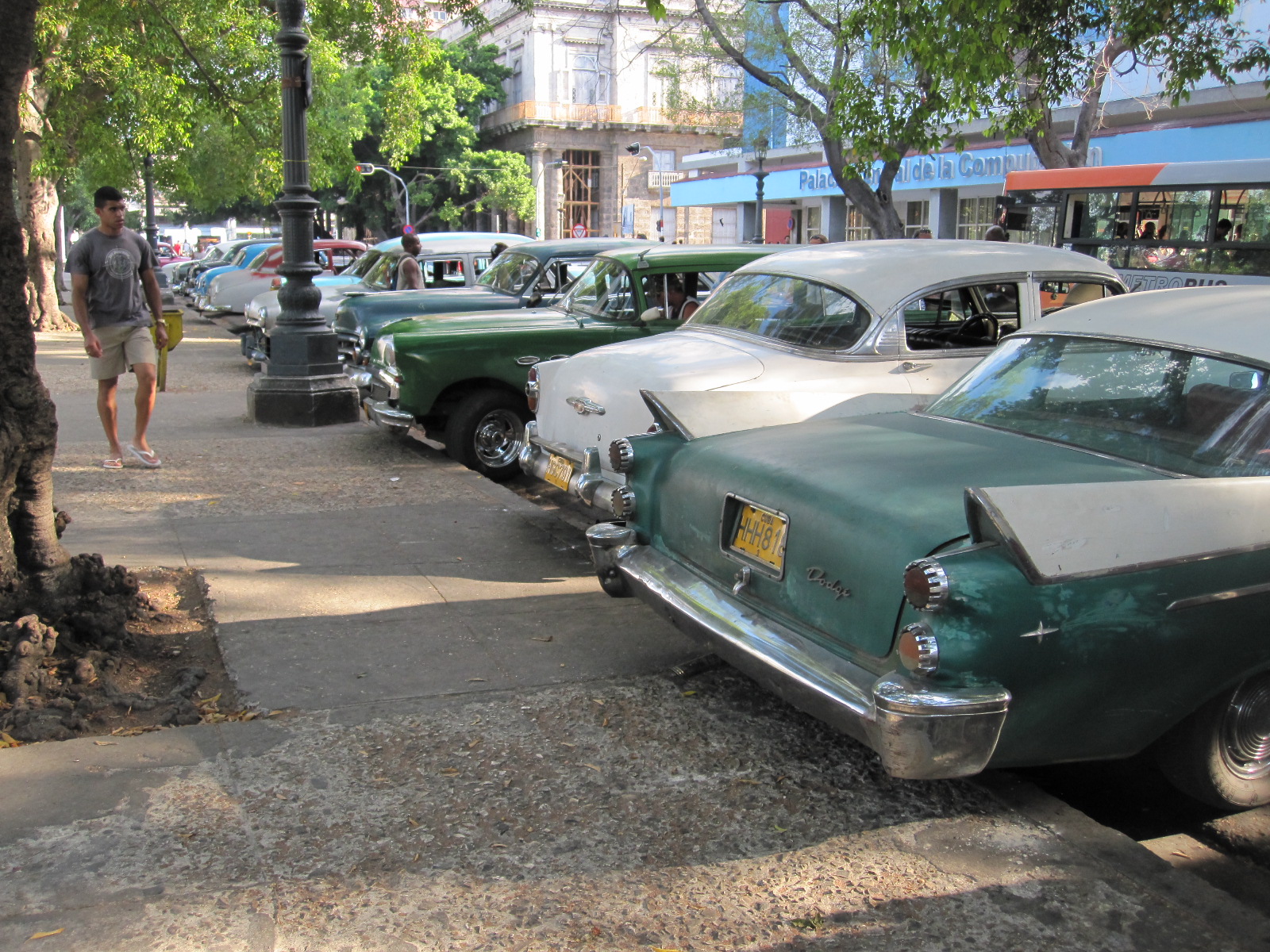 around Havana. Most are in well-used condition, and some are complete wrecks belching out clouds of smoke, but a few have been well restored. They range from the gangster-style saloons of the 1940s, with thick window frames, to the most outrageous finned monsters of the late 1950s. Parked at the side of the road you come across Edsels and Raymond Loewy Studebakers amongst other gems. Many are still used as taxis or can be hired with driver as a tourist attraction, but they are not available for self-drive hire.
There is a small area of parkland in central Havana where American cars for sale are more or less permanently on display, as many as 60 or 70, like a motor show.
In addition to the big saloons and convertibles there are many Jeep-type vehicles and trucks around, from the same period. Also a few yellow school buses, and some trucks are used as buses in country areas.
British Cars
 There were far more British cars than I expected, dating from the same period as the American ones, and I had no idea that we had sold so many cars in Cuba. Amongst the most popular ones were:
Ford - Anglia 100E, Consul and Zephyrs Mks. I and II,
Hillman - Minx post-war Mks. I and II.
Vauxhall - Victor Mk. I
Austin - A40 Devon, A50 Cambridge, A55 Cambridge, A60 Farina
Morris - Minor
Also seen - Jaguar Mk.5, Hillman Husky, Standard 10, Hillman Avenger, Austin Metropolitan
Other European cars
Peugeot 403, 404
 Renault - 750, Dauphine, Four
Fiat - 126 (many, may have come from Poland)
Simca - Aronde
Russian Cars
The most popular single make and model of any car in Cuba is the basic Lada, of which there are vast numbers. Second to that is the Moskvich, a car dear to my heart because I had one once although I did not actually own it. It belonged to a neighbour of my business premises in Littlehampton who had a 412 as an everyday car and bought a second rough one for spares. He asked me if he could keep it for a couple of weeks on my land while he took some parts off it. The couple of weeks turned into a couple of years, and the image of that dark metallic gold Moskvitch with matching areas of rust is indelibly etched into my memory. Judging by the numbers still running around Cuba they must have been far better cars than we thought they were at the time.
Many of them have been quite well restored and a favourite additional feature is a Ferrari badge on each side just ahead of the front  doors.
There are also a fair number of Volgas, UAZ 4x4 vans and Russian trucks.
Almost all of the old cars have been modified to some degree, either just to keep them running or, increasingly I think, to make them smarter. A very large proportion have modern flashy wheels, and quite a lot are jacked up at the back.
Motorcycles
Motorcycles are widely used, many with sidecars. By far the most popular makes are MZ, CZ/Jawa, and the Ural/Dnepr Soviet boxer twins, copied from BMW. There are some Japanese bikes, but I did not see any British ones at all.
In the last 10 years there has obviously been a trickle of new cars coming into the country, mainly from Korea, but some from Europe. Very recently new vehicles of all sorts have been imported bfrom China, including Geely cars, which are used by the police and some car rental outlets. The Geely has had a lot of European design input, and looks good. The vast majority of new buses, lorries and fire engines are from China. Also some electric scooters, which seem to be very popular in Cienfuegos.
Museo del Automóvil
It seems strange that a city that is a living car museum should have a building dedicated for that purpose, but Havana has. It is actually only a small museum, with an entry fee of 1CUC, unless you want to take photographs, for which there is an outrageous 5CUC extra charge.
The main space in the museum is given over to vintage cars, which are not generally seen on the roads. Most are American and in well- worn condition, but the most interesting one was a 1920s Rolls-Royce 4-seater open tourer in a dilapidated state but absolutely complete. An astonishing "barn find" which would be worth a fortune outside Cuba.
There was a separate roped-off area with an odd selection of vehicles in it, including an MG TD replica, possibly a VW-engined Lafer from Brazil, and a sports car that the lady in charge described as a Maserati, but I very much doubt whether it is. Also a Daimler DS420 limousine and several motorcycles including a Ducati.
Not the best car museum I have been to, but another one for the collection.
Spain – Tangier – Gibraltar 2010-2011
Years ago I went on a rather unsuccessful windsurfing course on Lanzerote in the Canary Islands, but I had never been to mainland Spain. Almost everyone I knew in England had been there and I felt left out when they were talking about it, so I thought it was time to get some first hand experience of the place.
Most of my trips have been meticulously planned in advance, sometimes down to studying the white lines on the road on Google satellite photographs. This one was different, because due to adverse weather in England and air traffic controllers' strikes in Spain it was uncertain when I would get there, if at all. The only things booked in advance were the flight and rental car as it might have been difficult to get them at short notice.
The plan was to fly to Malaga with easyJet and stay one night along the coast in Nerja with my friends Barbara and Jim, who now spend every winter there to escape from the horrors of the British weather. It would be impolite of me to disclose their ages, but they are quite old.
In the event there was no hold up, and the plane arrived more or less on time. The car was booked through Holiday Autos, whose local agent was an outfit called record go. The lady at the desk gave me the keys to a Ford Focus Diesel, which was parked in the vast multi-storey car park nearby. I spent 20 minutes searching for it before discovering that there was a plan on the papers that I had been given showing exactly where it was. When I examined the car I found a scrape in the bodywork all along one side, not marked on the rental agreement, so I had to walk ¼ mile back to the desk to report it. The lady made the cryptic statement "Oh yes, a lot of our cars are scratched or dented. We don't tell you". I was not very happy about this, but it seemed to be the way they work.
Nerja is about 40 miles east of Malaga, linked by a motorway that runs past the airport. The scenery could probably be best described as a very spectacular urban landscape, with high-density development covering the mountains on both sides, and sea views where the land dropped away on the right. This was my first sight of the Mediterranean since 1959. The satnav led me with unerring accuracy through the narrow streets of Nerja to Calle Malaga, where my friends lived. They were standing in the street waiting for me, and Barbara, who is easily capable of running a medium-sized town single-handed, quickly created a parking space in the street in front of their apartment block.
Nerja has a large ex-pat population, and Barbara and Jim seem to be well-established in the community, with many friends of various nationalities. They showed me round the town, which is quite smart, in fact in retrospect I can say that it was probably the smartest place I saw in Spain. In the evening we went down to the beach, where the waves were breaking over the rocks under floodlight. The temperature was about 15 deg, a very considerable improvement over what I had left behind at Gatwick.
After a walk on the promenade the next morning Jim drove us up to a mountain village called Frigiliana, with steep narrow streets which  I was to discover are the norm for villages and towns in that part of Spain. Apparently the road up to the village, along with the motorway from Malaga and civic improvements around the beach in Nerja, has been built in recent years with EU money, but this was just a drop in the ocean compared with what I was to see later.
After a tapas meal in Frigiliana I left my friends and drove westwards to Torremolinos, taking the coast road rather than the motorway as far as Malaga. The previous evening they had asked me where I was going from Nerja, and I just wish I had a photograph of their faces when I said "Torremolinos". 'Terrible Torrie' as it used to be known, with its reputation for providing package holidaymakers with a roaring good time, would not give me the image of Spain that they would like me to have. However, I pointed out that I go to places to find out what they are like, not to find that they are nice, and intended to get a wider overview of the area in due course.
There was little traffic on the coast road, which runs very close to the beach in some places, but the drive was spoilt by endless road humps, which are a feature of all the urban areas that I went to. Round Malaga and on to Torremolinos the only practical route was to go up to the Carretera Nacional N340, which is one of the most dangerous roads in Europe. It is the main highway through the Costa del Sol, although for some stretches there is a parallel toll motorway, with more under construction. The N340 is really an urban dual carriageway with no hard shoulders and many entry and exit points, as well as bus stop lay-bys. There are no slip roads at most of the junctions, which means that vehicles are often entering the road from a standstill, and have to slow down to a very low speed to turn off, so with speed limits of 80 or 100kph it is no surprise that there are a lot of accidents.
The centre of Torremolinos is not far from the N340, and I followed signs to a hotel called the ROC Flamingo. It looked quite good by my standards, and had an arrangement for parking with the Carrefour supermarket opposite. My room was on the fifth floor, with a small balcony facing the fifth floor of the next building.
Somehow I had imagined that Torremolinos would be flat, which is far from the case. From the hotel the streets sloped down through the shopping area, and then turned into 99 steps leading to the beach, according to the people in a restaurant. There are a lot of different routes, but they all involve climbing in one form or another, and the lift did not seem to be working. By the time I had got to the beach, walked along it for about ½ mile and found my way back to the hotel via another lot of hills and steps I was worn out.
It was rather surprising, therefore, to find that the several hundred people in the hotel breakfast room in the morning were all aged over 50 with the exception of one, and she was about 40. They certainly didn't look as if they would be living it up into the night in the traditional Torremolinos style, although many of them looked as if they had lived it up pretty well in the past. The breakfast was very comprehensive, with areas laid out to appeal to different national tastes, but in fact the vast majority of people there were Spanish. It appeared that they had arrived by coach, and the hotel had a coach to take them to and from the beach.
From Torremolinos I drove westwards on the N340, stopping to look at Fuengirola, Marbella, Estapona and briefly at Sottogrande.  Fuengirola has a large ex-pat British community, with a long promenade lined with cafés offering Fish & Chips, English breakfasts and all the delights of an British seaside resort excepting the winter weather. I have to confess to stopping at a British-run café for a proper cup of tea.
Marbella is a smarter place, but obviously more expensive, and when I asked a Spanish policeman for the way to the nearest toilets he turned out to be English. Parking near the front was £2.20 per hour, so I didn't stay for long. The resort is famous as a retreat for British criminals, and it may be that they are now running the car parks.
Estapona looked a pretty up-market place, although I did not stop, and at Sottogrande the strong cool wind deterred me from staying for long. It was strange, because there was no wind in Marbella, and the temperature there was about 17 deg. There is not much in Sottogrande anyway, apart from the beach and a massive unfinished residential development.
It was my intention to spend a day on Gibraltar (Great Britain) and a day in Tangier (Morocco), but I was not sure of the exact arrangements for getting to either place, and whether the impending New Year might produce complications. The Rough Guide to Andalucia (hereafter referred to as RG) that I had borrowed from Bognor library had quite a lot of information but was several years out  of date, so I decided to go on to Algeciras, a ferry port, and stay the night there.
On the way the road passes through San Roque, which is very industrial, with a huge oil refinery. It is a fairly depressing place, founded in 1704 by the original inhabitants of Gibraltar when they were driven out by the British. They expected to return within a few years, but that did not happen.
San Roque is, however, bright and cheerful compared with the suburbs of Algeciras, in which I found myself in the course of looking for a hotel. In 1969 Franco closed the border with Gibraltar, cutting off access for the Spanish people who worked in the naval dockyard, and decided to industrialise Algeciras to provide employment for them. Most of the people around appeared to be immigrants from North Africa. The port was easier to find than the town centre, and I eventually got a room in a hotel facing the port entrance. The room was on the 8th floor, with a fabulous view over the town and mountains in the background.
The area was just a bit sleezy, with a definite 'On the Waterfront' sort of atmosphere. In the same block as the hotel were several travel agents, with touts outside trying to sell ferry tickets. For miles before getting to the town I had passed places advertising tickets to Tangier and Ceuta, a Spanish protectorate on the coast of Morocco (a relationship similar to that of Gibraltar to Britain, and the Spanish are just as determined to hang on to it). Judging by the number of people engaged in selling tickets, it must a profitable business.
The hotel had an underground car park in a back street that you would not want to walk down at night, and after putting the car away I made enquiries about the ferries to Tangier. The RG warned about being misled by ruthless ticket sellers, and after getting conflicting information from several travel agents it was clear that for a day return to Tangier I needed to use the fast ferry from Tarifa, about 12 miles to the west.
 The main street was actually not far from the hotel, but I walked in the wrong direction and it took me a long time to find it. It was a great contrast to the dingy port area, with all the shops open until late, more Christmas decorations than in a British high street, and the place was thronging with people. It was hard to believe that the country was in a state of financial crisis.
As I stuffed myself full at breakfast time the next morning it did not occur to me that I might be seeing it all again later a few miles off the coast of Morocco. At this stage I did not even know I would be going to Tangier that day, but when I got to Tarifa it was quite straightforward to get a return ticket from the ferry company at the same price as the touts had been asking and after leaving the car (with some reservation) in the street near the harbour I walked to the ferry.
This was a cross-channel style car-carrying catamaran, and was supposed to do the journey in 35 minutes. The passport stamping was carried out in the main cabin by two Moroccan officials, so that passengers could walk straight off the boat on arrival. We started late, and about two-thirds of the way across the sea got quite rough and the vessel was almost flying off the waves. We were actually travelling through the area where the Mediterranean meets the Atlantic, and as Tarifa is now a famous wind-surfing centre, said to be on a par with Hawaii, it is hardly surprising that there were big waves.
In the fifty or more years that I have been using ferries I have always claimed to be a good sailor, but on many occasions it has been demonstrated to me that I am not, and this was one of them. Other people started to be sick, and eventually I had to run to the room labelled Caballeros . The cubicles were all occupied, and as I hung on to the edge of the stainless steel wash basin I think that could be described as the low point of the trip. It was a very sad face that looked back at me from the mirror behind the basin.
The great thing about seasickness, to use a contradiction in terms, is that when it's over, it's over, and by the time I had walked the half mile from the terminal to the port gate in Tangier I had forgotten all about it. It was a bright day, temperature about 23 degrees, as I walked along the promenade after fighting my way past the men selling watches and other items of jewellery just outside the gates. On my previous trip to Morocco, a few years earlier, I had so much hassle from the locals in the desert towns that I said I would not go again, but in a big city like Tangier there is always someone else to whom they can turn their attention if you make it clear that you are not  going to buy.
The only large city I had visited previously in Morocco was Marrakech, which is more or less flat. Tangier is anything but flat, with streets rising steeply up from the sea front. After taking photographs of the beach, with its palm trees, I walked up the hill into the 'modern' business quarter and found a café to replace some of what I had lost on the boat. The area had the chaotic mixture of old and new, with the frantic traffic that is typical of Morocco. A man in the Europcar office directed me to the old part of the city, a longish walk over the hill, and as I came within sight of it I heard the call to prayer. On the way through a shopping area I passed a large tent-like structure in which several men were praying, some in Muslim dress, and some in modern suits. An alley led down steps into the proper souk (market), and it was here that I made rather a bad mistake. I stopped to take a photograph of the market area, with an ancient  building in the background, without realising that a lady in a burka was walking towards me. As I pressed the button she screamed, put her hands across her eyes and ran for cover into a stall on the side. A torrent of prayers followed as I walked past, and I was annoyed with myself, because I was aware that you have to be careful not to cause offence by photographing people in that situation, and I had simply forgotten. As it happens, she was not in the photograph anyway.
The souk was brilliant, with narrow alleyways between stalls selling everything from electronic equipment to food to household goods to utter rubbish. It is strange how, when you are there, you venture into places that you think you would not go into when you read about them or see them in pictures. In the end I walked down a darker, narrower, muddier alley that I had been along anywhere else in Morocco and it was sad to see the absolute junk that some people were hoping to sell to make a living.
Eventually I emerged into the sunlight, and spent some time looking around the rest of the old town before making my way back to the harbour. There was supposed to be a ferry to Tarifa every hour on the hour, and it was a mystery to me why, as I walked towards the boat exactly on the half hour, the men standing at the bottom of the ramp shouted and waved at me to hurry up. I ran up the ramp just as they started to close the doors, and was worried in case I was on a ferry to somewhere other than Tarifa, but in fact it was correct. It was much larger than the one coming over, like a little ocean liner, with a big glass dome over the main passenger cabin, and completed the crossing very smoothly in the stated 35 minutes.
Tarifa is an EU border and a main entry point for people coming from Africa. It was therefore interesting, but totally predictable, that non-EU passport holders were processed four times more quickly than citizens of EU states.
By now I had decided to visit Gibraltar the next day, before moving on westwards and up into the mountains. Gibraltar was about 25 miles from Tarifa, with Algeciras in between, and I made enquiries about staying in Tarifa, but the hotels seemed rather expensive, so I went back to the Al Mar in Algeciras for the night. This time I was promoted to the 9th floor, with a view of the port and Gibraltar in the background. The port, which is the seventh largest container terminal in Europe and extremely modern, looked like a huge working model from my window and I could have watched it for hours. However, hunger eventually drove me to go out and find a restaurant, and I picked the nearest one to the hotel without realising that it qualified for an entry in the Book of Rip-off Spain. It was not much more than a greasy-spoon café, and a 2-course meal with coffee from the four-language menu came to €20.
The RG advised against taking a car into Gibraltar because of the queues, and recommended leaving it in a car park in La Linea de la Conceptión, and walking through the frontier. The next morning I drove round to La Linea ("The Line"), which is the Spanish town right up against the frontier with Gibraltar, and decided to look for a hotel, so that it would leave the whole day free for exploring the British colony. A quick look around La Linea was enough to determine that it is a pretty depressing place, apparently with a high unemployed immigrant population, and the best bet was the first hotel I came to, about 200 yards from the entrance to Gibraltar. It was expensive and up-market by my standards, but very convenient.
After getting sorted I walked along the road to the frontier. As predicted by the RG, there was a long queue of vehicles, but few pedestrians, and no delay at the passport check. A short distance from the frontier the only road into Gibraltar crosses the main airport  runway, and everyone had to wait a few minutes while an easyJet plane taxied across the road at speed on its take off run.
The town has an unmistakeable military atmosphere, with utilitarian blocks of flats at first, leading to a square  surrounded by traditional naval buildings, and then Main Street, which is lined with shops. These consist mainly of British high street names such as Marks and Spencer, Peacocks, BHS etc., together with a large number of locally-owned shops selling tax-free goods, particularly phones, cameras, computers and other electronic items. All the UK icons are there, red telephone kiosks, pillar boxes and policemen in British uniforms.
Fortunately when I got an all-day breakfast in a Sports Bar at the end of Main Street I discovered some English money in my backpack, because the exchange rate for euros in business premises is very poor. What I did not realise until it was too late is that although the coins in the change I was given looked like English ones some of them were Gibraltar ones which cannot be changed outside the colony.
I had picked up a map from the tourist office, and decided to walk up the Rock until I came to the apes, although I had no idea how far that would be. In fact, it was a very long way by my standards, and everybody else seemed to be driving up or going in minibuses. There is a cable car that was closed due to high winds, which seemed rather strange, because where I was there was no wind at all. A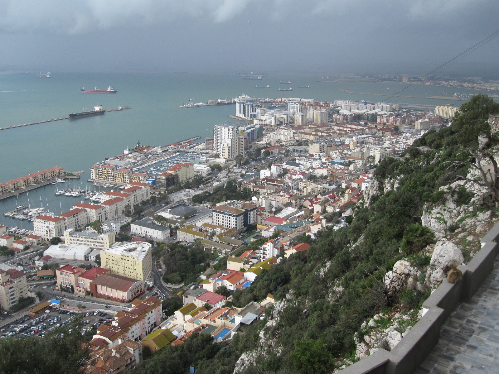 fter slogging up the hill for a long time I came to the Jews' Gate, where you had to pay 50p to proceed any further. My knee was starting to give trouble, and I debated whether I was going to be able to walk on far enough to get full value for the 50p, but decided to risk it. Looking down below I was surprised at how high I had climbed, and the views over the naval dock-yard and town were superb. In the distance I could see the port of Algeciras and the mountains beyond, with the mountains of Morocco clearly visible to the south.
After about another ¼ mile I saw a parked car with some things running round it, and realised that I had made it to the apes. They were quite tame, and allowed people to get close to them, but did not really engage with anyone as far as I could see. Certain aspects of their conduct in public left something to be desired, and perhaps the authorities should consider putting up some notices telling them to moderate their behaviour.
Not long after reaching the apes there was a track leading downhill, with a notice saying that it was a military road and led to an apes' habitat. I took it, thinking that it would take me back to the town, and after about 600 yards I came to an old lookout point where the track finished. At that moment an ape came out from behind a rock and looked at me with a broad smile. I smiled back, and then realised that the ape was not actually smiling, it was baring its teeth in preparation for a territorial challenge. It had an awful lot of teeth, far more than I've got, and it seemed wise to withdraw before there was any trouble.
Eventually, after returning to the road and climbing even higher I found a route that really did lead back to the town, finishing on a rough path and then a vast number of steps. Back into scooterland. Motor scooters are the staple transport for a large proportion of the population of Gibraltar, which makes sense considering the limited road mileage and parking space on the colony. Some roads have a wide strip marked along one side for car parking, and a narrow strip on the other side for scooters and motorcycles. In the town centre  are parking areas full of scooters of every known make and type, like a permanent scooter rally.
It was New Year's Eve, and by 5.00pm everything was closing, so I had a snack and bought some food to take back to the hotel, because I did not know whether I would be able to get anything later. My room was on the 5th floor, with a view of Gibraltar town, Rock and airstrip. I was not bothered about not celebrating the New Year, because that is for people who still imagine that the New Year will be better than the old one, and when you get to my age you know it won't be. In the event I was woken at midnight by fireworks, and had a grandstand view of the display in the centre of Gibraltar.
In the morning I set off on the coast road to the west, passing Algeciras again, and stopped for a proper look at Tarifa, which has a historic area within the well-preserved town walls. Moving on westwards on the N340 from Tarifa I came to the largest wind farm I have ever seen, one of the largest in Europe, with over 200 turbines. When the wind is blowing it provides sufficient electricity for the town of Tarifa, but bearing in mind that the town is not very large and has a warm climate, it brings home how unrealistic it is to think that wind energy can ever begin to meet the needs of a whole country. It is on the route taken by migratory birds, and many have fallen victim to the massive blades of the generators.
After looking at Facinas, a quaint hill top village overlooking the wind farm, I cut through to Zahara de los Atunes, which had a vast empty car park adjacent to a vast empty beach with nice sand. It was New Year's Day, and everything seemed to be closed, but a few miles further along the coast I came to Barbate, which had a small promenade with a string of cafés, a couple of which were doing meals.
From Barbate I decided to go inland to explore the "pueblos blancos" or white towns, starting with Medina Sidonia and then Arcos de la Frontera, where I planned to stay the night. The road to Medina had been upgraded recently with EU money and was much better than I would have expected for a cross-country route. Medina itself was shaped like a steep sided cone, dominated by a large church at the top. The narrow streets were lined mainly with terraced white houses, characteristic of the white towns, and I set off on foot to explore, but after a short distance realised that I was not going to make it to the top of the hill. Back in the car I drove towards the centre, and turned off to go up the hill, which proved to be much more challenging than I had expected. The road was incredibly steep and narrow, with tight bends, and I could now understand why every car in Andalucia is scratched and dented. Eventually the road opened out into a beautiful square with fine buildings around it, but there was nowhere to stop, and the way down was similar to the way up. At the entrance to the town I had noticed a sign barring entry to quads. This does not infringe the human rights of persons with three siblings of the same age, but applies to four-wheeled motorcycles, otherwise known, to the horror of classics students, as quad bikes. I think the reason for the ban may be that such vehicles are difficult to handle on steep cambered turns, of which there are many in Medina. Apart from a few good buildings I did not actually find the town particularly attractive.
The EU money stretched all the way to Archos de la Frontera, where on the outskirts I found a hotel of the sort that I usually stay in for €20 per night, en-suite room including bed but not breakfast or very much space. The young lady in reception said it was a ten minute walk into town.
After walking for twenty minutes in the direction she had suggested I remembered how she had run up and down the stairs in the hotel, and realised that she was talking about ten of her minutes, not mine. Archos was larger than Medina and came across to me as much more attractive as I walked along the streets lined with orange trees. Towards the centre the streets narrowed between high stone  buildings and climbed to a square, one side of which is on the edge of the massive cliff that extends the whole way along the side of the town. The views from here across the valley below are superb.
The next morning I had another walk round Archos and then set off for Ronda, a much larger picturesque and historically important town, but diverted when I saw a sign to Setenil de las Bodegas. Setenil was described by the RG as having "curious cave-like streets", and it is certainly a quite remarkable place. It is built along a gorge in which the river has eroded the sides away, leaving enormous overhanging cliffs which extend out over the streets. They form the roofs of some of the buildings, and in places stretch right across to buildings on the other side of the road, so that it really does seem that the street is in a cave. Without a map I got lost on foot, and afterwards I looked at the Google maps of Setenil, with a satellite view looking like a pile of worms, unlike anywhere else I have ever seen. As the name suggests this was wine-growing country at one time.
Approaching Ronda from Setenil it seemed a bit like Cheltenham, quite pleasant but not spectacular. I found a small hotel with an underground car park near the town centre, and set off to look round with a map. In fact, the town is very spectacular indeed, being built high on a ridge in the Sierra and split in half by a gorge with sheer sides 130m deep. The most famous feature of the town is the New Bridge, an extraordinary tall, narrow, arched bridge rising up from the bottom of the gorge, and built in the 18th century. This might not seem very new, but it is compared with the other two bridges about ½ mile away, and the gorge itself looks like something from an  old print. Ronda is the home of bullfighting in Spain, and has the oldest bullring in the country. It was not open when I was there, but from the outside it looked surprisingly small, although in fact it is one of the largest around and has a double-tiered seating area supported by stone columns and arches.
From the New Bridge it is a downhill walk to the older and smaller Arab Bridge, from which you can look up into the gorge, another view like an ancient print. In the course of taking photographs here I heard the sound of  metal striking stone, and looked down to see my nice Seiko watch on the cobbles. The metal bracelet was broken, and although the watch was still going when I picked it up, it stopped shortly afterwards. Fortunately back at the hotel I had the £4 Chinese watch that I wear in places where I think I am going to get mugged.
The next day was to be dedicated to finding The Scariest Footpath in the World, called the Camino del Rey, which I had no intention of walking along, but just wanted to see. It was a catwalk high up on a sheer cliff face in the El Chorro Gorge, built in the 1920s as part of a hydroelectric power scheme, and was regarded as one of the wonders of Spain until it fell into disrepair. Originally it consisted of a narrow concrete path supported by metal brackets, but the concrete gradually eroded away, leaving holes and eventually in some places just the brackets. People continued to walk the path, but after some deaths it was officially closed and sections at both ends were removed completely to prevent access. There are still organised trips for climbers, using ropes to get down to the path. If you put Camino del Rey into Youtube there is a video made by a man who walked the path holding a video camera pointing downwards, and just stepped from bracket to bracket. Not for the squeamish.
From Ronda the most direct route was on mountain roads across country via El Burgo and Ardales. The EU money had definitely run out by El Burgo, and from there it was more like an Albanian road, with a rough surface, disappearing altogether for one stretch. Ardales, on the side that I approached it, was a strange place, with an unfinished bypass with tape across it, and the only way through appeared to be via incredibly steep, narrow concrete streets. With some trepidation I took one of these, and eventually ended up in a cul-sac at a farm entrance. Nearby was a man putting stuff into a car, and when I asked him the way to El Chorro he did not speak English but indicated that I should follow him in his car. He led me back through the concrete streets and then on a tortuous route round the town, which was much larger than I thought, until we came to the road to El Chorro.
According to the RG the best way to see the Camino del Rey is from the railway that runs alongside the river at the bottom of the gorge, but on foot they describe two ways of getting there, one by walking along railway tunnels. The RG has never quite lost its backpacker roots. Having seen the trains, some of which look like TGVs, I did not think this was a very good idea and chose the alternative way,  which appeared to be a walk of about two miles on mountain tracks, starting from a restaurant in the valley.
By sheer chance I found the restaurant and had a meal before embarking upon the trek up the mountain. The restaurant overlooked a valley with a dam and reservoirs that had the greenest water I have ever seen, but presumably it does not come out of the taps that colour. The track ran straight up from the car park and appeared to match the description in the RG, with beautiful mountain scenery spoil only by the pylons carrying the cables from the power station below. Apart from a few people going the other way there was no one about, and after walking for almost two hours according to the Chinese watch I felt that I was at the limit of the range  that my knee could stand. The path was still climbing and there was no sign of the gorge or Camino, so now comes the exciting anti-climax - I turned back.
The village of El Chorro was a few miles away, and from there it was possible to see the end of the gorge, but there appeared to be no way of getting to it apart from walking through the railway tunnel. A sign on a minor road in the village stated something that I interpreted as meaning that it led to the gorge, but after climbing for a couple of miles on a narrow winding road past part finished houses in the hills I concluded that it was referring to a residential development. Eventually I found myself at a road junction in the middle of nowhere, and resorted to the satnav, which said I was not on the road at all, but in a field about 200 yards from it. It seemed that the road had been built since the satnav was programmed, which means that it was unlikely that it was more than five years old. It was rather surprising,  therefore, when after about a mile I came to a place where the road had cracked along the middle, and the tarmac and foundations on my side had disappeared completely, leaving a muddy track for about 100 yards. Shortly after this there was a step about 12 inches high in the tarmac right across the road, with a makeshift soil ramp leading to it, and it was obvious that the whole hillside was unstable. Some distance ahead I could see a village in the valley, and turned off towards it. The road ran downhill to a T junction with a muddy track to the right and a "bridge" consisting of a large slab of concrete across a river to the left. There was a piece of tape on the ground indicating that the route was closed, which was not surprising, because the river was like a raging torrent, lapping over the "bridge", and there was a gap of a few yards in the road the other side.
I was beginning to think I would be spending the rest of my life trapped in the collapsing road network of rural Spain, but after turning back to the last junction and taking the alternative route I eventually came back to civilisation and the satnav recognised where I was.
Over the last two days the weather had become cooler, so I decided to return to the coast and stay in the Flamingo Hotel in Torremolinos, because it was easy. On the morning of the last day I thought I should take a look at the retail scene, and stopped at an out-of-town shopping mall on the outskirts of Fuengirola. It was just like an out-of-town shopping mall anywhere else, with a huge DIY store, a Decathlon sports shop and a Burger King, amongst many other things. From there I went down the road to the splendidly named El Corte Ingleses (The English Cut, referring to gentlemens' suits) a branch of the only remaining department store chain in Spain. This was a very impressive modern building, with a round five-storey glass structure on top of a Hippocor supermarket which is part of the same company. The multi-storey underground car park was an absolute madhouse, but the department store was extremely smart and, again, it was hard to believe that the country was in the grip of a recession.
 The afternoon was spent looking around Mijas, the nearest traditional village to the big coastal resorts in the area, a quite attractive place despite being very touristy.
After all this I still did not know quite what to think about the country. The region, Andalucia, has a lot going for it, good weather, beautiful scenery, nice people, and any visitors should be able to find something to suit their tastes. Shortly after I was there the British Post Office produced a report saying that Spain was one of the cheapest places to go for a holiday, based on a package of items, but I did not think it was particularly cheap, especially for food.
One thing I found surprising was that so many people did not speak English once you get away from the coast, and, as always, I wished I had made a bit more of an effort with the language before going. Also, apart from on a few roads in the mountains, I found driving in Spain to be a fairly miserable experience, with road humps in all urban areas, even on main roads, and massive over-regulation. Spanish drivers were not as bad as I expected, and are certainly very good at handling their vehicles in confined spaces.
It was hard to believe the vast amount of EU money that has been poured into the region. Apart from the new roads all over the place, everywhere you go there are EU supported development projects, but it does not seem to have led to anything. Unemployment in Andalucia as a whole is 28% and in some places like Nerja it is 40%. If Spain stays in the Eurozone it will just be a bottomless pit for this type of investment and it simply doesn't make sense to take money from northern European countries that can compete in the world and give it to southern ones that will never be able to. No British government will have the courage to deal with this, but hopefully the Germans will.
Boston to Orlando – April 2006
12 States in 12 Days
This is something I had wanted to do for years, drive down the east coast of the United States from the cold and damp of Massachusetts to the warm sunshine of Florida. The big deterrent was the high charge for renting a car in one place and dropping it off in another, more than 1000 miles away. There are ways round it, but none of them suitable for the way I wanted to travel, and in the end I decided to swallow it on the basis that it was to be a one-time experience.
The flight was booked from Gatwick to Boston via Philadelphia with US Airways, but in the event I was transferred to a flight via Charlotte, North Carolina, which seemed rather silly, because Charlotte is more than half way from Boston to Orlando, but that is how things sometimes work out.
Massachusetts
At Boston Airport I collected the car from Alamo. It was a choice between a Chevrolet Cavalier and a Saturn Ion, so I chose the Saturn because it was unknown in England, and I would be able to tell everyone that it was a much bigger and better car than it actually was.
After spending the night in a motel in Malden I started the journey proper. A few years earlier I had had a couple of days in Boston, and it was not my intention to spend any time in the city on this trip, but there was just one place I wanted to visit, namely the Larz Anderson Museum. Now, don't stop reading, it was the only car museum on the trip, and a rather special one. At the beginning of the 20th century Mr.Anderson, a pioneer motorist, owned a large estate in Brookline, which was then on the outskirts of Boston. Every few years he bought an expensive new car, and put the old one in his motor house. Eventually he built up a collection of cars, and had a new motor house built in the style of a French chateau, and that is where the cars are today, in the condition that they were when he last used them.
Finding the museum proved to be difficult, and the two Hispanic girls in a fast food place had no idea, although one of them said I had nice eyes. In the search I came across The Country Club, a golf and sports club, and when I went through the door it was like walking straight from Massachusetts into Surrey, a little bit of Olde England in the middle of New England. At least the ladies in the oak-panelled office knew where the museum was.
From Boston the route ran roughly south east past Worcester and entered Connecticut on the Interstate freeway I-84.
Connecticut
The drive through Connecticut was pleasant but generally unexciting, via Hartford and Danbury, into southern New York State near Brewster.
New York State
After the Fishkill Mountains, which are mountains in name only, I turned south on to a scenic minor road that ran along the eastern side of the Hudson river, from which there was an astonishing view of the West Point Military Academy on the other bank. I had imagined West Point to be a large Victorian-style building in the middle of parkland, but in fact for all practical purposes it is a fair-sized town.
Things went a bit wrong after crossing the Hudson at Camp Smith, and I got lost in Harriman State Park, which is a forest, and eventually picked up Interstates 87 and 287 to New Jersey.
New Jersey
I-287 led straight to my night stop, the Howard Johnson motel in a dormitory town called Parsippany, about 35 miles west of New York City. I had discovered Parsippany on a previous trip after giving up trying to drive into Manhattan or find accommodation close to New York. It is a boring town, but has cheap motels and a dedicated fast bus service into the capital, taking about 45 minutes. Tickets cannot be bought on the bus, but are obtainable in various shops in the town, and I got one after getting sorted in the evening.
The next morning, a Saturday, the temperature was about 45ºF and raining, just how I had imagined the start of my trip would be. The motel receptionist said the bus stop was in front of the Holiday Inn, next door. The 4 people standing on the grass verge in front of the Holiday Inn said they thought it was the bus stop, and when the bus arrived after about 15 minutes we were all pretty well soaked.
There can be few places on earth more depressing than New York Port Authority Bus Terminal on a wet and windy Saturday morning and the street outside was no better. It was almost deserted apart from hooded figures standing in every doorway gazing into space, which did nothing to enhance the walk through to the theatre district. However, after reaching a more civilised area and having a good breakfast in a proper New York deli I felt considerably cheered.
On my previous visit to New York, for one day, I explored the area south from the bus terminal, including the Empire State Building, Greenwich Village, The World Trade Center, Wall Street, Brooklyn Bridge, City Hall etc. This time I went north and east through the rain and wind, taking in Times Square, Grand Central Station, the Chrysler Building, United Nations, and a quick look at Central Park, which was deserted and uninviting, despite the blossom on the trees.
Grand Central Station, with its fabulous architecture, marble and chandeliers, was quite stunning, the extreme opposite to the concrete jungle bus terminal. In the basement was a huge food market, and the whole place far exceeded expectation. As I was walking through Times Square two fire engines appeared, sirens blaring and full-sized American flags streaming out behind them. All the people around moved to the edge of the pavement and clapped as the machines went past, showing that New Yorkers had not forgotten the heroic actions of their fire fighters five years earlier. This could only be America.
By the time the bus got back to Parsippany it was dark, and somehow I missed the bus stop opposite to the Holiday Inn, which was not surprising really, because there wasn't one. As a result I finished up ¾ mile farther along the road, by chance in front of a large restaurant. During the meal the rain got worse, and eventually I had to fight my way back to the Howard Johnson in the dark over an assault course of banks, ditches, areas of rubble and other obstacles along the side of the main road. American urban highways are not designed for pedestrians, and it was a rather ignominious end to a good day.
The next morning I managed an early start and set off for Washington DC through the ongoing rain. The route down to Trenton was part freeway, part state road, and after Trenton, in worsening weather, I took the freeway again east of the Delaware River to avoid Philadelphia. At Deepwater I crossed the river to Wilmington in Delaware.
Delaware
This was the state in which I did the least driving, a total of about 12 miles, but the weather improved at last as I went through into Maryland.
Maryland
From Wilmington I took I-95 right through to Washington DC, and I cannot say that it was a particularly memorable journey.
Washington DC
Now, I know that I am cheating here by counting the District of Columbia as a state, because it is not one, but on the other hand it is not in any other state either. The founding fathers of the United States decreed that it should be neutral territory as far as states are concerned, and if I don't count it there will be hole in the middle of my journey on the map.
 It was Sunday and I drove straight to the middle of Washington, arriving about midday, by which time the weather had turned really warm and sunny. It was easy to park, and after a snack I walked through to the White House. The most surprising thing was how close it was possible to get on foot to the front of the building, with the iconic view across the lawn. From there I walked most of the length of Constitution Avenue towards the Capitol, with the Lincoln Memorial and Washington Monument on the right hand side, and imposing neo-classical government buildings lining much of the road. It was all very impressive, and it was easy to imagine that the British government of the period must have realised that the game was up as far as world domination was concerned when they saw the capital of the United States taking shape.
In Constitution Avenue about 20 people went past me on a Segway tour, something I would like to have done had I had the time. For  those who have never seen one, the Segway is a high tech personal transportation device consisting of a platform on which the rider stands between two wheels at the sides, with a vertical tube with handlebars in front. Balance is maintained by some gyroscopic means controlled by a computer. They are battery-powered and almost silent.
From Washington I had no definite route planned, but was thinking of going south west into Virginia. The centre of Washington might be very smart, but that cannot be said of some of the suburbs, and due to a misleading direction sign on the way out of the city I finished up in one of those areas where it is best not to stop. Once I managed to escape without being dragged from the car and mugged I realised that I was on the eastern side of the city, and stuck in a dreadful traffic jam, which according to the radio was seven miles long. In view of this I decided to go back into Maryland and down to Virginia on the eastern side of the Potomac River.
The road I took is known as Indian Head Highway, and is not a freeway, but is like one, which is rather strange because Indian Head and neighbouring places are actually quite small. The high standard of the road is probably due to the presence of a small military base at Indian Head, but the amount of traffic going there on the Sunday evening was astonishing. In typical American fashion there were two lanes of traffic moving side by side at 60mph, and I can only assume that everyone from the area must have been to Washington for the day. The orderly proceedings were disrupted momentarily (a word which has a different meaning in the USA) when a motorcycle came up from behind travelling, in my estimation, at over 150mph. It went straight between the two lines of cars, and everything else appeared to be standing still. A few miles down the road we came to some traffic lights, and the rider was standing there with his helmet off, waiting for his mates, who were travelling at the speed of the rest of the traffic.
Shortly before Indian Head I turned eastwards to a small town called La Plata, and after finding a motel for the night I decided on a plan for the rest of the journey to Orlando. As I was already quite close to the coast it seemed that the most interesting route would be to drive to Norfolk, Virginia, and then through the string of islands off North Carolina known as The Outer Banks. This would take me through Kitty Hawk, the site of the Wright Brothers first powered flight.
The next morning a few miles south of La Plata, in heavy mist, I crossed the Potomac bridge into Virginia. This was to be the first of many bridges, tunnels and ferries in the next few days.
Virginia
 After stopping briefly for the beautiful views across the river at Potomac Beach and Colonial Beach I drove down to Norfolk via Farnham, Lancaster and Gloucester, passing also through Warsaw, which did seem a bit out of place. The bridge over the Rappahannock River was about 2 miles long, and I lost count of how many others there were.
The next stop was Virginia Beach, reached by a minor coastal road (more bridges) after the tunnel between Hampton and Chesapeake, and here I spent a couple of hours, mostly walking on the beach, as I needed some exercise after all the driving. As I was not fishing I was too mean to pay the $7 to go on the fishing pier, and when I got back to the car, too mean to pay the toll on the Norfolk - Virginia Beach Expressway. Instead I found a way round using minor roads.
North Carolina
A few miles down highway 168 was the border into North Carolina and after a couple more bridges I reached Kitty Hawk, which was to be my night stop. The first thing that struck me about Kitty Hawk was the extraordinary lack of development, considering that it is such a famous place. Most of the buildings were wooden houses in the traditional local style and at first there seemed to be no motels, but then I found a recently-opened Days Inn in Kill Devil Hills, just down the road. There were a few restaurants and a K-mart, but the whole place had an air of being very low key.
Before doing anything else the next morning I phoned through to the Okracoke - Cedar Island ferry to reserve a place on the 6pm crossing. I had found out about this from a guide book, and if you don't book in advance you can drive right down through the Outer Banks and be unable to get a ferry across to the mainland at the end. After breakfast I went for a walk on the beach and then drove to the Wright Brothers Memorial.
 Now, from my experience the Americans do this sort of thing either very well or very badly, and the Wright Brothers Memorial is outstandingly good. By some miracle the site of their pioneer flight has remained intact, and is now a National Park. It consists of a large flat field with a 90ft high sand dune towards one end, which is the actual Kill Devil Hill from which the first flight took place. On the hill is a 60ft grey granite monument commemorating the event and a wonderful full-size bronze sculpture of the aircraft and the people who took part in the launch, including, of course, the two brothers. This was put in place in 2003 to celebrate the centenary of the flight. In the Visitor Centre towards the other end of the field is a replica of the aircraft and a vast amount of other information about the early days of powered flight.
It was then a fast drive south through Bodie Island and Hatteras Island to the Hatteras-Okracoke ferry. On the way I passed through a number of places consisting mainly of wooden houses, often on stilts and almost all with a tower, usually on one corner, to provide a view over the sea wall or other properties. From a distance these settlements looked like fantasy towns, and there were also a couple of lighthouses, painted up with stripes in the style that Americans are very fond of.
 Eventually I came to the Hatteras-Ocracoke ferry, which is free, taking about 40 minutes and holds 30 cars parked along both sides of a high superstructure in the middle. Throughout the entire journey the funnel belched out thick black smoke which went all over the cars on the side where I was parked. More about that later. Apart from the smoke, it was too foggy to see much during the crossing anyway.
There was nothing much to see on Ocracoke Island excepting Ockracoke itself, and as I arrived at 3 o'clock for the 6pm ferry I had plenty of time to look around after getting something to eat. It was actually a very attractive marine village, with a wooden post office and lots of shops. There is also a small British cemetery containing the graves of a number of British seamen who were killed in the second World War defending shipping off the coast of Carolina.
 The Ocracoke-Cedar Island ferry is the same general style as the Hatteras one used earlier but is considerably larger and has a much longer crossing, at about 20 miles. The journey takes about 2¼ hours and at the time of my trip cost $10 for a car and passengers. After about an hour we were out of sight of land from the car deck, which I found somewhat surprising, considering that the vessel was like a large flat-bottomed punt, hardly the sort of thing for putting out to sea. However, when I looked at the map I realised that we were actually in the Pamlico Sound, which is entirely sheltered from the Atlantic by the Outer Banks and explained why the crossing was extremely smooth. The islands continue for a long way south west from Ocracoke, although it is not possible to drive through them.
When we reached Cedar Island it was pitch dark, and as I left the ferry terminal I discovered that there was a problem with the car. Viewed through the windows any bright lights, particularly headlights, were surrounded by haloes in all colours of the rainbow, making it very difficult to see anything. There was obviously a film of oil on the windows, which must have come from the smoke on the Hatteras ferry. I tried to remove it from the windscreen, with little success, and by the time I finished messing about everybody else had gone. Why they were not so affected I do not know, but perhaps most of them had only been to Ocracoke.
I had no accommodation arranged, and it was unlikely that I would find any on Cedar Island in the dark. The most likely places for motels were Beaufort and Morehead City, and it was a very unpleasant 40-mile drive, although fortunately there was little traffic coming the other way, because Cedar Island is thinly populated and the ferry had stopped running. The first motel I came to was the appropriately named Buccaneer in Morehead City, by which time it was 10pm, and I had no choice but to pay the inflated price demanded. The next morning the first thing I did was to go down the road and get some paper towel and surface cleaner from Kmart to deal with the car windows.
Continuing along the coast through Jacksonville (not the big one in Florida) and Wilmington I entered South Carolina.
South Carolina
For about the next 50 miles the coast road passed through a number of seaside resorts, the largest of which was Myrtle Beach. Many stretches of American coastline are relatively undeveloped, or have small settlements with just a wooden fishing pier, but that cannot be said of the area around Myrtle Beach. It is very highly developed indeed and has attracted a large retirement population. There was a gale-force wind blowing, but it was not cold, and after having a snack I went for a long walk on the beach.
Some distance on from Myrtle Beach the built-up area finished, and the road eventually ran through the edge of the Awendaw National Forest for a long way, with the Intracoastal Waterway on the left hand side. This continued right down to Charleston, where I planned to stay the night. The room in the very basic Motel 6 was better than that in the Buccaneer and less than half the price, although there were some noisy people next door.
Most people probably think of Charleston and Savannah as being similar, as they date from the same period, but actually they are quite different from one another. This was my first visit to Charleston, but I had been to Savannah a few years earlier. The historic area of Savannah covers about a square mile alongside the Savannah River, and contains a fair number of modern buildings intermingled with the old ones that have been preserved.
The historic area of Charleston is on a point of land between the Ashley and Cooper Rivers, effectively set back in a harbour with an open aspect to the Atlantic, and it seemed to me that it was less spoilt by recent development than Savannah. There is also a main street very similar to the ones found in old towns in Europe.
After spending the morning in Charleston I moved on in a general south westerly direction to Hilton Head Island. The whole stretch of coast between the two old towns is broken up by creeks and rivers, rather like parts of Essex, and Hilton Head Island is a genuine island, joined to the mainland by a bridge. There are opportunities for all sorts of sporting and leisure activities, but the thing it is most famous for is golf, as it is the venue for some championship events, with courses all over the island.
On my previous trip to the area I had stayed for a couple of days at Hilton Head, so I booked into the same motel this time and then went down to the beach. It was warm and sunny, and I realised that I had reached the South at last, so by way of celebration I had a meal in a Chinese buffet. When I got back to the motel I heard something going on not far away, and discovered an area called Harbourside with folk singers and street performers entertaining a fair-sized crowd in the dusk alongside a waterway.
") The next morning I went down to the beach and rented a bicycle, as I had done previously. The bicycles were wonderful American cruisers, with wide handlebars and no front brake. The only brake was operated by backpedalling, which takes some getting used to, especially if there is no other way of stopping. They are fine for use on the beach, which is where I started off, but after some distance I came through to the road, and that is when it got quite exciting. A lot of the time there are cycle paths, but when you come to a junction or have to cross a road it is difficult to remember the braking procedure, and on several occasions I finished up with my hands grasping for the non-existent brake levers while my feet slid along the ground.
The next morning I went down to the beach and rented a bicycle, as I had done previously. The bicycles were wonderful American cruisers, with wide handlebars and no front brake. The only brake was operated by backpedalling, which takes some getting used to, especially if there is no other way of stopping. They are fine for use on the beach, which is where I started off, but after some distance I came through to the road, and that is when it got quite exciting. A lot of the time there are cycle paths, but when you come to a junction or have to cross a road it is difficult to remember the braking procedure, and on several occasions I finished up with my hands grasping for the non-existent brake levers while my feet slid along the ground.
Later in the day I resumed my journey, passing through Savannah and into Georgia, to join the I-95 freeway southwards in the direction of Florida.
Georgia
The freeway ran parallel to the coast, which was still fragmented into islands, creeks and rivers. Shortly before Brunswick the freeway passed close to Fort King George, a memorable historic site that I visited on a previous trip. As the name suggests it was British army encampment from 1721 to 1727, to protect Colonial interests from attack by the Spanish, French and Native Americans. It has been very effectively reconstructed in a way that shows the appalling conditions in which the soldiers lived, and was particularly memorable to me for the vast number of insects lying in wait to pounce upon anyone who dared to enter the site, which is on the edge of a marshy creek. On the counter in the ticket office was a spray can of insect repellent which I was invited to apply liberally to any exposed body parts, and all visitors were advised to wear a rather ridiculous hat with netting attached that came down to the waist. When you went into the encampment the need for this became apparent, and how the soldiers survived is hard to imagine. In fact, a large proportion of them didn't, which is why the camp lasted for such a short time.
Near Brunswick I found a motel and went into the Old Brunswick for a meal and look round. It is a very pleasant town on a promontory almost surrounded by water, but protected from the Atlantic by yet more islands.
On the freeway the next morning, about 40 miles south of Brunswick, I came to the Florida Welcome Center.
Florida
Shortly after the state border I turned off the freeway to Amelia Island, which is well known to classic car enthusiasts as the venue for one of the world's best concours events, in which cars worth millions of dollars are displayed and sometimes sold at auction. This was my first visit, and there were no classic cars, but I discovered Fernandina Beach, which I have referred to in another story.
 The main street of Fernandina Beach has a genteel air, and is lined largely with shops purveying antiques and goods of an artistic nature. The traffic travels very slowly and quietly, and if you look as much as if you might be thinking of crossing the
  road the cars will stop. The public lavatories are called Comfort Stations, and I decided to bestow upon Fernandina Beach the title of World Centre of Niceness, which had previously been held by Carmel in California.
Running south from Amelia Island is a long string of narrow islands joined by bridges, carrying the relatively minor highway called A1A, which continues, with a few gaps, all the way down to Miami. The road can be used to by-pass Jacksonville, but this entails using a short ferry to cross the mouth of the St.John's River, which I decided to take. There was a half-hour wait, but the ferry provided a good view of the Mayport Naval Base on the opposite bank of the river.
From here A1A runs through a number of number of beach resorts, and I stopped for some time at Neptune Beach for a walk, and then drove on past largely undeveloped stretches of beach down to St.Augustine.
St.Augustine is the oldest continuously occupied European-founded city in the USA, and dates from 1565, when it was established by a Spanish explorer with a long unpronounceable name. It has a very chequered history, having been fought over for centuries by the Spanish, French and British, getting almost completely destroyed a couple of times in the process. It has a historic area with old buildings, some of which are reproductions, and a wide river with an attractive bridge called The Bridge of Lions. The town has a similar atmosphere to Stratford-upon-Avon, and to my mind it is actually a nicer place, although I am sure I shall get shot for saying that.
There is one problem with St.Augustine, namely difficulty in finding accommodation, especially at weekends. It was late Saturday afternoon when I arrived, and the people in the Visitor Center said I would not find any rooms under $100 and probably none at all. They were right. This whole stretch of coast, for 40 miles down to Daytona is very popular, and at weekends it can be difficult to get in anywhere in Daytona itself, despite the huge number of motels and hotels there.
Eventually I managed to find a room in a really dreadful motel, even by my standards, in Holly Hill near Daytona, and went into the city for a meal. A thing I found rather amusing was that there were ghost tours of Daytona on offer, presumably inspired by the ghost tours of St. Augustine. With its long and violent history St.Augustine might well have ghosts, but Daytona? It would be like offering ghost tours of Stevenage or Basildon.
Daytona is one of my favourite places in the USA, but it has lost much of its character in recent years. With its long tradition of motor racing and driving on the beach it had a unique atmosphere that attracted students from all over the States for the Spring Break and bikers likewise for Bike Week. The tattoo studios, bars, gaming parlours and cheap motels gave the place a slightly hard edge, but some years ago the authorities decided to try to go upmarket and make it into a family resort. Driving on the beach has been greatly reduced and the old motels are gradually being replaced with tower block hotels, so that Daytona is becoming like any other large resort. On one visit I made my views known to the ladies in the Visitor Center, and they said many other people felt the same way, but there was nothing they could do about it.
After checking out of the terrible motel the next morning I had breakfast at Dennys and went on to the Flea and Farmers' Market, where you can find the latest crackpot American novelties, some of which make good presents because they will not have reached Britain yet. Next stop was the International Speedway racing circuit, where testing was in progress, and it was possible to get right up to within a few feet of the cars as they hurtled past just below the safety wall. Free of charge, as well. Then to Daytona Beach, where I managed to find a room in a decent motel and spent the rest of the day on the beach, at the bike shops and the pier area.
At 11.00am the next day I arrived in Orlando. Since Hilton Head Island the weather had been sunny and gradually getting warmer, or perhaps I should say hotter, because it was now about 90ºF. This was exactly how I had imagined it would be, from 45ºF and raining in NewYork to 90ºF in bright sunshine in Orlando.
The most direct driving distance from Boston to Orlando is about 1300 miles, and every winter thousands of people ("snowbirds") drive  down in their own cars to escape from the harsh northern winter. Most would do the journey in a couple of days, using turnpikes and freeways, and a few, with more than one driver, would travel non-stop apart from food and fuel. My journey, with its all its islands, bridges, minor roads and diversions amounted to a total distance of 1910 miles, and was undoubtedly a very different, and to my mind much more pleasant, experience. When I took the car to Alamo at Orlando Airport I felt that I had achieved what I set out to do.
Skiing by Elva Courier – 1963
Skiing by Elva Courier - December 1963
This is a story of travelling hopefully and, somewhat against the odds, arriving.
In the Autumn of 1963 I mentioned to my friend Jeff Ward that I was thinking of going skiing. He had been a couple of times before, whereas I was a complete beginner, and he suggested that we should go together on a package holiday to Austria. He duly made arrangements for us to go in February with a firm called Ski Plan to Oberau, a small village in the Tirol, flying to Innsbruck and on by coach.
Towards the end of 1963 I had some holiday left and thought it might be a good idea to try to fit in a week's skiing before Christmas, which would mean that I would not be a complete beginner on the holiday. I contacted Ski Plan, and they said they did not have any organised holidays before the New Year, but they had a training week for their reps in December in St.Anton (Tirol) and they could provide me with accommodation, ski school and equipment there. However, I would have to make my own travel arrangements.
There were no cheap flights in those days, and I did not want to go by train, which I saw as complicated, so I decided to drive down. At that time it was quite unusual to drive to the Alps in the winter, and people who did it wrote articles for magazines about the experience. I had driven to the Alps a couple of times in the summer, but had never been abroad at all in the winter, and had absolutely no idea of winter conditions in the mountains.
I had three cars, an Austin 750 racing special, a hand-painted 1953 Austin Somerset Convertible, and a 1960 Elva Courier sports car. The 750 special was like a smaller, more primitive Lotus 7, which most people would find hard to imagine, and the Somerset, my everyday car on the days that it would go, was worn out and unreliable. The only car that had even the remotest chance of making it to St.Anton in December was the Elva.


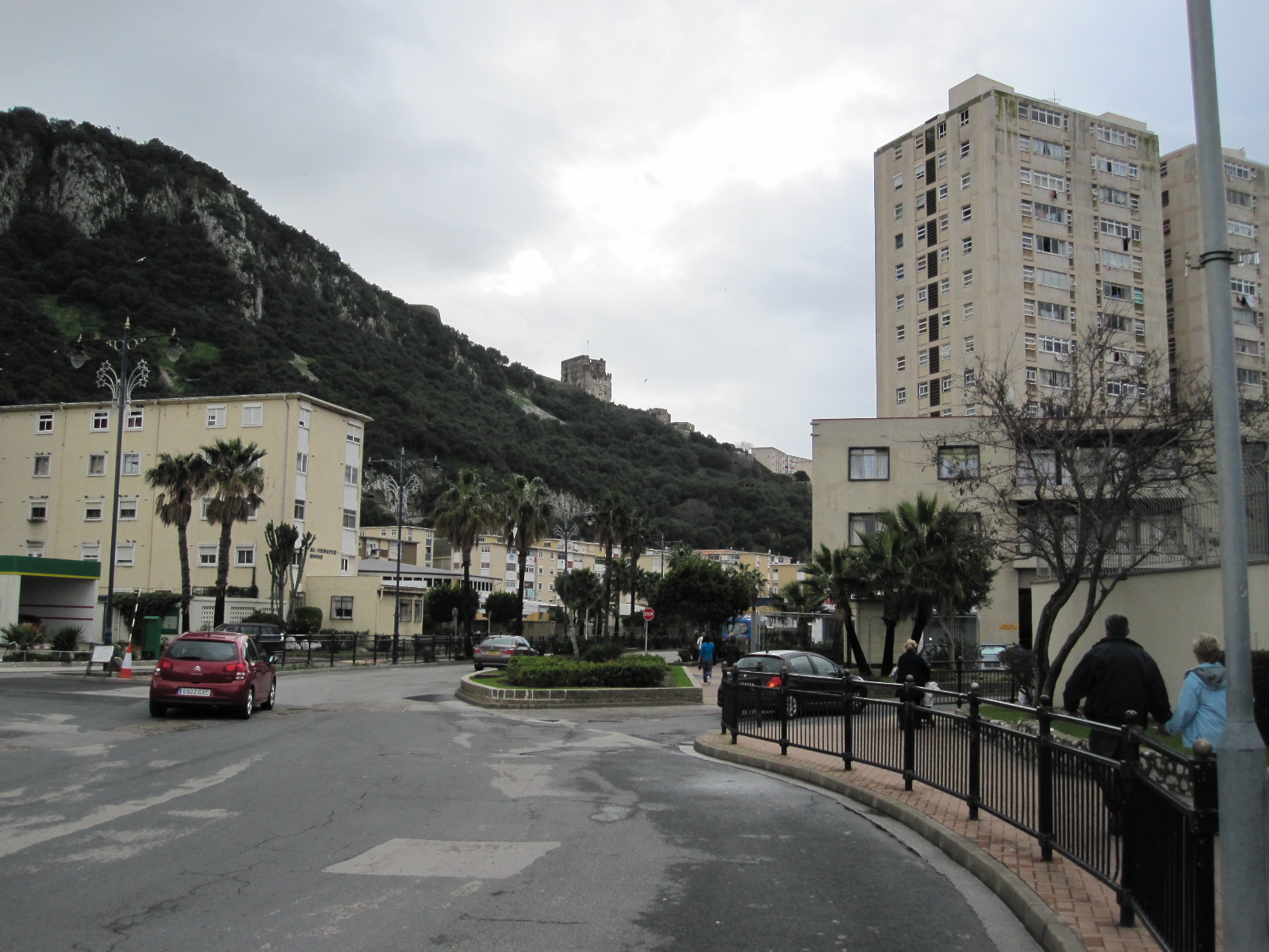
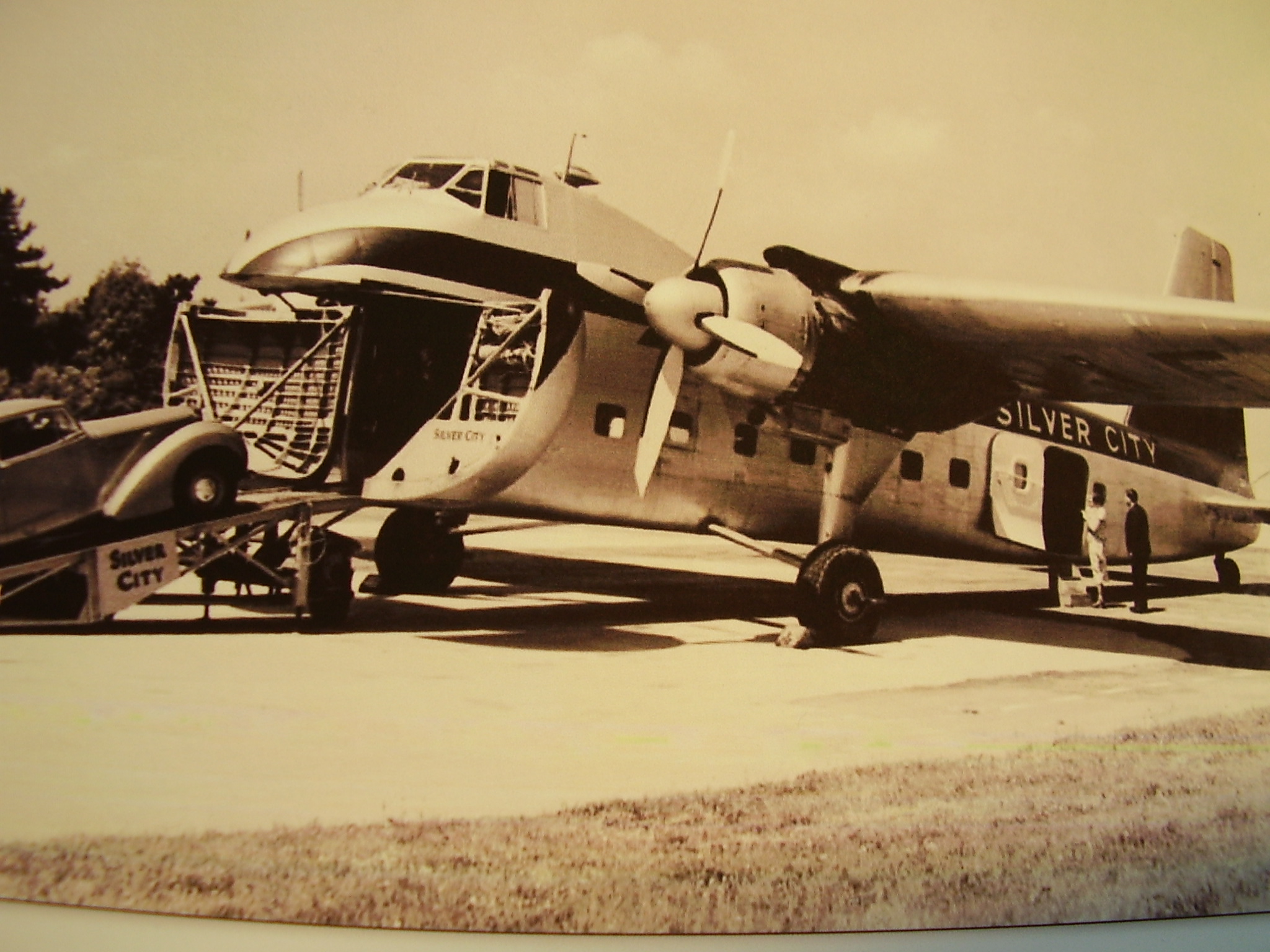
For those unfortunate readers who are not members of the classic car cognoscenti I should explain that the Elva Courier was a lightweight, glass-fibre bodied sports car made in small numbers in the late 1950s and 1960s in England. Mine was a Mark II, with the 1600cc MGA engine. For weather protection the car had a basic hood and detachable side screens with Perspex windows, which left a hole about 3/4in square at the top corner of the windscreen on each side when everything was in place. There was a recirculating air heater, which just heated up the air already inside the car, but there was never any shortage of fresh air in a Courier from the numerous gaps around the scuttle and other areas of the bodywork.
The ground clearance was a few inches, and the tyres were as you would expect to find on a car of that type, suitable for driving in what residents of alpine regions would describe as "summer" conditions. The idea of getting tyre chains did not occur to me, and anyway I doubt whether there was enough space under the wheel arches to fit them.
At the time I was living in a flat in Bromley and kept the car in a garage but had little in the way of workshop facilities (no electricity) and I am sure that I did not do much preparation for the journey, beyond checking the oil, anti-freeze and tyres.
The plan was to do the journey in two days, via France and Switzerland. On the first day I would drive to Lydd in Kent, cross the channel to Le Touquet with the Silver City air ferry, and stay the night in a hotel in Reims. From there I was hoping to reach St.Anton on the second day.
 The Silver City air ferries were the fastest-ever way of taking a car across the channel and are still thought of with great affection by most people who used them. In 1963 they consisted of Bristol Freighters, converted to carry three cars and about 20 passengers. The cars were driven up a ramp at the front of the plane by airport staff, while the passengers waited in little groups in the terminal. Once the cars were loaded the passengers were called by tannoy e.g. "Mr.Smith and party", and took their seats in a cabin behind the car compartment. The planes had two engines, which started with a great commotion, belching out smoke and flames in full view of the passengers, accompanied by much noise and vibration. But it was fun. The plane flew at about 1500 feet and took 20 minutes from Lydd to Le Touquet.
The journey through France was to be entirely on routes nationale, as there were no autoroutes in those days anywhere near where I was going. At the time I was attending French evening classes in Beckenham, and I told the lecturer what I was proposing to do. He knew nothing about cars but was supposed to know quite a bit about France, and when he came out to the car park he looked at the Elva and said "Well, you won't get over the Vosges Mountains in December in that!" I had never even heard of the Vosges Mountains.
 Possibly I did not think about it at the time, but the day I set off was Friday 13th December 1963. The 220 mile drive from Bromley to Reims, with the channel crossing, was uneventful, and I arrived at the Hotel Foch in the evening. The hotel was booked through a travel agent, and it still exists, but only as a restaurant now.
At 7.30 the next morning I was rather perturbed to find that the streets of Reims were largely covered with ice, which meant a slow start to the long day's drive, but it cleared during the course of the morning. French road gradings have changed considerably since that time, and the most obvious route to take then was through Bar-le-Duc to join the N66 right down to Basel. I had some food in the car and stopped briefly a couple of times for snacks and fuel, but pushed on as far and fast as I could. There were few if any by-passes, which meant that I had to drive right through all the towns, including one called Remiremont, which still had a main street with a dirt and mud surface. This was actually the place in which, on a subsequent trip with a more sensible car, I caused confusion by going into a café and asking for a café blanche. After an impromptu staff meeting it was decided that I wanted a café au lait. It seemed that the French lessons hadn't had much impact on me.
A few miles after Remiremont was the Col de Bussang, the crossing point over the dreaded Vosges Mountains. At 731m (approx 2400ft) this was little more than a bump in the landscape compared with most alpine passes and was no problem at all.
I had calculated that it would take around 7½ hours to reach Basel, and that was about right. From there the route went through the entire length of northern Switzerland, including the centres of Basel and Zürich, and again there were no autobahns, just ordinary main roads. It was fairly flat, as it ran some distance north of the mountains, but was nevertheless slow going, and to the Austrian border near Feldkirch took about 4½ hours.
St.Anton lies at the foot of the Arlberg Pass on the eastern side, which meant that it could only by reached via the pass, because the tunnel was still years away. At 1793m (5883ft) the Arlberg is not one of the highest alpine passes, but from experience on subsequent trips I know that it is a very cold area, and temperatures of -20ºC (-4ºF) are not unusual in the winter. At about 8.30pm I reached the start of the pass, by which time it was, of course, pitch dark, and with some trepidation decided to attempt to reach my accommodation in St.Anton. There was snow around, but the road itself was clear and dry and the indications were that it would stay that way. Although the road leads to the high villages of Lech, Zürs and St.Christoph there was no other traffic at all. So I had a whole mountain pass to myself in an Elva Courier, and with the exhaust note echoing off the rock faces this should have been paradise, but as I plunged ahead into the darkness after a long day it felt as if I was driving to the end of the world.
Eventually I reached the summit and the lights of St.Christoph, from which it was quite literally downhill all the way to St.Anton. The main road ran straight into the centre of the town (no by-pass then) and without too much trouble I found Haus Kössler in a back road. The distance from Reims was 424 miles.
The next morning, before my first skiing lesson, I went out to look at the car and tried to start it. The engine turned over slowly, with a strange noise, and when I looked into the header tank the anti-freeze had turned to sludge. As mentioned earlier, before leaving home I had checked the anti-freeze, and it was all right. All right for Bromley that is, but not for -15º in St.Anton. This was also the moment when I discovered that you cannot freeze bananas, or at any rate, you can't eat them afterwards. Behind the passenger's seat was a bag containing half a dozen totally black bananas.
After a traumatic first day's skiing I came back to the car, which had been standing in the sun, and the anti-freeze had thawed out. The engine started immediately, so I drove to a garage in the town and got some anti-freeze to strengthen the mixture.
During the week the weather was very cold but dry, and the roads were clear, so I took a bit of time off skiing to drive up the pass to St. Christoph, Lech and Zürs, all high ski resorts. The car seemed none the worse for its experiences so far, and I could now really enjoy the drive, with fantastic views. Much of the road was protected by concrete snow shelters, like open-sided tunnels to keep it clear at times of heavy snowfall, although it was still frequently closed for quite long periods in the winter.
By the end of the week, with sore feet, aching muscles and many bruises it was time go home, so at 7.30 on the Saturday morning I set off to retrace my route to Reims. Conditions were much the same as before, but it was easier now, because I knew what lay ahead. After spending another night at the Hotel Foch, and surviving another flight with Silver City I arrived home on the Sunday evening.
Over the next 40 years I was to drive to the alps in more sensible cars very many times for skiing, often over the same route as in 1963, and I realise now how lucky I was on that trip. Some journeys were trouble free as far as the weather was concerned, but often I would run into problems with snow and ice for at least part of the time, and occasionally I would have a real hell journey, battling through falling or drifting snow over long distances.
It is actually not true to say that I travelled hopefully in the Elva, because I really had no idea of the conditions that I might face, and was quite confident that I would get there and back without trouble. Such was my optimism that I had no breakdown cover, and I cannot imagine what would have happened if I had broken down that night on the Arlberg Pass.
Unfortunately I was not into photography in those days, and have no pictures of that holiday at all. The ones above were taken elsewhere and are of poor quality.
The car - where is it now?
The survival rate of Elva Couriers has been quite high, because they were always a bit special and had well-made glass-fibre bodies that did not rust, so it is quite likely that my car still exists.
 I bought it secondhand in August 1963 from Gold Seal Sports Cars, in south-east London, and it had the rather inappropriate registration number 6777VW. This was immediately changed for my own number BEV15, which stayed on it throughout my ownership. The car was eventually sold in about April or May 1965 by my father in Northampton, because I was working in Germany at the time. My registration number was put on retention, and I think the Elva reverted to 6777VW, but I am not sure about that. Unfortunately I did not keep a record anywhere of the chassis or engine numbers.
The Elva company still exists and Roger Dunbar, the present owner of the firm, has an archive but has no record of a Courier with either of the above registration numbers. Since this article was first published Roger has advised me that the chassis number of my car was 200/25/R, and in the early 1980s it was registered in Kenley, Surrey, England, with the number TVV801.
In January 2011 Roger contacted me again to say that the car was advertised for sale on the Pistonheads web site. It was still in Surrey, and I rang the owner, Craige Amos, and arranged to go and look at it. On 8th January 2011, over 43 years since I had last seen the car, I sat in it again. Craige, who used to be in the motor trade, had rebuilt it completely with an MGB 1800cc engine, many other new parts, and sprayed the body red. It was an excellent restoration, but I found it difficult to identify with the car, and could not really imagine driving to Austria in it. I was surprised at how difficult it was to get in, something that I don't remember being a problem when I was 25, but that goes for a lot of other things. It may be because Craige has fitted new racing-style seats which are ok for him but too low for me.
Anyway, it was good to see that the car has survived and is now in better condition that when I owned it.